Enable Location

We need your location to show you interesting places around you

Discover nearby places

Find interesting locations and hidden gems around you

Precise directions

Get accurate directions and distances to places

Your location is never shared with other users. It's only used when you tap the location button.

Lamoille County

Log in to your account

Start exploring — it's free

Trusted by 61,887 travelers worldwide

Continue with Google
Continue with Apple
or

We will send you a code to connect

By continuing, you accept our Terms and Conditions and our Privacy Policy

Check your inbox

We've sent a pincode in your inbox. Please enter the code below.

Lamoille County, Administrative county in northern Vermont, US

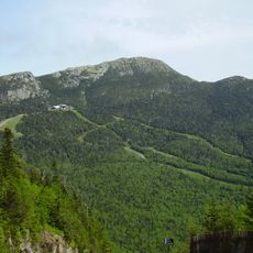
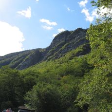
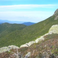
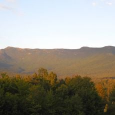
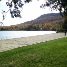
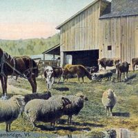
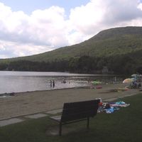
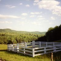
Lamoille County is an administrative county in northern Vermont with mountainous terrain throughout its territory. The Green Mountains run through the western portion, with rivers and streams flowing across the landscape.

The Vermont Legislature created this county in 1836 by combining lands from four surrounding counties. This reorganization established a new administrative unit in the northern part of the state.

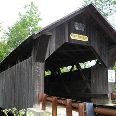
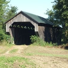
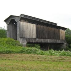
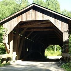
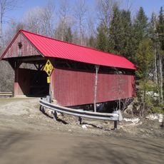
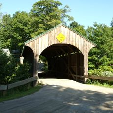
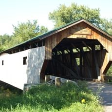
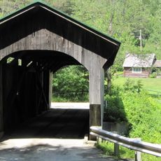
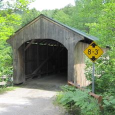
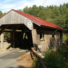
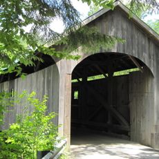
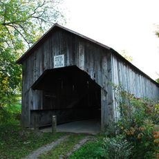
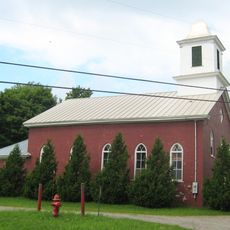
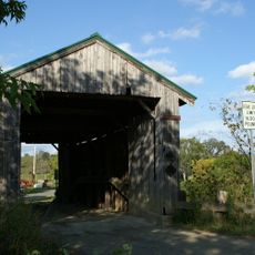
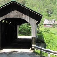
The region is known for traditional covered bridges crossing its rivers and shaping the landscape. Hikers regularly explore the Long Trail that runs along the ridge of the Green Mountains.

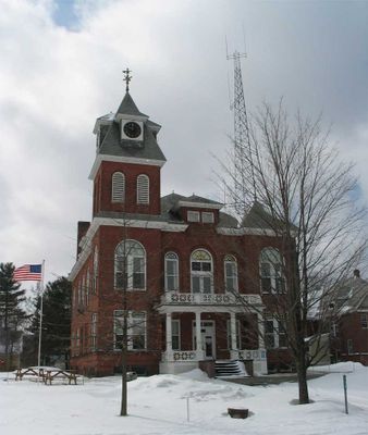
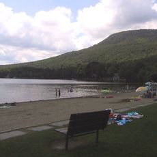
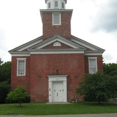
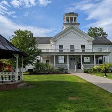
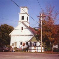
Hyde Park serves as the county seat, while Morristown functions as the main commercial hub where visitors find services and supplies. Exploring the region by car works best, as rural roads and highways connect the scattered communities.

Mount Belvidere in the area once housed an asbestos mining operation that remained active into the 20th century. After it closed, the site became the focus of environmental research studies.

The community of curious travelers

AroundUs brings together thousands of curated places, local tips, and hidden gems, enriched daily by 60,000 contributors worldwide.

Start exploring
Location
Inception
1836
Capital city
Hyde Park
Shares border with
Orleans County, Caledonia County, Washington County, Chittenden County, Franklin County
GPS coordinates
44.60007,-72.63315
Latest update
December 7, 2025 19:28
Around this place
Mount Mansfield
United States of America

Mount Mansfield

15.7 km
Long Trail
United States of America

Long Trail

14.8 km
Gold Brook Covered Bridge
United States of America

Gold Brook Covered Bridge

18.2 km
Smugglers' Notch State Park
United States of America

Smugglers' Notch State Park

13.9 km
Vermont Ski and Snowboard Museum
United States of America

Vermont Ski and Snowboard Museum

14.9 km
Mount Mansfield State Forest
United States of America

Mount Mansfield State Forest

19 km
Elmore State Park
United States of America

Elmore State Park

10.3 km
Peoples Academy
United States of America

Peoples Academy

5.4 km
Gates Farm Covered Bridge
United States of America

Gates Farm Covered Bridge

19.6 km
Underhill State Park
United States of America

Underhill State Park

17.6 km
Fisher Covered Railroad Bridge
United States of America

Fisher Covered Railroad Bridge

18 km
Grist Mill Covered Bridge
United States of America

Grist Mill Covered Bridge

15.7 km
Green River Reservoir State Park
United States of America

Green River Reservoir State Park

8.8 km
Red Covered Bridge
United States of America

Red Covered Bridge

9.7 km
Church Street Covered Bridge
United States of America

Church Street Covered Bridge

14.8 km
Poland Covered Bridge
United States of America

Poland Covered Bridge

15.4 km
Morgan Covered Bridge
United States of America

Morgan Covered Bridge

17.6 km
St. Thomas Church
United States of America

St. Thomas Church

23.6 km
Stowe Village Historic District
United States of America

Stowe Village Historic District

15.5 km
Montgomery Covered Bridge
United States of America

Montgomery Covered Bridge

14.9 km
Cambridge Meetinghouse
United States of America

Cambridge Meetinghouse

16.4 km
Power House Covered Bridge
United States of America

Power House Covered Bridge

5 km
Mill Covered Bridge
United States of America

Mill Covered Bridge

18.1 km
East Fairfield Covered Bridge
United States of America

East Fairfield Covered Bridge

27.5 km
St. George's Catholic Church
United States of America

St. George's Catholic Church

24.1 km
The Current
United States of America

The Current

15.7 km
Scribner Covered Bridge
United States of America

Scribner Covered Bridge

4.4 km
Jeffersonville Bridge
United States of America

Jeffersonville Bridge

16.6 km
Show the full map
« Lamoille County - Administrative county in northern Vermont, US » is provided by Around Us (aroundus.com). Images and texts are derived from Wikimedia project under a Creative Commons license. You are allowed to copy, distribute, and modify copies of this page, under the conditions set by the license, as long as this note is clearly visible.

Discover hidden gems everywhere you go!

From secret cafés to breathtaking viewpoints, skip the crowded tourist spots and find places that match your style. Our app makes it easy with voice search, smart filtering, route optimization, and insider tips from travelers worldwide. Download now for the complete mobile experience.

Around Us App Screenshot

A unique approach to discovering new places

Le Figaro

All the places worth exploring

France Info

A tailor-made excursion in just a few clicks

20 Minutes

Around Us
Travel Guide & Maps
Download

Send to your phone

QR Code
1

Open the camera app on your mobile.

2

Point at the QR code with your camera. A notification will appear.

3

Tap the notification to open the link.