Enable Location

We need your location to show you interesting places around you

Discover nearby places

Find interesting locations and hidden gems around you

Precise directions

Get accurate directions and distances to places

Your location is never shared with other users. It's only used when you tap the location button.

Pico Naiguatá

Log in to your account

Join the adventure

Create your free account and start exploring (like 60k+ others)

We will send you a code to connect

or
Continue with Google
Continue with Apple
By continuing, you accept our Terms and Conditions and our Privacy Policy

Check your inbox

We've sent a pincode in your inbox. Please enter the code below.

Pico Naiguatá

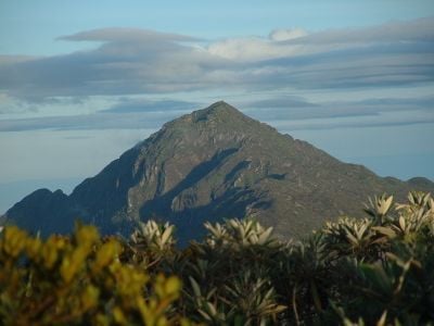
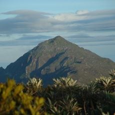
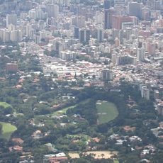
Pico Naiguatá, Mountain summit in Venezuelan Coastal Range, Venezuela.

Description

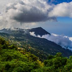
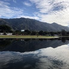
Pico Naiguatá is a mountain summit in Venezuela's Coastal Range that rises to 2,765 meters above sea level and stands as the highest point in both Miranda and Vargas states. The terrain transitions from forested slopes at lower elevations to rocky and exposed terrain near the peak itself.

History

The mountain formed millions of years ago through geological processes that created the Venezuelan Coastal Range near present-day Caracas. This peak has been a defining geographic landmark for the region throughout its history.

Culture

The peak holds meaning for climbers and hikers from nearby communities who view it as representing their connection to the mountains and regional pride. Local mountaineering traditions remain tied to this landmark as a destination for those seeking high-altitude experiences.

Practical

The best season for climbing runs from November through February when clear skies and reduced rainfall create favorable conditions for ascents. Visitors should prepare for changing weather conditions at higher elevations and bring appropriate gear for temperature shifts.

Did you know?

With a prominence of 2,455 meters, this peak stands as one of the Caribbean's highest elevations and towers above surrounding mountains in a way that makes it visually distinct from afar. Few other peaks in the region command such a dramatic vertical separation from their neighbors.

Location
Location
Elevation above the sea
2,765 m
GPS coordinates
10.54283,-66.78275
Latest update
December 7, 2025 20:41

AroundUs brings together thousands of curated places, local tips, and hidden gems, enriched daily by 60,000 contributors worldwide. Discover all places nearby (Miranda).

« Pico Naiguatá - Mountain summit in Venezuelan Coastal Range, Venezuela » is provided by Around Us (aroundus.com). Images and texts are derived from Wikimedia project under a Creative Commons license. You are allowed to copy, distribute, and modify copies of this page, under the conditions set by the license, as long as this note is clearly visible.

Discover hidden gems everywhere you go!

From secret cafés to breathtaking viewpoints, skip the crowded tourist spots and find places that match your style. Our app makes it easy with voice search, smart filtering, route optimization, and insider tips from travelers worldwide. Download now for the complete mobile experience.

Around Us App Screenshot

A unique approach to discovering new places

Le Figaro

All the places worth exploring

France Info

A tailor-made excursion in just a few clicks

20 Minutes

Around Us
Travel Guide & Maps
Download

Send to your phone

QR Code
1

Open the camera app on your mobile.

2

Point at the QR code with your camera. A notification will appear.

3

Tap the notification to open the link.