Dawlat Yar District, district in Ghor Province, Afghanistan
Location: Ghōr
Elevation above the sea: 2,568 m
Shares border with: Marghab District
GPS coordinates: 34.58028,65.75139
Latest update: March 6, 2025 02:17

Blue Mosque
267 km
Minaret of Jam
115.2 km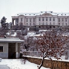
Tajbeg Palace
308.7 km
Band-e Amir National Park
138.4 km
Tillya Tepe
235.4 km
Mundigak
298.7 km
Qala-i-Jangi
257.6 km
Ghazni Minarets
271.9 km
Citadel of Ghazni
271.8 km
Surkh Kotal
303.5 km
Cyropolis
264.3 km
Takht-e Rostam
277.1 km
Palace of Sultan Mas'ud III
272.5 km
Haji Piyada
259.6 km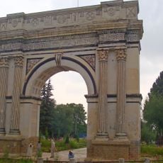
Taq-e Zafar
293.9 km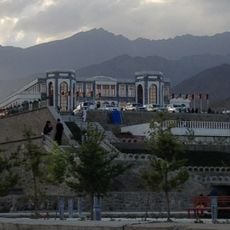
Paghman Hill Castle
295.1 km
Green Mosque
263.6 km
Shahr-e Zuhak, Bamyan
191.4 km
Cultural Landscape and Archaeological Remains of the Bamiyan Valley
192 km
Forward Operating Base Arian
272.9 km
Zadian Minaret
292.6 km
Paropamisus
178.6 km
Forward Operating Base Zeebrugge
292.6 km
Aq Köprük
177.5 km
Shāh Fōlādī
171.8 km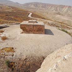
Takht-e Rostam
278.2 km
Qalat City Fort
295.1 km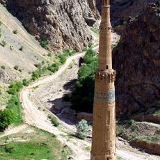
Minaret and Archaeological Remains of Jam
115.2 kmReviews
Visited this place? Tap the stars to rate it and share your experience / photos with the community! Try now! You can cancel it anytime.
Discover hidden gems everywhere you go!
From secret cafés to breathtaking viewpoints, skip the crowded tourist spots and find places that match your style. Our app makes it easy with voice search, smart filtering, route optimization, and insider tips from travelers worldwide. Download now for the complete mobile experience.

A unique approach to discovering new places❞
— Le Figaro
All the places worth exploring❞
— France Info
A tailor-made excursion in just a few clicks❞
— 20 Minutes