Serra de Santa Bárbara State Park, State park in western Mato Grosso, Brazil
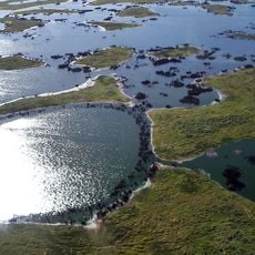
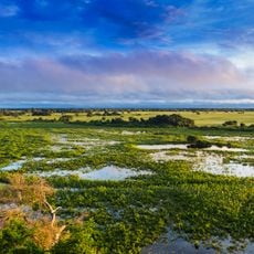
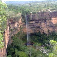
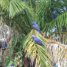
Serra de Santa Bárbara State Park is a large protected area in Mato Grosso that extends across two municipalities and encompasses diverse regional ecosystems. Two highways mark its borders and provide access to different parts of the park.
The park was established in 1997 as a conservation effort to protect the region's natural ecosystems and biodiversity. This action represented an important step toward preserving the landscape of Mato Grosso.
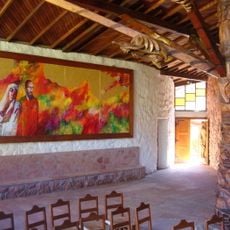
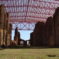
The area contains archaeological sites where visitors can find traces of pre-colonial settlements from centuries past. These locations tell the story of communities that inhabited this region long before the park was established.
The park can be reached via two main highways that run along its borders and provide various entry points. Visitors should check ahead about which areas are accessible and what facilities are available on site.
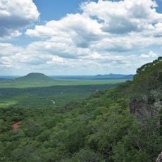
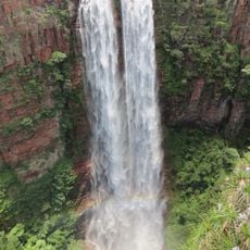
The park contains the highest elevation in the state, a mountain that rises above 1,000 meters. This distinctive geographic feature makes the area stand out as a notable landmark in the region's landscape.
Location: Mato Grosso
Inception: 1997
Website: https://uc.socioambiental.org/arp/1345
GPS coordinates: -15.92490,-59.35996
Latest update: December 14, 2025 16:40
Pantanal
257.5 km
Arena Pantaloneta
348.9 km
Noel Kempff Mercado National Park
247.2 km
Chiquitania
240.8 km
Jesuit Missions of Chiquitos
338.8 km
Pantanal Matogrossense National Park
291.4 km
Estádio José Fragelli
348.9 km
Mãe Bonifácia State Park
350.8 km
Immaculate Conception Cathedral, Concepción
285.9 km
Parque nacional Histórico Santa Cruz La Vieja
262.3 km
Catarata Arco Iris
293.4 km
Catarata Véu da Noiva
319.3 km
Igreja Nossa Senhora do Bom Despacho
351.5 km
Santuario Mariano de la Torre
256.7 km
Igreja de Nossa Senhora Auxiliadora
351.2 km
Marco do Jauru
179.7 km
Museu do Morro da Caixa D'Água Velha
351 km
Serra Ricardo Franco State Park
179.3 km
Cachoeira do Jatobá
135.8 km
Igreja de Nossa Senhora da Guia
347.1 km
Encontro das Águas State Park
314.5 km
Museu do Rio Cuiabá
350.1 km
Cathedral of St. Louis of France
179.7 km
Bajo Paraguá Municipal Protected Area
295.2 km
San Matías Integrated Management Natural Area
193.2 km
Taiamã Ecological Station
223.4 km
Federico Ahlfeld Falls
297.6 km
Ruins of the Church of the Holy Trinity
120.3 kmVisited this place? Tap the stars to rate it and share your experience / photos with the community! Try now! You can cancel it anytime.
Discover hidden gems everywhere you go!
From secret cafés to breathtaking viewpoints, skip the crowded tourist spots and find places that match your style. Our app makes it easy with voice search, smart filtering, route optimization, and insider tips from travelers worldwide. Download now for the complete mobile experience.
A unique approach to discovering new places❞
— Le Figaro
All the places worth exploring❞
— France Info
A tailor-made excursion in just a few clicks❞
— 20 Minutes