Chest opened
+${chestReward.xp} XP
Explorer
NOUVEAU ×${chestReward.collectible.quantity}
tapez pour fermer
Chest locked

Open chests in the app

Around Us is built for your phone — chests unlock when you walk, explore and capture nearby places.

Enable Location

We need your location to show you interesting places around you

Discover nearby places

Find interesting locations and hidden gems around you

Precise directions

Get accurate directions and distances to places

Your location is never shared with other users. It's only used when you tap the location button.

Log in to your account

Start exploring — it's free

Trusted by 72,978 travelers worldwide

Continue with Google
Continue with Apple
or

We will send you a code to connect

By continuing, you accept our Terms and Conditions and our Privacy Policy

Check your inbox

We've sent a pincode in your inbox. Please enter the code below.

San Cristobal Wash
Discussion Reviews Photo
1.6k Popularity

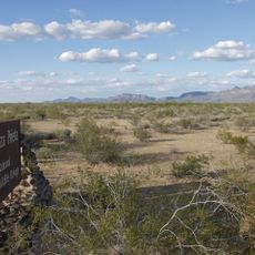
San Cristobal Wash, Tributary in southwestern Arizona, United States.

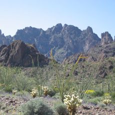
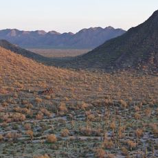
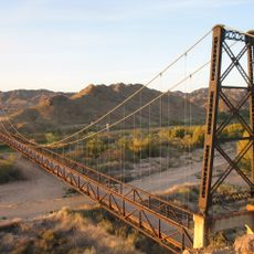
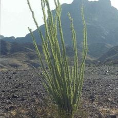
San Cristobal Wash is a tributary flowing through the desert landscape of southwestern Arizona in a northwesterly direction. The waterway forms part of a larger drainage network that channels toward the Gila River Valley system.

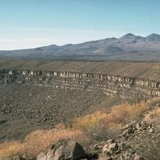
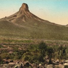
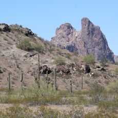
The waterway formed over geological time through erosion processes that carved channels through Arizona's Basin and Range mountain formations. These natural water pathways developed into the drainage systems visible in the landscape today.

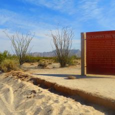
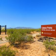
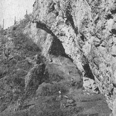
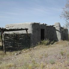
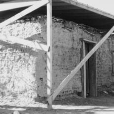
Local Native American tribes utilized these seasonal waterways for migration routes and water sources across the southwestern desert landscapes.

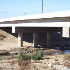
Flash flooding can occur during monsoon seasons, so check weather conditions before crossing the wash if you plan to visit the area. Plan visits during cooler months and earlier in the day to avoid extreme heat and sudden water surges.

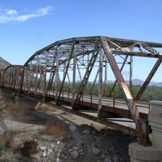
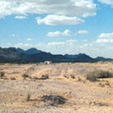
The wash disappears approximately 8 miles (13 kilometers) south of the Gila River, demonstrating how desert environments naturally absorb water into the ground. This geological feature shows a different water behavior compared to permanent river systems.

The community of curious travelers

AroundUs brings together thousands of curated places, local tips, and hidden gems, enriched daily by 60,000 contributors worldwide.

Start exploring
Location
GPS coordinates
32.29210,-113.31500
Latest update
December 14, 2025 13:01
Around this place
El Pinacate y Gran Desierto de Altar Biosphere Reserve
Mexico

El Pinacate y Gran Desierto de Altar Biosphere Reserve

65.4 km
All-American Canal
United States of America

All-American Canal

126.5 km
Kofa National Wildlife Refuge
United States of America

Kofa National Wildlife Refuge

123.9 km
Sonoran Desert National Monument
United States of America

Sonoran Desert National Monument

99.1 km
El Camino Del Diablo
United States of America

El Camino Del Diablo

25.4 km
Painted Rock Petroglyph Site
United States of America

Painted Rock Petroglyph Site

85.1 km
Cabeza Prieta National Wildlife Refuge
United States of America

Cabeza Prieta National Wildlife Refuge

13.7 km
McPhaul Suspension Bridge
United States of America

McPhaul Suspension Bridge

116.1 km
Painted Rock Dam
United States of America

Painted Rock Dam

91.3 km
Gillespie Dam Highway Bridge
United States of America

Gillespie Dam Highway Bridge

116 km
Ventana Cave
United States of America

Ventana Cave

102 km
Imperial Reservoir
United States of America

Imperial Reservoir

126.6 km
El Elegante Crater
Mexico

El Elegante Crater

50.1 km
Cabeza Prieta Wilderness
United States of America

Cabeza Prieta Wilderness

10.2 km
Playa Bonita Resort
Mexico

Playa Bonita Resort

110.8 km
Isanaklesh Peaks
United States of America

Isanaklesh Peaks

100.2 km
Eagletail Mountains Wilderness
United States of America

Eagletail Mountains Wilderness

128.6 km
Bates Well Ranch
United States of America

Bates Well Ranch

37 km
United States of America

Ajo Peak

38.7 km
Gatlin Site
United States of America

Gatlin Site

96.3 km
Dos Lomitas Ranch
United States of America

Dos Lomitas Ranch

72.6 km
Hassayampa Bridge
United States of America

Hassayampa Bridge

130 km
Muggins Mountain Wilderness
United States of America

Muggins Mountain Wilderness

101.3 km
Gachado Well and Line Camp
United States of America

Gachado Well and Line Camp

68.4 km
Westwind Golf Course
United States of America

Westwind Golf Course

115.6 km
Aquariam Mar De Cortez
Mexico

Aquariam Mar De Cortez

112.4 km
Gila Bend Visitor Center and Museum
United States of America

Gila Bend Visitor Center and Museum

91.1 km
Stout's Hotel
United States of America

Stout's Hotel

92.1 km
Show the full map
Reviews
Share your experience

No review yet

Discussions
Start a discussion...

No discussion yet

« San Cristobal Wash - Tributary in southwestern Arizona, United States » is provided by Around Us (aroundus.com). Images and texts are derived from Wikimedia project under a Creative Commons license. You are allowed to copy, distribute, and modify copies of this page, under the conditions set by the license, as long as this note is clearly visible.

Discover hidden gems everywhere you go!

From secret cafés to breathtaking viewpoints, skip the crowded tourist spots and find places that match your style. Our app makes it easy with voice search, smart filtering, route optimization, and insider tips from travelers worldwide. Download now for the complete mobile experience.

Around Us App Screenshot

A unique approach to discovering new places

Le Figaro

All the places worth exploring

France Info

A tailor-made excursion in just a few clicks

20 Minutes

Around Us
Travel Guide & Maps
Download

Send to your phone

QR Code
1

Open the camera app on your mobile.

2

Point at the QR code with your camera. A notification will appear.

3

Tap the notification to open the link.