Enable Location

We need your location to show you interesting places around you

Discover nearby places

Find interesting locations and hidden gems around you

Precise directions

Get accurate directions and distances to places

Your location is never shared with other users. It's only used when you tap the location button.

Kentucky Camp

Log in to your account

Start exploring — it's free

Trusted by 62,538 travelers worldwide

Continue with Google
Continue with Apple
or

We will send you a code to connect

By continuing, you accept our Terms and Conditions and our Privacy Policy

Check your inbox

We've sent a pincode in your inbox. Please enter the code below.

Kentucky Camp, human settlement in Arizona, United States of America

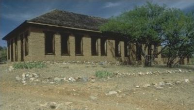
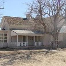
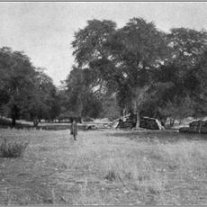
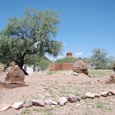
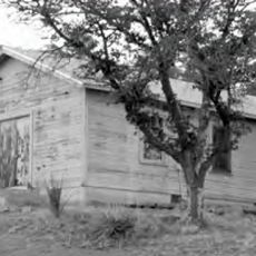
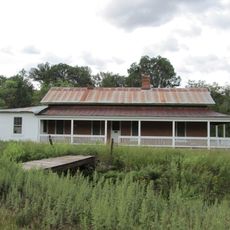
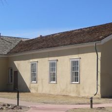
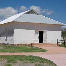
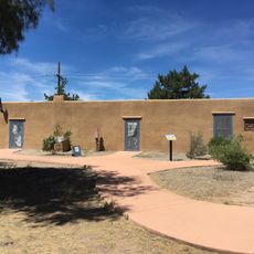
Kentucky Camp is a historic mining settlement in the Santa Rita Mountains founded in 1904 to support gold mining operations in the area. The site contains well-preserved adobe structures, including a large ten-room headquarters building, a small ore processing facility, and workers' quarters that together illustrate the layout and construction methods of an early mining camp.

The camp was established in 1904 to support mining companies seeking gold and silver deposits and quickly became an active center for workers and their families. Operations ceased following the sudden death of the chief engineer, after which the land served as a cattle ranch for approximately 50 years before being transferred to Coronado National Forest in 1989.

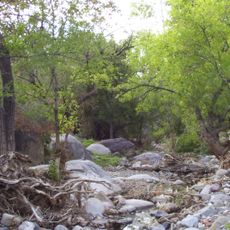
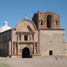
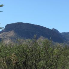
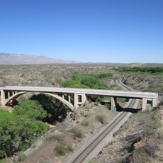
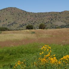
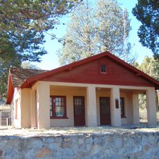
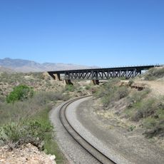
The site is located within a national forest and can be explored on foot, with a small adobe building available for overnight stays to experience the history firsthand. The Arizona Trail passes through the area and offers hiking and biking routes through the surrounding mountain landscape.

The mysterious disappearance of the chief engineer led to the camp's abandonment, yet the structures were discovered in surprisingly good condition after decades of neglect. Volunteers and conservation groups have since undertaken extensive restoration work, making the adobe building one of the largest surviving examples of construction from this era.

The community of curious travelers

AroundUs brings together thousands of curated places, local tips, and hidden gems, enriched daily by 60,000 contributors worldwide.

Start exploring
Location
Inception
1905
GPS coordinates
31.73694,-110.72861
Latest update
February 7, 2026 11:00
Around this place
Titan Missile Museum
United States of America

Titan Missile Museum

31.6 km
Madera Canyon
United States of America

Madera Canyon

20.2 km
Empire Ranch
United States of America

Empire Ranch

9.8 km
Mount Wrightson
United States of America

Mount Wrightson

12.2 km
VERITAS
United States of America

VERITAS

22.2 km
MMT Observatory
United States of America

MMT Observatory

15.8 km
Patagonia Lake State Park
United States of America

Patagonia Lake State Park

29.6 km
Fred Lawrence Whipple Observatory
United States of America

Fred Lawrence Whipple Observatory

15.5 km
Fort Buchanan
United States of America

Fort Buchanan

9.1 km
Tumacácori Mission
United States of America

Tumacácori Mission

35.8 km
Tubac Presidio State Historic Park
United States of America

Tubac Presidio State Historic Park

33.2 km
Mount Hopkins
United States of America

Mount Hopkins

15.7 km
Las Cienegas National Conservation Area
United States of America

Las Cienegas National Conservation Area

12.8 km
Tucson ring meteorite
United States of America

Tucson ring meteorite

25.8 km
Tubac Presidio
United States of America

Tubac Presidio

33.2 km
Apache Peak
United States of America

Apache Peak

30 km
Infrared Optical Telescope Array
United States of America

Infrared Optical Telescope Array

15.7 km
Ciénega Bridge
United States of America

Ciénega Bridge

32.4 km
The Little Outfit Schoolhouse
United States of America

The Little Outfit Schoolhouse

30.6 km
Canelo Hills Cienega Reserve
United States of America

Canelo Hills Cienega Reserve

27.3 km
Canelo Ranger Station
United States of America

Canelo Ranger Station

28.8 km
James Finley House
United States of America

James Finley House

30.4 km
Old Tubac Schoolhouse
United States of America

Old Tubac Schoolhouse

33.2 km
San Ignacio Golf Club
United States of America

San Ignacio Golf Club

28.5 km
Tubac Presidio State Historic Park
United States of America

Tubac Presidio State Historic Park

33.3 km
Otero Hall
United States of America

Otero Hall

33.2 km
Rojas House
United States of America

Rojas House

33.1 km
Marsh Station Bridge
United States of America

Marsh Station Bridge

32.4 km
Show the full map
« Kentucky Camp - human settlement in Arizona, United States of America » is provided by Around Us (aroundus.com). Images and texts are derived from Wikimedia project under a Creative Commons license. You are allowed to copy, distribute, and modify copies of this page, under the conditions set by the license, as long as this note is clearly visible.

Discover hidden gems everywhere you go!

From secret cafés to breathtaking viewpoints, skip the crowded tourist spots and find places that match your style. Our app makes it easy with voice search, smart filtering, route optimization, and insider tips from travelers worldwide. Download now for the complete mobile experience.

Around Us App Screenshot

A unique approach to discovering new places

Le Figaro

All the places worth exploring

France Info

A tailor-made excursion in just a few clicks

20 Minutes

Around Us
Travel Guide & Maps
Download

Send to your phone

QR Code
1

Open the camera app on your mobile.

2

Point at the QR code with your camera. A notification will appear.

3

Tap the notification to open the link.