Enable Location

We need your location to show you interesting places around you

Discover nearby places

Find interesting locations and hidden gems around you

Precise directions

Get accurate directions and distances to places

Your location is never shared with other users. It's only used when you tap the location button.

Yachats

Log in to your account

Start exploring — it's free

Trusted by 61,505 travelers worldwide

Continue with Google
Continue with Apple
or

We will send you a code to connect

By continuing, you accept our Terms and Conditions and our Privacy Policy

Check your inbox

We've sent a pincode in your inbox. Please enter the code below.

Yachats, Coastal town in Lincoln County, Oregon

Description

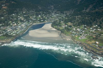
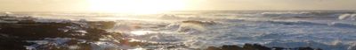
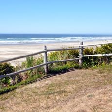
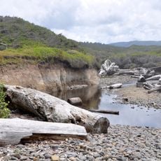
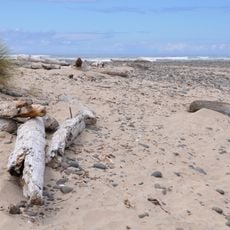
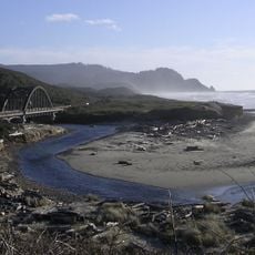
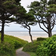
Yachats is a coastal town situated along the Pacific Ocean at the base of the Oregon Coast Range, featuring black basalt formations and natural tide pools. The shoreline displays dramatic rocky outcrops that create sheltered coves and tidal areas along the water's edge.

History

The town takes its name from indigenous language meaning dark water at the foot of the mountain. The area became officially incorporated as a city in 1967.

Culture

Local art galleries display works from regional artists, while craft shops sell handmade items reflecting Pacific Northwest traditions. You can find these creative spaces scattered throughout the downtown area.

Practical

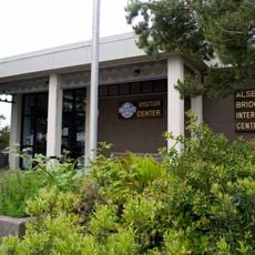
The Yachats Area Chamber of Commerce provides visitor information and local business directories throughout the year. Allow extra time when exploring the coastal features, as trails and tidal areas are more accessible depending on the season.

Did you know?

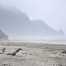
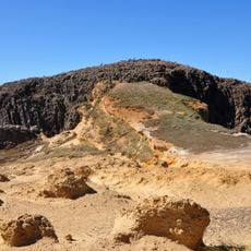
Thor's Well and Devil's Churn are natural water features carved into the black basalt coastline that display powerful currents during high tide periods. These formations developed over countless centuries of wave action and tidal movement wearing away at the rock.

Location
Inception
1967
Elevation above the sea
13.7 m
GPS coordinates
44.31111,-124.10444
Latest update
December 19, 2025 22:09

AroundUs brings together thousands of curated places, local tips, and hidden gems, enriched daily by 60,000 contributors worldwide. Discover all places nearby (Lincoln County).

Around this place
Heceta Head Light
United States of America

Heceta Head Light

19.4 km
Devils Churn
United States of America

Devils Churn

3 km
Alsea Bay Bridge
United States of America

Alsea Bay Bridge

13.7 km
Cleft of the Rock Light
United States of America

Cleft of the Rock Light

2.4 km
Cummins Creek Wilderness
United States of America

Cummins Creek Wilderness

8.3 km
Rock Creek Wilderness
United States of America

Rock Creek Wilderness

15.1 km
Carl G. Washburne Memorial State Park
United States of America

Carl G. Washburne Memorial State Park

17.1 km
Cape Creek Bridge
United States of America

Cape Creek Bridge

19.8 km
Driftwood Beach State Recreation Site
United States of America

Driftwood Beach State Recreation Site

17.1 km
Heceta Head Lighthouse
United States of America

Heceta Head Lighthouse

19.6 km
Beachside State Recreation Site
United States of America

Beachside State Recreation Site

7.9 km
Neptune State Scenic Viewpoint
United States of America

Neptune State Scenic Viewpoint

5.6 km
Seal Rock State Recreation Site
United States of America

Seal Rock State Recreation Site

20.8 km
Alsea Bay Historic Interpretive Center
United States of America

Alsea Bay Historic Interpretive Center

13.3 km
Yachats State Recreation Area
United States of America

Yachats State Recreation Area

363 m
Muriel O. Ponsler Memorial State Scenic Viewpoint
United States of America

Muriel O. Ponsler Memorial State Scenic Viewpoint

15.7 km
Smelt Sands State Recreation Site
United States of America

Smelt Sands State Recreation Site

1.2 km
Yachats Ocean Road State Natural Site
United States of America

Yachats Ocean Road State Natural Site

548 m
Stonefield Beach State Recreation Site
United States of America

Stonefield Beach State Recreation Site

9.6 km
Tokatee Klootchman State Natural Site
United States of America

Tokatee Klootchman State Natural Site

11.5 km
W. B. Nelson State Recreation Site
United States of America

W. B. Nelson State Recreation Site

12.8 km
Big Creek Bridge
United States of America

Big Creek Bridge

15.2 km
Governor Patterson Memorial State Recreation Site
United States of America

Governor Patterson Memorial State Recreation Site

11.6 km
Ten Mile Creek Bridge
United States of America

Ten Mile Creek Bridge

9.7 km
North Fork of the Yachats Bridge
United States of America

North Fork of the Yachats Bridge

10.7 km
Fisher School Bridge
United States of America

Fisher School Bridge

21.1 km
Thor's Well
United States of America

Thor's Well

3.7 km
Cape Perpetua Shelter and Parapet
United States of America

Cape Perpetua Shelter and Parapet

2.7 km
Show the full map
« Yachats - Coastal town in Lincoln County, Oregon » is provided by Around Us (aroundus.com). Images and texts are derived from Wikimedia project under a Creative Commons license. You are allowed to copy, distribute, and modify copies of this page, under the conditions set by the license, as long as this note is clearly visible.

Discover hidden gems everywhere you go!

From secret cafés to breathtaking viewpoints, skip the crowded tourist spots and find places that match your style. Our app makes it easy with voice search, smart filtering, route optimization, and insider tips from travelers worldwide. Download now for the complete mobile experience.

Around Us App Screenshot

A unique approach to discovering new places

Le Figaro

All the places worth exploring

France Info

A tailor-made excursion in just a few clicks

20 Minutes

Around Us
Travel Guide & Maps
Download

Send to your phone

QR Code
1

Open the camera app on your mobile.

2

Point at the QR code with your camera. A notification will appear.

3

Tap the notification to open the link.