Chest opened
+${chestReward.xp} XP
Explorer
NOUVEAU ×${chestReward.collectible.quantity}
tapez pour fermer
Chest locked

Open chests in the app

Around Us is built for your phone — chests unlock when you walk, explore and capture nearby places.

Enable Location

We need your location to show you interesting places around you

Discover nearby places

Find interesting locations and hidden gems around you

Precise directions

Get accurate directions and distances to places

Your location is never shared with other users. It's only used when you tap the location button.

Log in to your account

Start exploring — it's free

Trusted by 73,004 travelers worldwide

Continue with Google
Continue with Apple
or

We will send you a code to connect

By continuing, you accept our Terms and Conditions and our Privacy Policy

Check your inbox

We've sent a pincode in your inbox. Please enter the code below.

Discussion Reviews Photo
24k Popularity

Warm Springs Indian Reservation, Native American reservation in Central Oregon, US

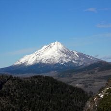
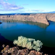
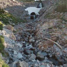
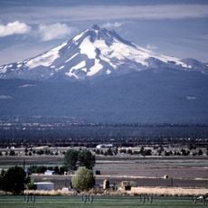
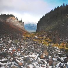
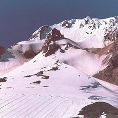
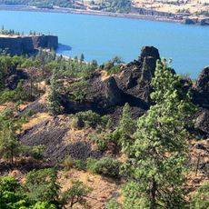
Warm Springs Indian Reservation is a protected territory in central Oregon that stretches from the Cascade Mountains to the Deschutes River cliffs. The land supports communities, cultural institutions, and economic facilities operated by the tribes who live there.

In 1855, the Wasco and Warm Springs tribes signed a treaty that reduced their lands but secured their rights to the reservation and traditional practices. This agreement formed the foundation for the communities that exist today.

The Wasco, Warm Springs, and Paiute peoples maintain their languages and cultural practices as core parts of daily community life. You can sense this living heritage in the way residents interact and in the institutions they operate across the reservation.

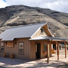
The reservation features a museum with tribal artifacts and a casino, both open to visitors. Check in advance which areas and facilities welcome tourists, as access can vary depending on current conditions.

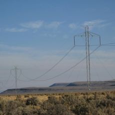
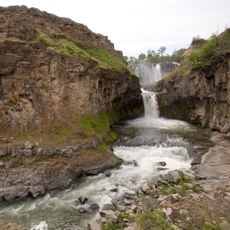
The tribes operate hydroelectric projects along the Deschutes River and have ventured into carbon offset programs. This blend shows how communities draw on traditional resources while exploring forward-thinking opportunities.

The community of curious travelers

AroundUs brings together thousands of curated places, local tips, and hidden gems, enriched daily by 60,000 contributors worldwide.

Start exploring
Location
Location
Inception
1855
Operator
Confederated Tribes of Warm Springs
GPS coordinates
44.87000,-121.45389
Latest update
March 5, 2026 18:15
Around this place
Mount Hood
United States of America

Mount Hood

59.2 km
Timberline Lodge
United States of America

Timberline Lodge

55.2 km
Maryhill Stonehenge
United States of America

Maryhill Stonehenge

104.9 km
Celilo Falls
United States of America

Celilo Falls

94.4 km
Painted Hills
United States of America

Painted Hills

96.2 km
Mount Jefferson
United States of America

Mount Jefferson

34.9 km
Pacific DC Intertie
United States of America

Pacific DC Intertie

84.9 km
Trillium Lake
United States of America

Trillium Lake

49.9 km
The Dalles Dam
United States of America

The Dalles Dam

86.5 km
Barlow Road
United States of America

Barlow Road

49.5 km
Lake Billy Chinook
United States of America

Lake Billy Chinook

32.1 km
Maryhill Museum of Art
United States of America

Maryhill Museum of Art

101 km
Columbia River Gorge National Scenic Area
United States of America

Columbia River Gorge National Scenic Area

88.8 km
The Cove Palisades State Park
United States of America

The Cove Palisades State Park

32.8 km
Mount Hood Railroad
United States of America

Mount Hood Railroad

87.6 km
Timberline Trail
United States of America

Timberline Trail

63.1 km
Timothy Lake
United States of America

Timothy Lake

38.2 km
Mount Jefferson Wilderness
United States of America

Mount Jefferson Wilderness

34.8 km
White River Falls State Park
United States of America

White River Falls State Park

50 km
Mount Hood Wilderness
United States of America

Mount Hood Wilderness

61.7 km
Cottonwood Canyon State Park
United States of America

Cottonwood Canyon State Park

102.6 km
Silcox Hut
United States of America

Silcox Hut

56.5 km
Starvation Creek State Park
United States of America

Starvation Creek State Park

92.9 km
United States of America

Tom Dick and Harry Mountain

53.7 km
Palmer Glacier
United States of America

Palmer Glacier

57.3 km
Western Antique Aeroplane & Automobile Museum
United States of America

Western Antique Aeroplane & Automobile Museum

90.1 km
Memaloose State Park
United States of America

Memaloose State Park

92.4 km
Ramona Falls
United States of America

Ramona Falls

62.2 km
Show the full map
Reviews
Share your experience

No review yet

Discussions
Start a discussion...

No discussion yet

« Warm Springs Indian Reservation - Native American reservation in Central Oregon, US » is provided by Around Us (aroundus.com). Images and texts are derived from Wikimedia project under a Creative Commons license. You are allowed to copy, distribute, and modify copies of this page, under the conditions set by the license, as long as this note is clearly visible.

Discover hidden gems everywhere you go!

From secret cafés to breathtaking viewpoints, skip the crowded tourist spots and find places that match your style. Our app makes it easy with voice search, smart filtering, route optimization, and insider tips from travelers worldwide. Download now for the complete mobile experience.

Around Us App Screenshot

A unique approach to discovering new places

Le Figaro

All the places worth exploring

France Info

A tailor-made excursion in just a few clicks

20 Minutes

Around Us
Travel Guide & Maps
Download

Send to your phone

QR Code
1

Open the camera app on your mobile.

2

Point at the QR code with your camera. A notification will appear.

3

Tap the notification to open the link.