Enable Location

We need your location to show you interesting places around you

Discover nearby places

Find interesting locations and hidden gems around you

Precise directions

Get accurate directions and distances to places

Your location is never shared with other users. It's only used when you tap the location button.

Manzanita

Log in to your account

Start exploring — it's free

Trusted by 63,934 travelers worldwide

Continue with Google
Continue with Apple
or

We will send you a code to connect

By continuing, you accept our Terms and Conditions and our Privacy Policy

Check your inbox

We've sent a pincode in your inbox. Please enter the code below.

Discussion Reviews 2 Photos
20.4k Popularity

Manzanita, city in Oregon, USA

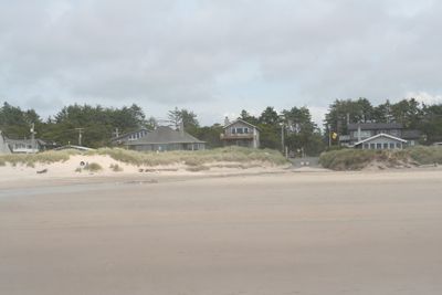
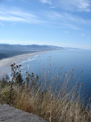
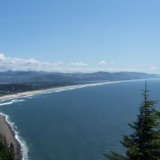
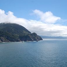
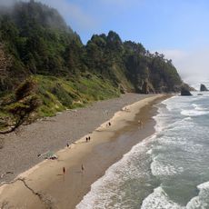
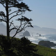
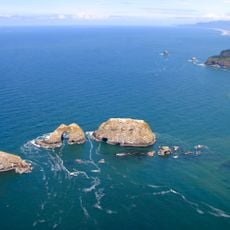
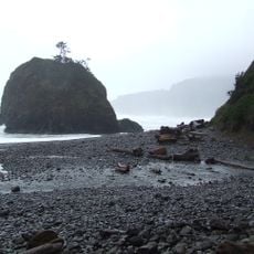
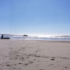
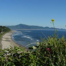
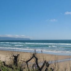
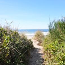
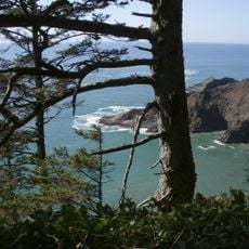
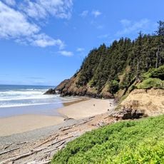
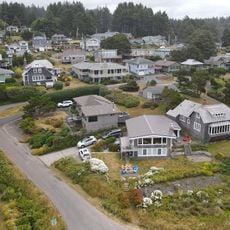
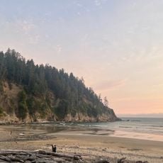
Manzanita is a small city on the north coast of Oregon in Tillamook County, surrounded by spruce and pine forests and featuring a long stretch of white sandy beach. The town consists of a mix of homes and small businesses that blend naturally with the natural surroundings.

The area was home to the Tillamook people for thousands of years until white settlers arrived in the 1800s, bringing illnesses that devastated the population. The town was planned as a beach resort in 1912, and a post office opened in 1914, named after the local manzanita plant.

The name Manzanita comes from Spanish, meaning 'little apple,' inspired by the wild plants that grow throughout the area. The town preserves its character as a quiet coastal community where residents and visitors value a simple, nature-focused way of life and gather regularly for local events.

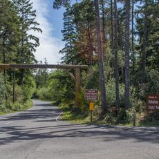
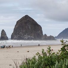
The town is very walkable with small shops, restaurants, and a seasonal farmers market that are easy to explore on foot. Visitors can also enjoy activities such as golfing, surfing, biking, kayaking, and hiking, as well as visit the nearby Oswald West State Park.

The ship Glenesslin sank offshore in 1913 and is one of Oregon's notable shipwrecks. There are also old stories about the Santo Cristo de Burgos from 1693, with tales suggesting treasure may be hidden on a nearby mountain.

The community of curious travelers

AroundUs brings together thousands of curated places, local tips, and hidden gems, enriched daily by 60,000 contributors worldwide.

Start exploring
Location
Inception
1946
Elevation above the sea
23.8 m
GPS coordinates
45.71917,-123.93583
Latest update
February 16, 2026 21:40
Around this place
Tillamook Rock Light
United States of America

Tillamook Rock Light

25.1 km
Oswald West State Park
United States of America

Oswald West State Park

5.9 km
Nehalem Bay State Park
United States of America

Nehalem Bay State Park

2.3 km
Neahkahnie Mountain
United States of America

Neahkahnie Mountain

3.3 km
Hug Point State Recreation Site
United States of America

Hug Point State Recreation Site

12 km
Cape Meares Lighthouse
United States of America

Cape Meares Lighthouse

26.1 km
Ecola State Park
United States of America

Ecola State Park

22.8 km
Three Arch Rocks National Wildlife Refuge
United States of America

Three Arch Rocks National Wildlife Refuge

28.9 km
Seaside Aquarium
United States of America

Seaside Aquarium

30.7 km
Short Beach
United States of America

Short Beach

27.3 km
Arcadia Beach State Recreation Site
United States of America

Arcadia Beach State Recreation Site

14.3 km
Oceanside Beach State Recreation Site
United States of America

Oceanside Beach State Recreation Site

28.9 km
Tolovana Beach Wayside
United States of America

Tolovana Beach Wayside

17.2 km
Cape Meares National Wildlife Refuge
United States of America

Cape Meares National Wildlife Refuge

25.9 km
Oceanside Beach State Recreation Site

Oceanside Beach State Recreation Site

28.7 km
Saddle Mountain State Natural Area
United States of America

Saddle Mountain State Natural Area

33.6 km
Manhattan Beach State Recreation Site
United States of America

Manhattan Beach State Recreation Site

8.5 km
Wilson River Bridge
United States of America

Wilson River Bridge

27.8 km
Harry F. Wentz Studio
United States of America

Harry F. Wentz Studio

1.7 km
Cape Falcon Marine Reserve
United States of America

Cape Falcon Marine Reserve

7.5 km
A. E. Doyle Cottage
United States of America

A. E. Doyle Cottage

1.2 km
Mary Frances Isom Cottage
United States of America

Mary Frances Isom Cottage

1.1 km
Indian Beach
United States of America

Indian Beach

23.5 km
Sunset Beach
United States of America

Sunset Beach

448 m
Short Sand Beach
United States of America

Short Sand Beach

5.2 km
Blumenthal Falls
United States of America

Blumenthal Falls

5.7 km
Latimer Quilt & Textile Center
United States of America

Latimer Quilt & Textile Center

28.3 km
Nehalem River Bridge
United States of America

Nehalem River Bridge

33.4 km
Show the full map
Reviews
Share your experience

No review yet

Discussions
Start a discussion...

No discussion yet

« Manzanita - city in Oregon, USA » is provided by Around Us (aroundus.com). Images and texts are derived from Wikimedia project under a Creative Commons license. You are allowed to copy, distribute, and modify copies of this page, under the conditions set by the license, as long as this note is clearly visible.

Discover hidden gems everywhere you go!

From secret cafés to breathtaking viewpoints, skip the crowded tourist spots and find places that match your style. Our app makes it easy with voice search, smart filtering, route optimization, and insider tips from travelers worldwide. Download now for the complete mobile experience.

Around Us App Screenshot

A unique approach to discovering new places

Le Figaro

All the places worth exploring

France Info

A tailor-made excursion in just a few clicks

20 Minutes

Around Us
Travel Guide & Maps
Download

Send to your phone

QR Code
1

Open the camera app on your mobile.

2

Point at the QR code with your camera. A notification will appear.

3

Tap the notification to open the link.