Log in to your account

AroundUs is a community-driven map of interesting places, built by curious explorers like you. It grows with every review, story, and photo you share.
Connect to save your favorite spots, contribute locations, and create personalized routes.
Continue with Google
Continue with Apple
Continue with X
Continue with Facebook
Continue with email
By continuing, you accept our Terms and Conditions and our Privacy Policy
Create an account
Add to collection
Map
Suggest a change
Share

Cadiz Dunes Wilderness, Protected wilderness area in San Bernardino County, United States.

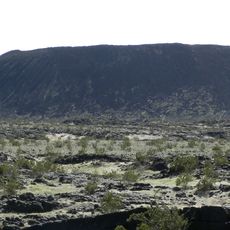
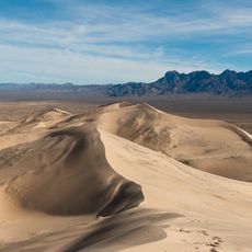
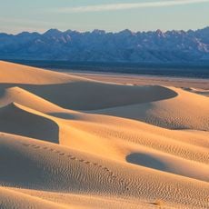
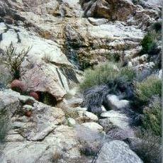
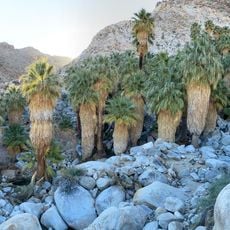
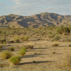
Cadiz Dunes is a protected wilderness area covering thousands of acres in the Mojave Desert with sand formations shaped by winds from the Cadiz dry lake. The terrain consists of expansive sandy surfaces continuously reshaped by wind erosion, creating an ever-changing topography.

Congress designated this section of California desert as a protected wilderness area in 1994, integrating it into the national preservation system. This protection marked the transition from other uses to a landscape preserved from commercial or mechanized activities.

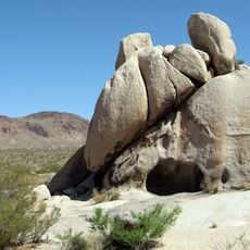
The Bureau of Land Management oversees this space where visitors encounter the desert in its raw state without modern infrastructure or amenities. People who come here typically seek solitude and the feeling of moving through an untouched landscape.

Visitors should bring adequate water supplies and navigation tools, as no marked trails or facilities exist within the area. The absence of infrastructure requires careful planning and self-sufficiency for anyone exploring this location.

In spring, rare desert wildflowers bloom among the dunes, including the Borrego milkvetch, a species adapted to these harsh conditions. This brief flowering period creates a surprising color contrast against the otherwise golden sandy landscape.

Location: San Bernardino County

GPS coordinates: 34.37497,-115.38565

Latest update: December 11, 2025 18:01

Photos
Around this place
United States of America

AN/URC-117 Ground Wave Emergency Network

44.3 km
Amboy Crater
United States of America

Amboy Crater

41.7 km
Kelso Dunes
United States of America

Kelso Dunes

69.1 km
Mitchell Caverns
United States of America

Mitchell Caverns

64.1 km
Mojave Trails National Monument
United States of America

Mojave Trails National Monument

59.5 km
Old Woman meteorite
United States of America

Old Woman meteorite

27.1 km
Old Woman Mountains Wilderness
United States of America

Old Woman Mountains Wilderness

20.1 km
Keys Desert Queen Ranch
United States of America

Keys Desert Queen Ranch

80.9 km
Providence Mountains State Recreation Area
United States of America

Providence Mountains State Recreation Area

64.7 km
Desert Queen Mine
United States of America

Desert Queen Mine

74.2 km
Bigelow Cholla Garden Wilderness
United States of America

Bigelow Cholla Garden Wilderness

68.5 km
Clipper Mountain Wilderness
United States of America

Clipper Mountain Wilderness

40.5 km
Turtle Mountains
United States of America

Turtle Mountains

50.1 km
Wall Street Mill
United States of America

Wall Street Mill

78.5 km
Fortynine Palms Oasis
United States of America

Fortynine Palms Oasis

72.7 km
Malapai Hill
United States of America

Malapai Hill

80.8 km
Goffs Schoolhouse
United States of America

Goffs Schoolhouse

67.8 km
Ruby Lee Mill Site
United States of America

Ruby Lee Mill Site

72.3 km
Joshua Tree Wilderness
United States of America

Joshua Tree Wilderness

40.1 km
Joshua Tree National Park Visitor Center
United States of America

Joshua Tree National Park Visitor Center

67.3 km
Cottonwood Visitor Center
United States of America

Cottonwood Visitor Center

80.6 km
Jumbo Rocks Campground
United States of America

Jumbo Rocks Campground

75.5 km
White Tank Campground
United States of America

White Tank Campground

72.6 km
Cottonwood Campground Amphitheater
United States of America

Cottonwood Campground Amphitheater

80.5 km
Cottonwood Campground
United States of America

Cottonwood Campground

80.8 km
Sheep Pass Campground
United States of America

Sheep Pass Campground

79.5 km
Belle Campground
United States of America

Belle Campground

71.7 km
Indian Cove Campground
United States of America

Indian Cove Campground

77.7 km
Show the full map
Reviews

Visited this place? Tap the stars to rate it and share your experience / photos with the community! Try now! You can cancel it anytime.

« Cadiz Dunes Wilderness - Protected wilderness area in San Bernardino County, United States » is provided by Around Us (aroundus.com). Images and texts are derived from Wikimedia project under a Creative Commons license. You are allowed to copy, distribute, and modify copies of this page, under the conditions set by the license, as long as this note is clearly visible.

Discover hidden gems everywhere you go!

From secret cafés to breathtaking viewpoints, skip the crowded tourist spots and find places that match your style. Our app makes it easy with voice search, smart filtering, route optimization, and insider tips from travelers worldwide. Download now for the complete mobile experience.

Around Us App Screenshot

A unique approach to discovering new places

Le Figaro

All the places worth exploring

France Info

A tailor-made excursion in just a few clicks

20 Minutes