Chest opened
+${chestReward.xp} XP
Explorer
NOUVEAU ×${chestReward.collectible.quantity}
tapez pour fermer
Chest locked

Open chests in the app

Around Us is built for your phone — chests unlock when you walk, explore and capture nearby places.

Enable Location

We need your location to show you interesting places around you

Discover nearby places

Find interesting locations and hidden gems around you

Precise directions

Get accurate directions and distances to places

Your location is never shared with other users. It's only used when you tap the location button.

Nipton

Log in to your account

Start exploring — it's free

Trusted by 72,883 travelers worldwide

Continue with Google
Continue with Apple
or

We will send you a code to connect

By continuing, you accept our Terms and Conditions and our Privacy Policy

Check your inbox

We've sent a pincode in your inbox. Please enter the code below.

Discussion Reviews 1 Photos
32.7k Popularity

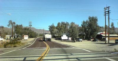
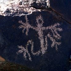
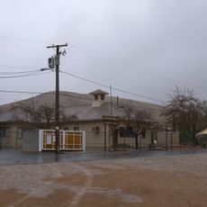
Nipton, Desert community in Ivanpah Valley, California, United States.

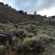
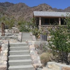
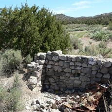
Nipton is a small desert settlement in Ivanpah Valley near the Nevada border that contains buildings and facilities from different periods. The site includes a historic adobe hotel built in 1910, a general store, trading post, restaurant, RV park, eco-cabins, and teepee camping areas.

The settlement began as Nippeno Camp in 1905 during the California gold rush and later became a key cattle-loading station on the San Pedro railway line. This role made it an economic hub for livestock transport across the region.

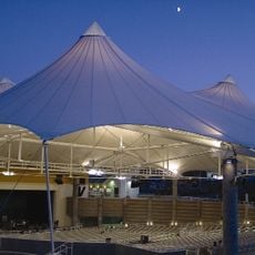
The settlement now functions as a creative hub where circus performers and theater groups develop new productions and artistic projects in the desert. This artistic purpose attracts performers looking for a quiet place away from city distractions.

The settlement sits about two miles from the Nevada border and roughly one hour from Las Vegas, making it accessible for day trips from that area. With its small population of around 25 residents, it offers modest accommodations and dining options for visitors exploring the region.

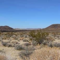
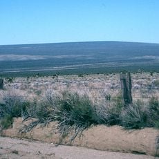
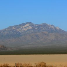
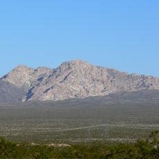
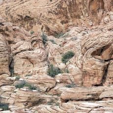
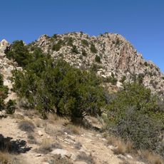
The site spreads across roughly 80 acres of Mojave Desert land with eucalyptus groves and mountain views at about 10,000 feet elevation. This combination of vegetation and elevation creates an unexpected landscape for a typical desert location.

The community of curious travelers

AroundUs brings together thousands of curated places, local tips, and hidden gems, enriched daily by 60,000 contributors worldwide.

Start exploring
GPS coordinates
35.46667,-115.27222
Latest update
December 20, 2025 00:12
Around this place
South Point Hotel, Casino & Spa
United States of America

South Point Hotel, Casino & Spa

61.3 km
Mojave National Preserve
United States of America

Mojave National Preserve

76.5 km
Desperado
United States of America

Desperado

19.3 km
M Resort
United States of America

M Resort

56.2 km
Black Canyon of the Colorado
United States of America

Black Canyon of the Colorado

63.2 km
Mitchell Caverns
United States of America

Mitchell Caverns

62.5 km
Castle Mountains National Monument
United States of America

Castle Mountains National Monument

26.9 km
United States of America

Black Mountain

55.7 km
Sloan Canyon National Conservation Area
United States of America

Sloan Canyon National Conservation Area

53.6 km
El Dorado Canyon
United States of America

El Dorado Canyon

57.7 km
Cima volcanic field
United States of America

Cima volcanic field

49.6 km
The Grandview at Las Vegas
United States of America

The Grandview at Las Vegas

61 km
Grapevine Canyon Petroglyphs
United States of America

Grapevine Canyon Petroglyphs

59.5 km
Mojave Memorial Cross
United States of America

Mojave Memorial Cross

30.4 km
Cima Dome & Volcanic Field National Natural Landmark
United States of America

Cima Dome & Volcanic Field National Natural Landmark

49.6 km
The District at Green Valley Ranch
United States of America

The District at Green Valley Ranch

64 km
Providence Mountains State Recreation Area
United States of America

Providence Mountains State Recreation Area

61.7 km
Clark Mountain
United States of America

Clark Mountain

29.5 km
Spirit Mountain
United States of America

Spirit Mountain

54.2 km
Aztec Sandstone
United States of America

Aztec Sandstone

54.4 km
Goodsprings Schoolhouse
United States of America

Goodsprings Schoolhouse

43.2 km
Henderson Pavilion
United States of America

Henderson Pavilion

63.9 km
Spirit Mountain Wilderness
United States of America

Spirit Mountain Wilderness

61.5 km
Potosi Mining District
United States of America

Potosi Mining District

61.2 km
United States of America

Bridge Canyon Wilderness

58.5 km
Grapevine Canyon
United States of America

Grapevine Canyon

59.5 km
Wee Thump Joshua Tree Wilderness, Nevada
United States of America

Wee Thump Joshua Tree Wilderness, Nevada

17.3 km
Dig This
United States of America

Dig This

54.3 km
Show the full map
Reviews
Share your experience

No review yet

Discussions
Start a discussion...

No discussion yet

« Nipton - Desert community in Ivanpah Valley, California, United States » is provided by Around Us (aroundus.com). Images and texts are derived from Wikimedia project under a Creative Commons license. You are allowed to copy, distribute, and modify copies of this page, under the conditions set by the license, as long as this note is clearly visible.

Discover hidden gems everywhere you go!

From secret cafés to breathtaking viewpoints, skip the crowded tourist spots and find places that match your style. Our app makes it easy with voice search, smart filtering, route optimization, and insider tips from travelers worldwide. Download now for the complete mobile experience.

Around Us App Screenshot

A unique approach to discovering new places

Le Figaro

All the places worth exploring

France Info

A tailor-made excursion in just a few clicks

20 Minutes

Around Us
Travel Guide & Maps
Download

Send to your phone

QR Code
1

Open the camera app on your mobile.

2

Point at the QR code with your camera. A notification will appear.

3

Tap the notification to open the link.