Zion National Park

Log in to your account

AroundUs is a community-driven map of interesting places, built by curious explorers like you. It grows with every review, story, and photo you share.
Connect to save your favorite spots, contribute locations, and create personalized routes.
By continuing, you accept our Terms and Conditions and our Privacy Policy
Add to collection
Map
Suggest a change
Share

Zion National Park, National Park in Utah, US

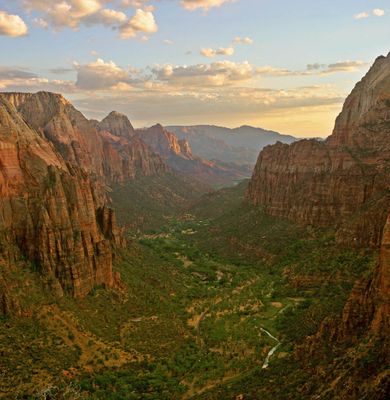
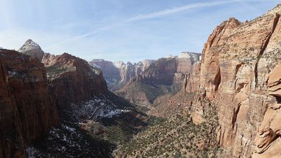
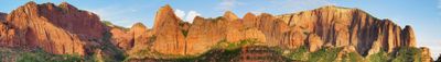
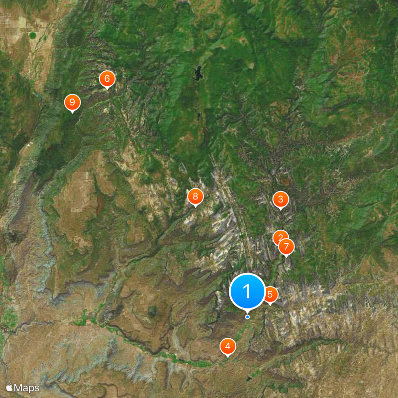
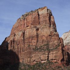
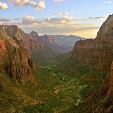
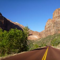
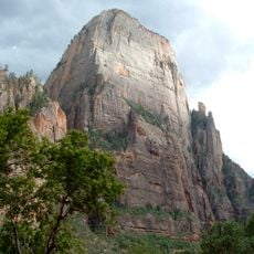
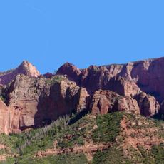
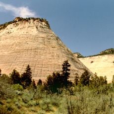
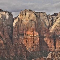
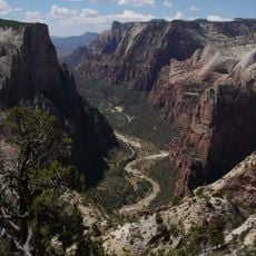
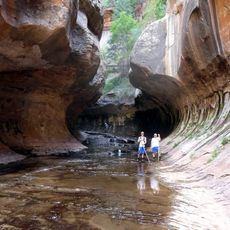
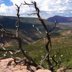
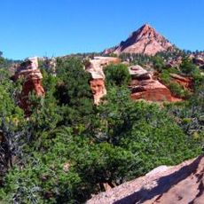
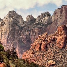
Zion National Park sits in southwestern Utah and covers an area where deep canyons, tall red sandstone cliffs, and the Virgin River shape the terrain. The rock walls reach heights up to 800 meters (2,600 feet) and form narrow valleys that hold trails and waterways running through the landscape.

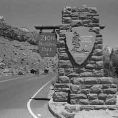
The area received protection in 1909 as Mukuntuweap National Monument, then gained its current status and name as a national park in 1919. This shift marked the transition to a larger protected area with expanded boundaries and official recognition.

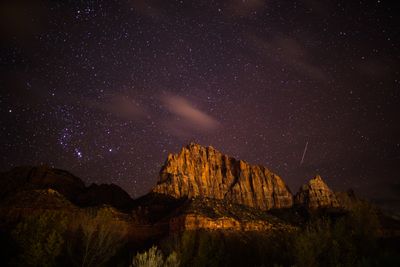
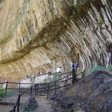
Hiking through the narrow canyons is a tradition many visitors follow in the early morning, when the sun first lights the red walls and the air remains cool enough for comfortable walking. People often pause at overlooks to share the view with strangers, creating a quiet sense of community among those who come to experience the landscape together.

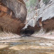
A free shuttle connects major trailheads and viewpoints along the main canyon road during spring, summer, and fall, making it easier to move between different areas without a car. Most trails are clearly marked, but some pass through water or over slippery rocks, so sturdy footwear and readiness for changing conditions help ensure a safer visit.

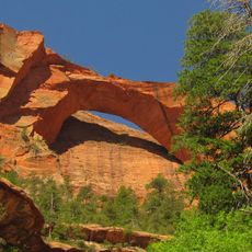
The rock layers reveal nine different geological formations that took shape over 150 million years and now appear through ongoing erosion, offering a visible cross-section of deep time. Visitors can trace these layers along the canyon walls while walking, seeing how ancient environments stacked one on top of the other.

Location: Washington County

Location: Iron County

Location: Kane County

Inception: November 19, 1919

Operator: National Park Service

Part of: Mighty Five

Website: https://nps.gov/zion

GPS coordinates: 37.20262,-112.98785

Latest update: December 11, 2025 23:54

Photos
Around this place
Show the full map
Angels Landing
United States of America

Angels Landing

8.2 km
The Narrows
United States of America

The Narrows

12.1 km
Zion Canyon
United States of America

Zion Canyon

4.7 km
Zion – Mount Carmel Highway
United States of America

Zion – Mount Carmel Highway

2.8 km
Kolob Arch
United States of America

Kolob Arch

28.8 km
The Great White Throne
United States of America

The Great White Throne

7.7 km
The Subway
United States of America

The Subway

13.1 km
Kolob Canyons
United States of America

Kolob Canyons

28.9 km
Checkerboard Mesa
United States of America

Checkerboard Mesa

9.8 km
Historical buildings and structures of Zion National Park
United States of America

Historical buildings and structures of Zion National Park

11.2 km
Court of the Patriarchs
United States of America

Court of the Patriarchs

4.4 km
Kolob Reservoir
United States of America

Kolob Reservoir

26 km
Horse Ranch Mountain
United States of America

Horse Ranch Mountain

34.2 km
Hurricane Mesa
United States of America

Hurricane Mesa

20.2 km
Floor of the Valley Road
United States of America

Floor of the Valley Road

6.6 km
Zion Wilderness
United States of America

Zion Wilderness

15.6 km
Blackridge Wilderness
United States of America

Blackridge Wilderness

25.9 km
Weeping Rock
United States of America

Weeping Rock

9 km
Beartrap Canyon Wilderness
United States of America

Beartrap Canyon Wilderness

26.4 km
LaVerkin Creek Wilderness
United States of America

LaVerkin Creek Wilderness

29.9 km
Deep Creek Wilderness
United States of America

Deep Creek Wilderness

21.2 km
Taylor Creek Wilderness
United States of America

Taylor Creek Wilderness

31.2 km
Goose Creek Wilderness
United States of America

Goose Creek Wilderness

18.9 km
Red Butte Wilderness
United States of America

Red Butte Wilderness

22.5 km
Deep Creek North Wilderness
United States of America

Deep Creek North Wilderness

28.2 km
Towers of the Virgin
United States of America

Towers of the Virgin

4.3 km
Rockville Bridge (Rockville, Utah)
United States of America

Rockville Bridge (Rockville, Utah)

6.6 km
Zion Lodge–Birch Creek Historic District
United States of America

Zion Lodge–Birch Creek Historic District

5.9 km
Show the full map
Reviews

Visited this place? Tap the stars to rate it and share your experience / photos with the community! Try now! You can cancel it anytime.

« Zion National Park - National Park in Utah, US » is provided by Around Us (aroundus.com). Images and texts are derived from Wikimedia project under a Creative Commons license. You are allowed to copy, distribute, and modify copies of this page, under the conditions set by the license, as long as this note is clearly visible.

Discover hidden gems everywhere you go!

From secret cafés to breathtaking viewpoints, skip the crowded tourist spots and find places that match your style. Our app makes it easy with voice search, smart filtering, route optimization, and insider tips from travelers worldwide. Download now for the complete mobile experience.

Around Us App Screenshot

A unique approach to discovering new places

Le Figaro

All the places worth exploring

France Info

A tailor-made excursion in just a few clicks

20 Minutes