Chest opened
+${chestReward.xp} XP
Explorer
NOUVEAU ×${chestReward.collectible.quantity}
tapez pour fermer
Chest locked

Open chests in the app

Around Us is built for your phone — chests unlock when you walk, explore and capture nearby places.

Enable Location

We need your location to show you interesting places around you

Discover nearby places

Find interesting locations and hidden gems around you

Precise directions

Get accurate directions and distances to places

Your location is never shared with other users. It's only used when you tap the location button.

Sawtooth National Forest

Log in to your account

Start exploring — it's free

Trusted by 72,949 travelers worldwide

Continue with Google
Continue with Apple
or

We will send you a code to connect

By continuing, you accept our Terms and Conditions and our Privacy Policy

Check your inbox

We've sent a pincode in your inbox. Please enter the code below.

Discussion Reviews 1 Photos
26.8k Popularity

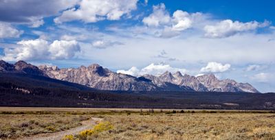
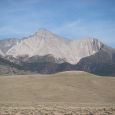
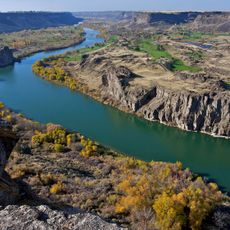
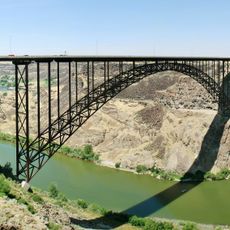
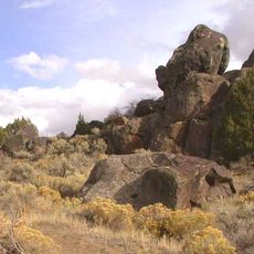
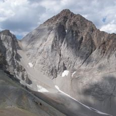
Sawtooth National Forest, National forest in southern Idaho and northern Utah, United States

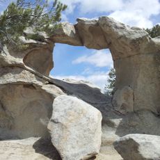
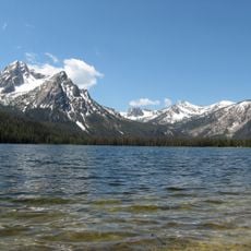
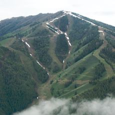
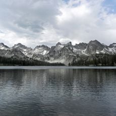
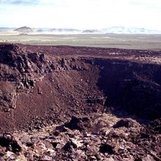
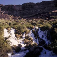
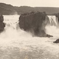
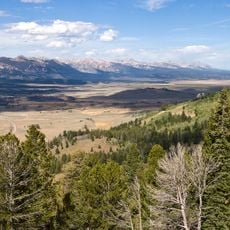
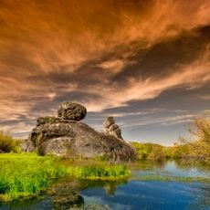
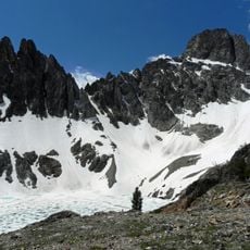
Sawtooth National Forest is a large protected area in southern Idaho and northern Utah with granite peaks, alpine lakes, and dense forests throughout. It has more than 1,000 miles of hiking trails and multiple areas for camping, skiing, and water activities.

President Theodore Roosevelt created this protected forest in 1905 as an early step in conservation efforts for the American West. This action helped establish the model for protecting wild lands across the nation.

Shoshone people lived in this forest region for thousands of years, depending on its plants and animals for food and moving with the seasons. Visitors today can find evidence of these long connections throughout the land.

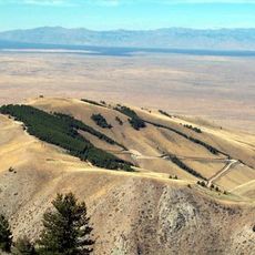
The forest has 81 campgrounds and offers year-round activities like hiking, boating, and skiing in winter areas. Plan your visit around the season, as weather and trail conditions change significantly throughout the year.

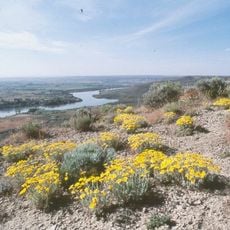
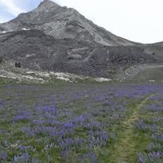
Christ's Indian paintbrush, one of Idaho's rarest plants, grows only in this forest on a small mountain area. This flower is so uncommon that botanists consider it one of the most limited plant species in the region.

The community of curious travelers

AroundUs brings together thousands of curated places, local tips, and hidden gems, enriched daily by 60,000 contributors worldwide.

Start exploring
Location
Location
Inception
May 29, 1905
Operator
United States Forest Service
GPS coordinates
43.73333,-114.66667
Latest update
December 20, 2025 14:40
Around this place
Craters of the Moon National Monument and Preserve
United States of America

Craters of the Moon National Monument and Preserve

94 km
Shoshone Falls
United States of America

Shoshone Falls

128.4 km
Experimental Breeder Reactor I
United States of America

Experimental Breeder Reactor I

136.1 km
Borah Peak
United States of America

Borah Peak

84 km
Snake River Canyon
United States of America

Snake River Canyon

128 km
United States of America

Ernest and Mary Hemingway House

23.8 km
Perrine Bridge
United States of America

Perrine Bridge

127.3 km
Massacre Rocks State Park
United States of America

Massacre Rocks State Park

179.8 km
City of Rocks National Reserve
United States of America

City of Rocks National Reserve

200.6 km
Sawtooth National Recreation Area
United States of America

Sawtooth National Recreation Area

47.8 km
Bald Mountain
United States of America

Bald Mountain

22.5 km
Hagerman Fossil Beds National Monument
United States of America

Hagerman Fossil Beds National Monument

107 km
Albion State Normal School
United States of America

Albion State Normal School

171.3 km
Sawtooth Wilderness
United States of America

Sawtooth Wilderness

43.7 km
Black Butte Crater Lava Field
United States of America

Black Butte Crater Lava Field

86.1 km
Big Southern Butte
United States of America

Big Southern Butte

137.6 km
Thousand Springs State Park
United States of America

Thousand Springs State Park

98.9 km
Twin Falls
United States of America

Twin Falls

129.8 km
Central Idaho Dark Sky Reserve
United States of America

Central Idaho Dark Sky Reserve

32.6 km
Wilson Butte Cave
United States of America

Wilson Butte Cave

111.8 km
Register Rock
United States of America

Register Rock

180 km
Castle Rocks State Park
United States of America

Castle Rocks State Park

195.1 km
United States of America

Priestly's Hydraulic Ram

111.1 km
Thompson Peak
United States of America

Thompson Peak

53.2 km
Twin Falls Idaho Temple
United States of America

Twin Falls Idaho Temple

128.9 km
Hyndman Peak
United States of America

Hyndman Peak

43.1 km
Castle Peak
United States of America

Castle Peak

34.7 km
Milner Dam
United States of America

Milner Dam

144.8 km
Show the full map
Reviews
Share your experience

No review yet

Discussions
Start a discussion...

No discussion yet

« Sawtooth National Forest - National forest in southern Idaho and northern Utah, United States » is provided by Around Us (aroundus.com). Images and texts are derived from Wikimedia project under a Creative Commons license. You are allowed to copy, distribute, and modify copies of this page, under the conditions set by the license, as long as this note is clearly visible.

Discover hidden gems everywhere you go!

From secret cafés to breathtaking viewpoints, skip the crowded tourist spots and find places that match your style. Our app makes it easy with voice search, smart filtering, route optimization, and insider tips from travelers worldwide. Download now for the complete mobile experience.

Around Us App Screenshot

A unique approach to discovering new places

Le Figaro

All the places worth exploring

France Info

A tailor-made excursion in just a few clicks

20 Minutes

Around Us
Travel Guide & Maps
Download

Send to your phone

QR Code
1

Open the camera app on your mobile.

2

Point at the QR code with your camera. A notification will appear.

3

Tap the notification to open the link.