Chest opened
+${chestReward.xp} XP
Explorer
NOUVEAU ×${chestReward.collectible.quantity}
tapez pour fermer
Chest locked

Open chests in the app

Around Us is built for your phone — chests unlock when you walk, explore and capture nearby places.

Enable Location

We need your location to show you interesting places around you

Discover nearby places

Find interesting locations and hidden gems around you

Precise directions

Get accurate directions and distances to places

Your location is never shared with other users. It's only used when you tap the location button.

Garrettsville

Log in to your account

Start exploring — it's free

Trusted by 72,931 travelers worldwide

Continue with Google
Continue with Apple
or

We will send you a code to connect

By continuing, you accept our Terms and Conditions and our Privacy Policy

Check your inbox

We've sent a pincode in your inbox. Please enter the code below.

Discussion Reviews 1 Photos
16.3k Popularity

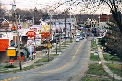
Garrettsville, village in Portage County, Ohio, United States

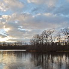
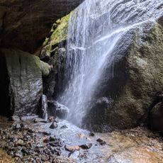
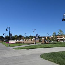
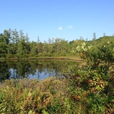
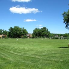
Garrettsville is a small village in Ohio featuring extensive green spaces, lakes, and trails that wind through the surrounding countryside. The settlement includes parks, dining establishments, a golf course, and nature reserves that provide both recreational opportunities and outdoor education.

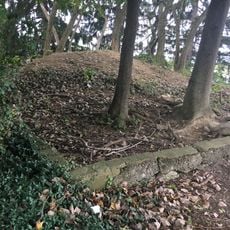
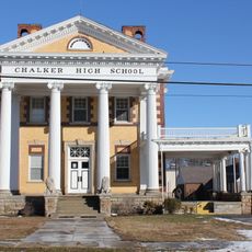
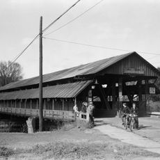
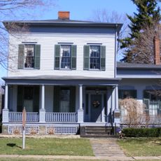
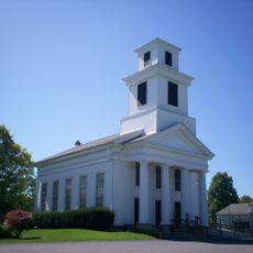
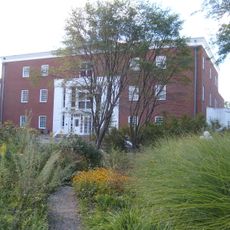
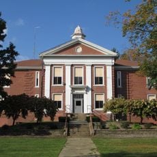
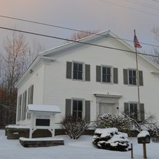
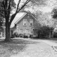
The village was established in the 19th century and developed as a rural settlement centered on farming and local crafts. Its historical structure has remained largely intact, continuing to shape the character of the settlement today.

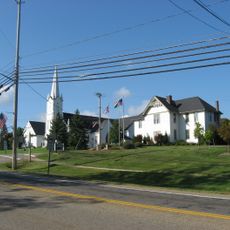
The village carries its founders' name and reflects the identity of a tight-knit rural community. Residents and visitors gather at local eateries and seasonal events, where the strong connection between neighbors becomes visible through shared traditions and daily interaction.

The village is easily accessible by car and offers limited parking in the center and free parking at nature reserves. Most activities are within walking or biking distance, and the infrastructure supports both day trips and longer stays.

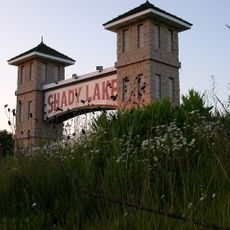
The settlement encompasses an old railway line that has been converted into the eight-mile Headwaters Trail, a popular route for walking and cycling with views of rural landscapes. This transformation of historic infrastructure demonstrates how communities repurpose their past into modern recreational use.

The community of curious travelers

AroundUs brings together thousands of curated places, local tips, and hidden gems, enriched daily by 60,000 contributors worldwide.

Start exploring
Location
Elevation above the sea
303 m
GPS coordinates
41.28390,-81.09530
Latest update
February 17, 2026 02:20
Around this place
Geauga Lake
United States of America

Geauga Lake

24 km
SeaWorld Ohio
United States of America

SeaWorld Ohio

24 km
Big Dipper
United States of America

Big Dipper

24.7 km
Dix Stadium
United States of America

Dix Stadium

24.4 km
Villain
United States of America

Villain

24.4 km
Raging Wolf Bobs
United States of America

Raging Wolf Bobs

24.4 km
Double Loop
United States of America

Double Loop

24.8 km
Partially Buried Woodshed
United States of America

Partially Buried Woodshed

25.7 km
Punderson State Park
United States of America

Punderson State Park

21.9 km
West Branch State Park
United States of America

West Branch State Park

15.7 km
Nelson Kennedy Ledges State Park
United States of America

Nelson Kennedy Ledges State Park

6.8 km
Beaver Land Mine Ride
United States of America

Beaver Land Mine Ride

24.7 km
Shady Lake Park
United States of America

Shady Lake Park

22.4 km
United States of America

Tanglewood National Golf Club

23.4 km
Memorial Stadium
United States of America

Memorial Stadium

25.7 km
Triangle Lake Bog State Nature Preserve
United States of America

Triangle Lake Bog State Nature Preserve

22.8 km
Chalker High School
United States of America

Chalker High School

11.8 km
Rockwell Field
United States of America

Rockwell Field

24.4 km
Newton Falls Covered Bridge
United States of America

Newton Falls Covered Bridge

14.9 km
Harriet Taylor Upton House
United States of America

Harriet Taylor Upton House

23.4 km
United States of America

Roller Coaster

24.7 km
Freedom Congregational Church
United States of America

Freedom Congregational Church

6.9 km
Hiram College Library
United States of America

Hiram College Library

5.1 km
Mantua Center School
United States of America

Mantua Center School

12.9 km
Free Will Baptist Church of Auburn
United States of America

Free Will Baptist Church of Auburn

15.5 km
Aurora Center Historic District
United States of America

Aurora Center Historic District

21.3 km
C.R. Howard House
United States of America

C.R. Howard House

20.1 km
Kent State University Center for the Performing Arts
United States of America

Kent State University Center for the Performing Arts

25.2 km
Show the full map
Reviews
Share your experience

No review yet

Discussions
Start a discussion...

No discussion yet

« Garrettsville - village in Portage County, Ohio, United States » is provided by Around Us (aroundus.com). Images and texts are derived from Wikimedia project under a Creative Commons license. You are allowed to copy, distribute, and modify copies of this page, under the conditions set by the license, as long as this note is clearly visible.

Discover hidden gems everywhere you go!

From secret cafés to breathtaking viewpoints, skip the crowded tourist spots and find places that match your style. Our app makes it easy with voice search, smart filtering, route optimization, and insider tips from travelers worldwide. Download now for the complete mobile experience.

Around Us App Screenshot

A unique approach to discovering new places

Le Figaro

All the places worth exploring

France Info

A tailor-made excursion in just a few clicks

20 Minutes

Around Us
Travel Guide & Maps
Download

Send to your phone

QR Code
1

Open the camera app on your mobile.

2

Point at the QR code with your camera. A notification will appear.

3

Tap the notification to open the link.