See the monuments around you in AROpen chests in the app
Around Us is built for your phone — point your camera at the streets and discover the monuments and places around you in augmented reality.Around Us is built for your phone — chests unlock when you walk, explore and capture nearby places.
Hidden gems of Chihuahua: canyons, waterfalls, colonial churches
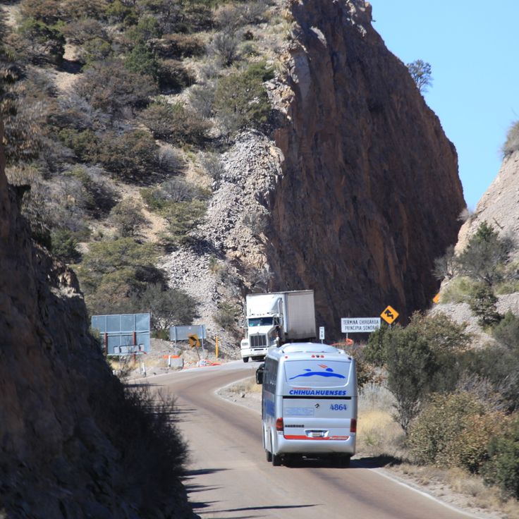
The Mexican state of Chihuahua extends from desert plains to pine forests in the Sierra Madre Occidental, reaching elevations above 2000 meters. The region preserves a rich cultural and natural heritage that includes pre-Columbian rock art, colonial-era mining facilities, and religious buildings from several centuries.
The landscape features deep gorges, natural waterfalls, and extensive mountain ranges. Archaeological sites document the early settlement of the region, while churches and chapels reflect Spanish influence from the 16th century onward. The diverse ecosystems range from arid zones to dense coniferous forests and support varied flora and fauna.
Hidden gems of Chihuahua: canyons, waterfalls, colonial churches
The Mexican state of Chihuahua extends from desert plains to pine forests in the Sierra Madre Occidental, reaching elevations above 2000 meters. The region preserves a rich cultural and natural heritage that includes pre-Columbian rock art, colonial-era mining facilities, and religious buildings from several centuries.
The landscape features deep gorges, natural waterfalls, and extensive mountain ranges. Archaeological sites document the early settlement of the region, while churches and chapels reflect Spanish influence from the 16th century onward. The diverse ecosystems range from arid zones to dense coniferous forests and support varied flora and fauna.
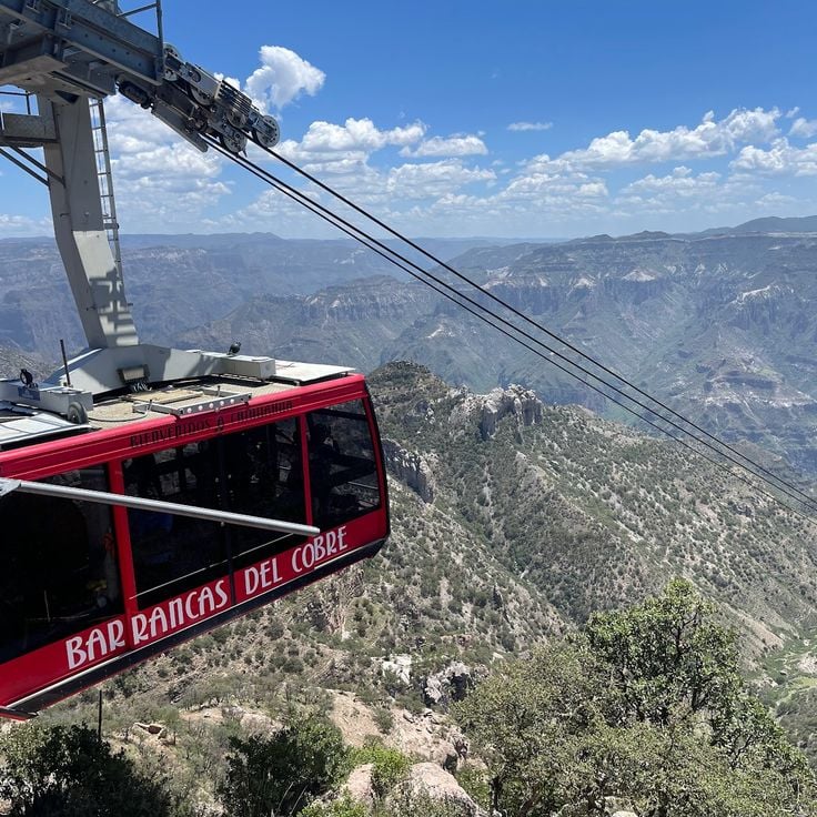
This adventure park is located in the Barrancas del Cobre and offers visitors the opportunity to explore the canyons of the Sierra Tarahumara through sporting activities. The facility features several zip lines suspended above the deep canyons, as well as suspension bridges running between the rock walls. From the observation platforms, visitors can view the mountain landscape and the depth of the gorges. The park caters to those seeking physical activities in a natural environment while experiencing the geological formations of the region from different perspectives.
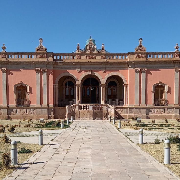
Quinta Carolina is a 19th-century historic residence that belonged to the Terrazas family during the Porfirio Díaz era. The building was constructed using traditional materials such as adobe and stone. The property documents the lifestyle of wealthy Mexican families during the Porfiriato period and displays architectural features characteristic of that era.
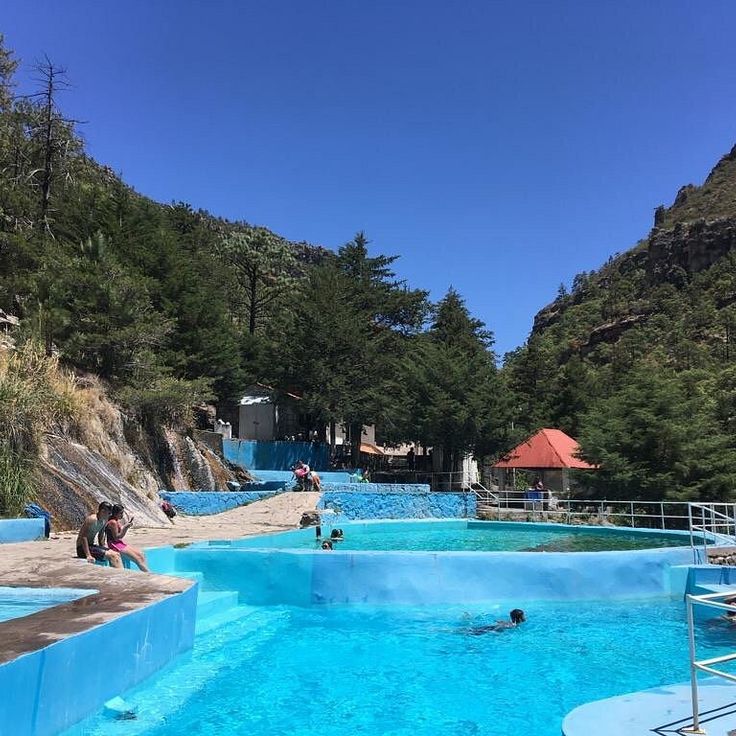
The Recowata Hot Springs are located in the mountains of the Sierra Tarahumara and offer mineral-rich water that emerges from underground sources. These natural springs are surrounded by rugged rock formations and native desert vegetation. The water temperature remains consistently warm throughout the year. Access is via unpaved trails through the mountainous terrain. The springs are used by locals and visitors for relaxation and therapeutic purposes. The remote location provides solitude away from tourist areas.
The Santa Eulalia Mining District is located approximately 25 kilometers east of Chihuahua City and operated as one of Mexico's most productive silver mines from the 18th to the 20th century. This area features an extensive network of underground tunnels spanning multiple levels, along with numerous 19th-century industrial buildings including smelters, processing facilities, and administrative structures. The historical infrastructure documents the evolution of mining technology across three centuries and demonstrates the significant economic impact this mine had on the Chihuahua region.
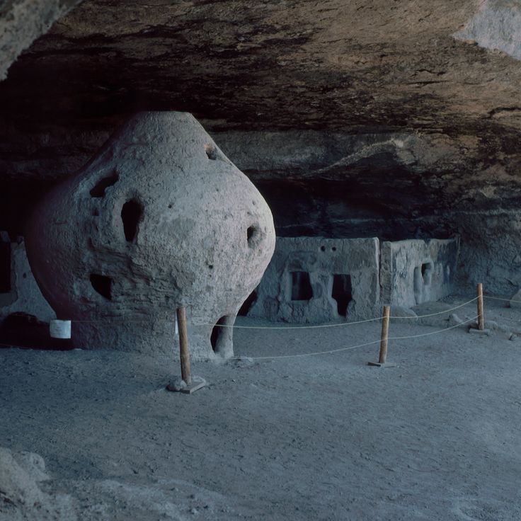
Cueva de la Olla is an archaeological site in the Sierra Madre Occidental, inhabited by the Mogollón culture between 1060 and 1205 AD. This cave houses large round adobe structures that served as grain storage facilities and were integrated into the rock face. The site includes several rooms and adobe constructions built within a natural cave formation. The walls display red and yellow rock paintings featuring geometric patterns and representations of humans and animals. Cueva de la Olla forms part of the Paquimé cultural complex and documents the advanced construction techniques and social organization of the pre-Columbian peoples of this region.
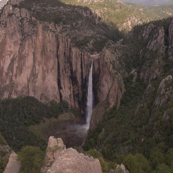
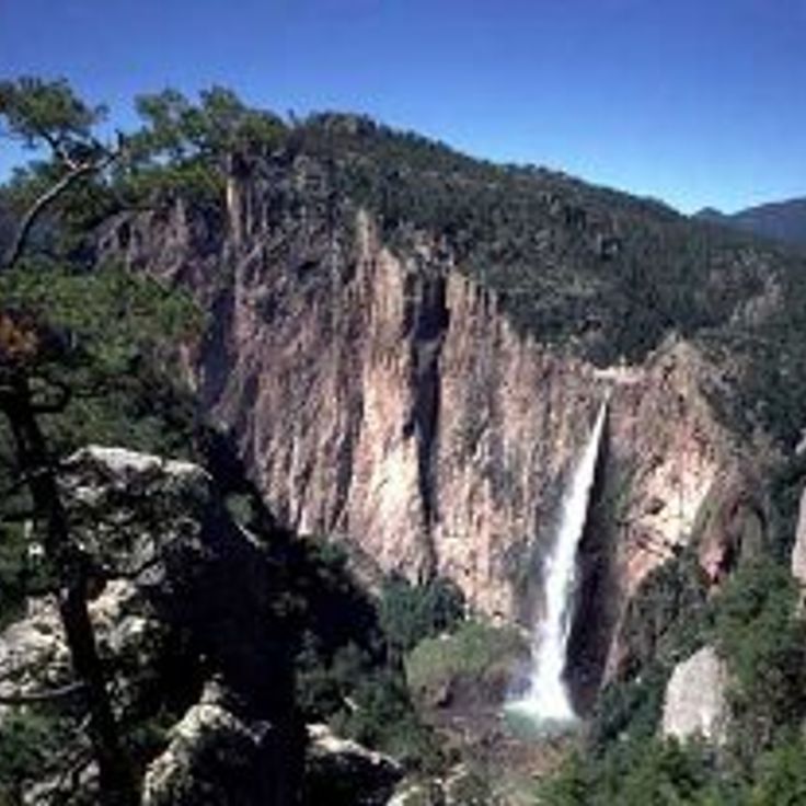
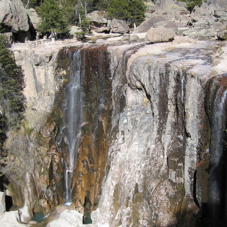
Cascada de Basaseachic National Park protects one of Mexico's highest waterfalls, with a drop of 246 meters. The protected area extends across the forested slopes of the Sierra Madre Occidental and contains extensive pine and oak forests. Several hiking trails lead through the terrain to various viewpoints overlooking the waterfall and surrounding canyons.
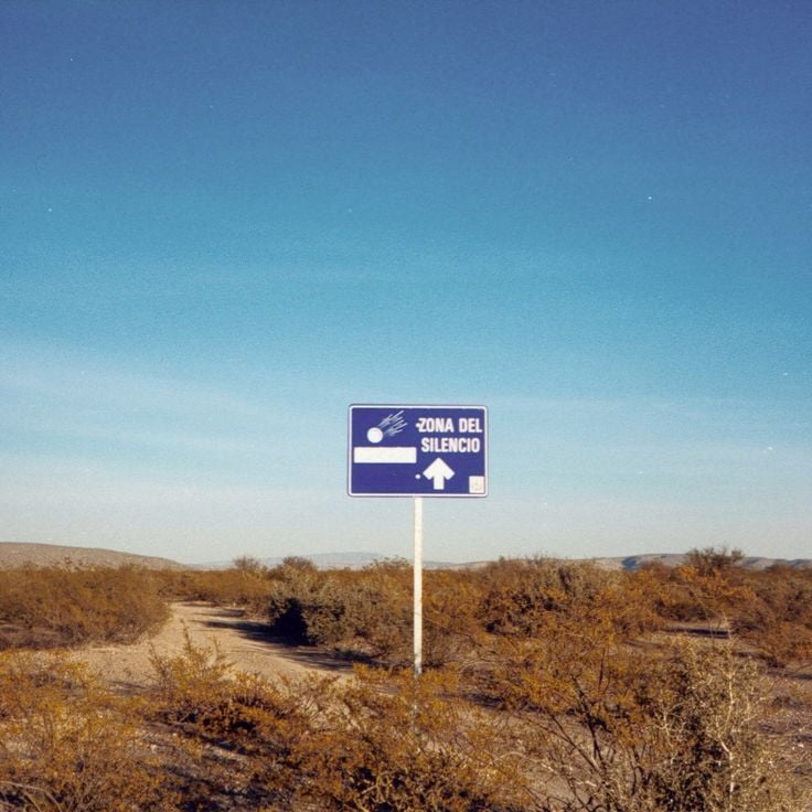
The Zone of Silence extends across a desert region in Chihuahua state, approximately 400 kilometers south of the American border. This area regularly records meteorite impacts and displays magnetic anomalies that affect scientific measurement equipment. The zone sits on the same latitude as the Bermuda Triangle and the Pyramids of Giza. Researchers document radio signal disturbances and unusual mineral formations in the soil here.
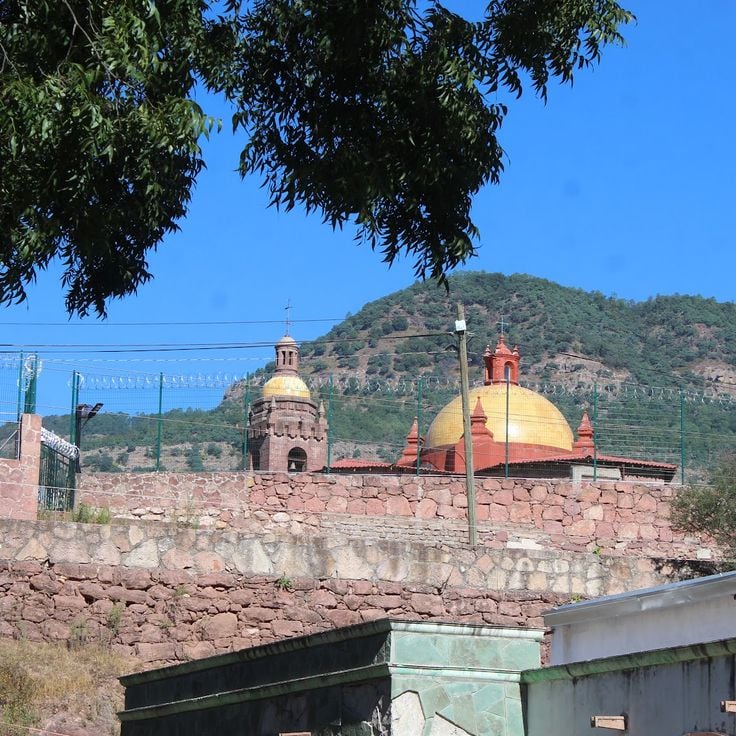
The Cerocahui Mission was established in the 17th century by Jesuit missionaries and serves as a religious center for the local community. This structure features thick stone walls and a central bell tower that rises beside a maintained garden. The church preserves colonial architectural elements and displays the craftsmanship of its era. Visitors can explore the interior with its religious artifacts and walk through the quiet surroundings of the adjacent garden area.
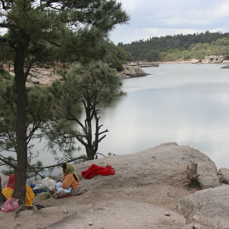
Lake Arareco sits in the Sierra Tarahumara mountains at approximately 2,200 meters above sea level. This natural freshwater lake is surrounded by dense pine forests and fed by several springs. The body of water features distinctive rock formations of weathered volcanic stone that rise along its shores. The Rarámuri people have used this area for centuries. Visitors can walk along the marked trails around the lake and observe native wildlife. Water temperature remains cool throughout the year, and visibility depth varies by season.
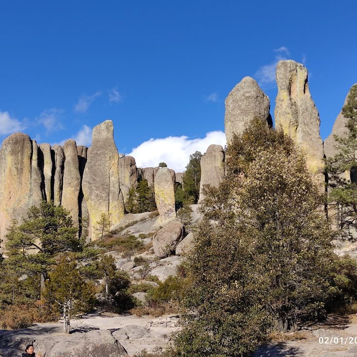
Piedra Volada is an observation point in the Sierra Tarahumara located at 2800 meters altitude. From this vantage point, visitors can observe the deep ravines and canyons of the region. The site is situated in the Guachochi area and provides views of the geological formations and the expanse of the landscape. The canyon below the viewpoint reaches considerable depths. Access is gained through hiking trails across the mountain terrain of the Sierra Madre Occidental.
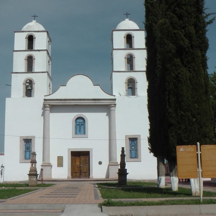
The Satevó Mission is an abandoned colonial temple from the 18th century located in a remote canyon near the Satevó River. The building displays baroque architectural elements with a stone facade that has retained its original decorative details despite decades of neglect. The church features a main nave with a high vaulted ceiling and side niches that once housed religious figures. Historical records suggest this mission was built by Jesuit missionaries to evangelize the indigenous population of the region. The isolation of the site and difficult access have contributed to the preservation of the structure.
The Cusarare Waterfalls are located within the traditional territory of the Rarámuri people in the southern Sierra Tarahumara. Water drops 30 meters into a natural pool, surrounded by pine forests at an elevation exceeding 2,000 meters. The waterfalls are accessible via a hiking trail of approximately two kilometers from Cusarare village. Rarámuri communities operate small stands selling local handicrafts along the path. Water flow varies by season, with the rainy months between July and September providing the greatest volume.
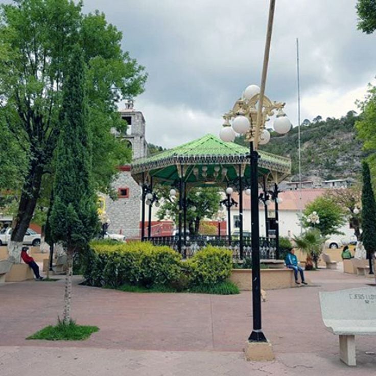
Guadalupe y Calvo was established in 1847 as a mining town for silver extraction. This municipality sits in the Sierra Madre Occidental and preserves its colonial architecture with buildings from the 19th century. The local population maintains traditional crafts and customs of the region. The surrounding mountains offer hiking trails through pine and oak forests.
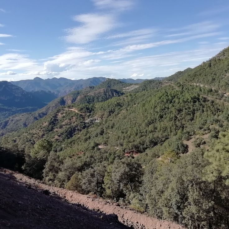
The Sierra Tutuaca is a mountain range in northern Chihuahua that rises to 2,900 meters above sea level. This region contains extensive forests of pine and oak trees that provide important habitat for various wildlife species. Black bears roam the forested slopes in search of food, while golden eagles nest in the higher elevations and soar above the ridgelines. The area is characterized by its remoteness and limited tourist infrastructure, making it a destination for nature enthusiasts seeking to explore undisturbed landscapes.
This archaeological site sits on a hill above Hidalgo del Parral and preserves over 500 pre-Columbian rock carvings. The petroglyphs, carved into volcanic rock, display geometric patterns, spiral shapes, and representations of animals including deer and serpents. The Cerro de la Máscara documents the presence of indigenous peoples in this region of Chihuahua during the pre-Hispanic period and likely served ritual or astronomical purposes.
Cueva Nohochi is a natural cave in the Sierra Tarahumara at an altitude of 2,300 meters. It preserves rock paintings and archaeological remains of the Raramuri people who have inhabited this region for centuries. Located near Creel, the cave documents the history of northern Mexico's indigenous peoples through its wall art and material evidence.
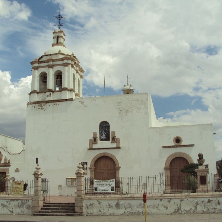
The Temple of San Francisco was built during the 18th century and features stone carving details on its facade and interior. The church contains multiple side altars and a central dome decorated with religious imagery. The structure has served as a place of worship since its construction and represents colonial religious architecture in the Chihuahua region.
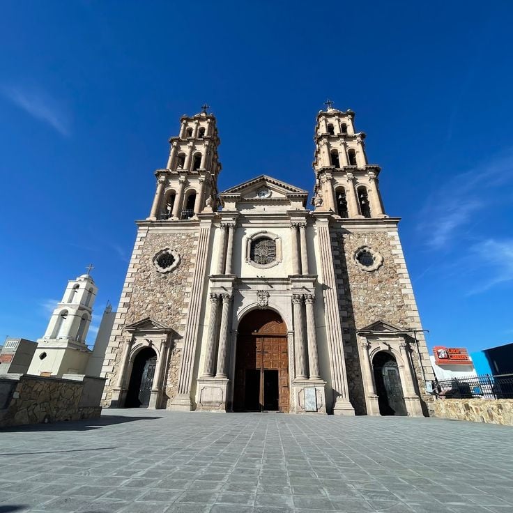
This cathedral was constructed during the 20th century and features two bell towers flanking a central dome that dominates the skyline of Ciudad Juárez. The building incorporates traditional stone masonry techniques and contains stained glass windows that illuminate the interior spaces. The architectural design combines religious functionality with craftsmanship, serving the Catholic community as a gathering place for liturgical celebrations.
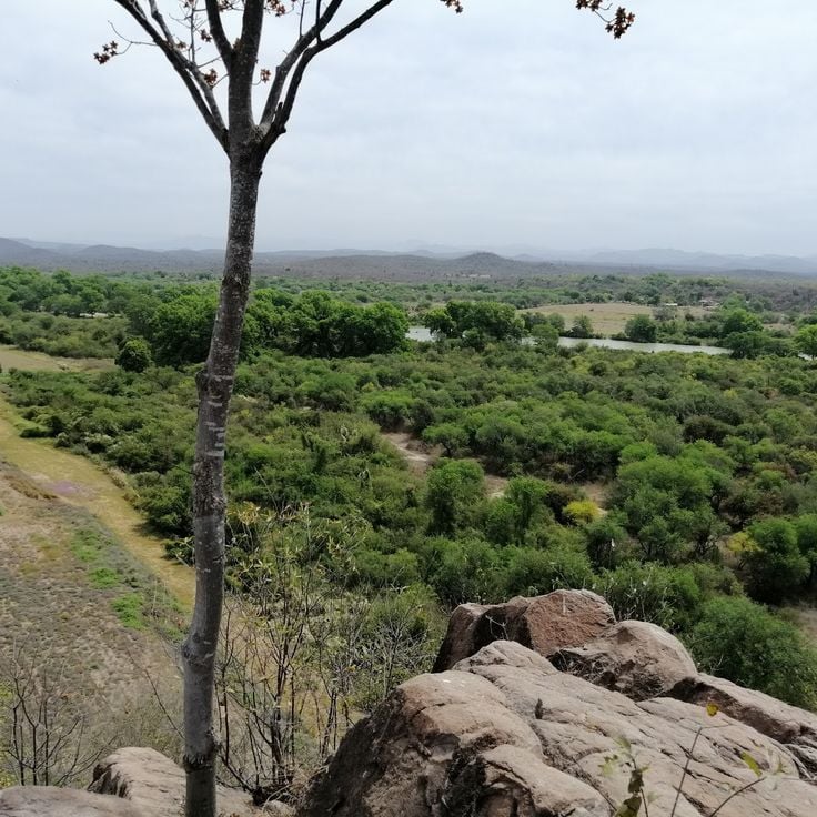
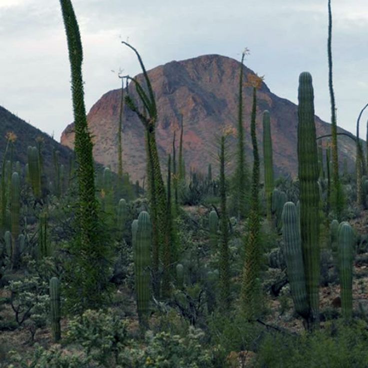
The Sierra de Álvarez extends across Chihuahua state, forming a mountain range covered with extensive pine forests. This mountainous region features numerous geological formations, including distinctive rock structures of volcanic origin. Several marked hiking trails traverse the area, providing access to different elevations, with some peaks reaching above 2000 meters. The region serves as habitat for various plant and animal species adapted to the mountain climate. Visitors can explore the different vegetation zones and discover the topographic diversity of this mountain landscape in northern Mexico.
This colony hosts Mexican prairie dogs living in an extensive system of underground tunnels and chambers. The animals dig complex burrows that reach several meters deep and feature numerous entrances. Visitors can observe the colony from designated viewing points, where prairie dogs can be seen foraging, digging, and engaging in social interactions. The population displays typical behaviors including sentinel duty, communication through calls, and communal organization.
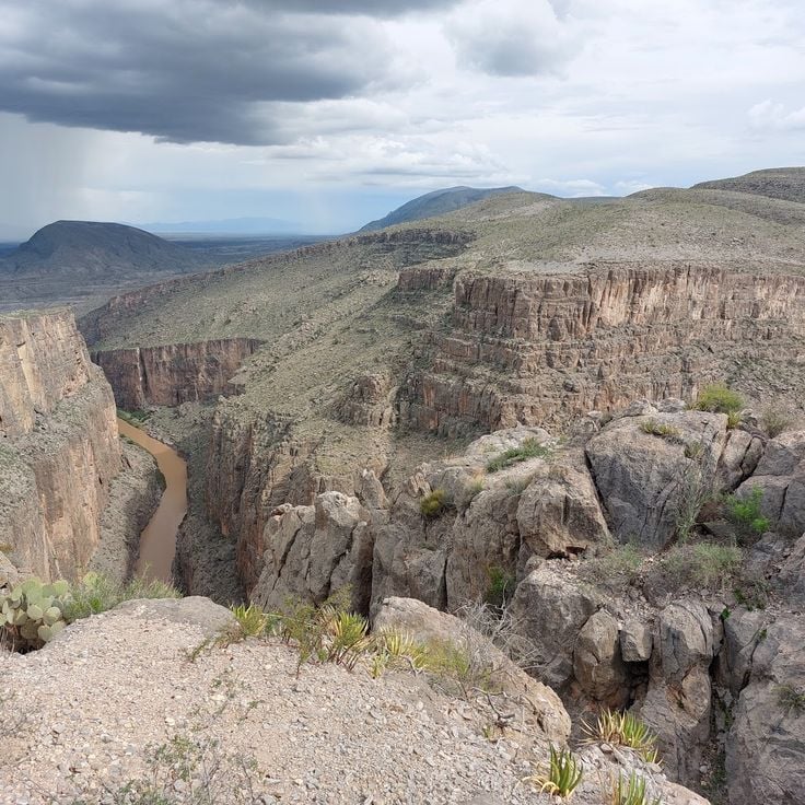
The Canyon del Pegüis cuts deeply into the Chihuahua landscape, forming vertical rock walls that rise up to 300 meters in height. The steep cliffs, composed of sedimentary rock, display various geological layers exposed by millions of years of erosion. Several hiking trails traverse the canyon, providing access to different elevations. Rock climbers find technically demanding routes on the cliff faces. The flora consists of cacti, agaves, and drought-resistant shrubs typical of the desert region. The canyon is located near Ojinaga, a border town on the Rio Grande, and forms part of the larger Chihuahuan Desert.
The Parral Tunnel descends 500 meters into an abandoned colonial-era silver mine. This underground site preserves original mining equipment, shafts, and galleries carved by 17th and 18th-century miners. The geological formations reveal the silver veins that made Parral one of New Spain's wealthiest mining centers. The tour exposes the harsh working conditions faced by miners and the extraction techniques of the period.
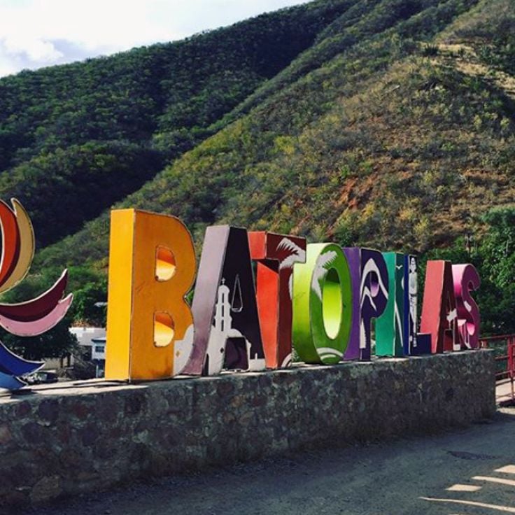
The Batopilas Caves form an extensive network of natural cavities in the rugged mountain terrain of the Sierra Madre Occidental. These caves preserve rock paintings and archaeological remains left by indigenous peoples who inhabited this region for centuries. The remote location has helped maintain the integrity of the prehistoric artwork and artifacts found within. Access requires a several-hour hike through steep terrain.
These stone pyramids were built between 900 and 1300 CE and feature multiple terraces along with architectural elements that show similarities to other Mesoamerican structures. The Tonachi structures are located in a remote region of the Barrancas del Cobre and document the presence of pre-Columbian cultures in northern Mexico. The site includes various platforms and constructions that indicate complex social organizations.
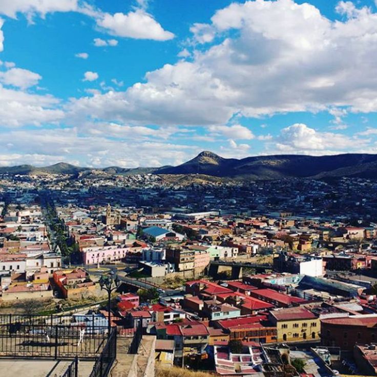
Mirador El Faro rises above the city of Chihuahua as an observation tower shaped like a lighthouse. From this elevated position, views extend across the urban structures of the capital of the state bearing the same name, as well as over the extensive desert landscapes that surround the area. The structure serves as a landmark and allows visitors to grasp the geographical layout of the region and the expanse of the Chihuahuan Desert territory.
Cumbres de Majalca National Park extends across an elevation of 2,300 meters in the Sierra Madre Occidental. The protected area encompasses extensive pine forests and notable granite formations created by erosion. The rock formations create natural sculptures in various sizes and shapes. Visitors find trails that lead through the mountain landscape, as well as areas for camping and nature observation. The flora consists primarily of Pinus species adapted to the high-altitude climate.
The Papigochi River flows through the mountainous regions of the Sierra Madre Occidental, traversing extensive pine and oak forests in the municipality of Bocoyna. Its transparent waters provide habitat for several endemic fish species, including various trout varieties that have adapted to the altitude and water temperatures. The river forms natural pools and small waterfalls along its course. The surrounding vegetation consists primarily of Pinus species and various oak types that create a dense canopy over the riverbanks. The local Raramuri population traditionally uses the riverside areas for agriculture and fishing.
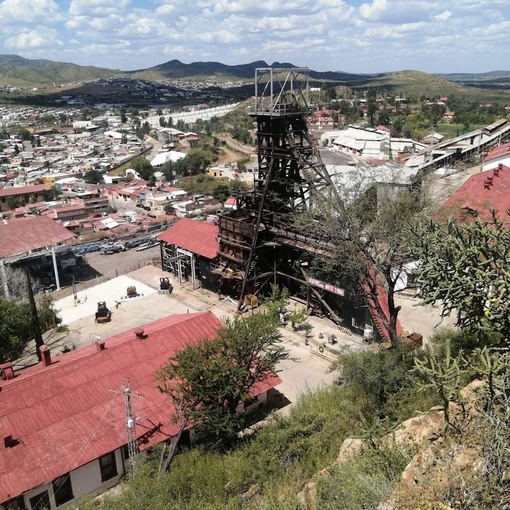
La Prieta Mine was established in the 16th century and formed the backbone of silver production in Hidalgo del Parral during the Spanish colonial period. This silver mine enabled the rapid growth of the town and attracted numerous settlers and workers from various regions of New Spain. The mining operation used extraction techniques typical of the era and employed both indigenous and European laborers. The mine contributed substantially to the royal revenues of the Spanish Crown and consolidated Parral's position as an important mining center in northern Mexico.
This adventure park is located in the Barrancas del Cobre and offers visitors the opportunity to explore the canyons of the Sierra Tarahumara through sporting activities. The facility features several zip lines suspended above the deep canyons, as well as suspension bridges running between the rock walls. From the observation platforms, visitors can view the mountain landscape and the depth of the gorges. The park caters to those seeking physical activities in a natural environment while experiencing the geological formations of the region from different perspectives.
Quinta Carolina is a 19th-century historic residence that belonged to the Terrazas family during the Porfirio Díaz era. The building was constructed using traditional materials such as adobe and stone. The property documents the lifestyle of wealthy Mexican families during the Porfiriato period and displays architectural features characteristic of that era.
The Recowata Hot Springs are located in the mountains of the Sierra Tarahumara and offer mineral-rich water that emerges from underground sources. These natural springs are surrounded by rugged rock formations and native desert vegetation. The water temperature remains consistently warm throughout the year. Access is via unpaved trails through the mountainous terrain. The springs are used by locals and visitors for relaxation and therapeutic purposes. The remote location provides solitude away from tourist areas.
The Santa Eulalia Mining District is located approximately 25 kilometers east of Chihuahua City and operated as one of Mexico's most productive silver mines from the 18th to the 20th century. This area features an extensive network of underground tunnels spanning multiple levels, along with numerous 19th-century industrial buildings including smelters, processing facilities, and administrative structures. The historical infrastructure documents the evolution of mining technology across three centuries and demonstrates the significant economic impact this mine had on the Chihuahua region.
Cueva de la Olla is an archaeological site in the Sierra Madre Occidental, inhabited by the Mogollón culture between 1060 and 1205 AD. This cave houses large round adobe structures that served as grain storage facilities and were integrated into the rock face. The site includes several rooms and adobe constructions built within a natural cave formation. The walls display red and yellow rock paintings featuring geometric patterns and representations of humans and animals. Cueva de la Olla forms part of the Paquimé cultural complex and documents the advanced construction techniques and social organization of the pre-Columbian peoples of this region.
Cascada de Basaseachic National Park protects one of Mexico's highest waterfalls, with a drop of 246 meters. The protected area extends across the forested slopes of the Sierra Madre Occidental and contains extensive pine and oak forests. Several hiking trails lead through the terrain to various viewpoints overlooking the waterfall and surrounding canyons.
The Zone of Silence extends across a desert region in Chihuahua state, approximately 400 kilometers south of the American border. This area regularly records meteorite impacts and displays magnetic anomalies that affect scientific measurement equipment. The zone sits on the same latitude as the Bermuda Triangle and the Pyramids of Giza. Researchers document radio signal disturbances and unusual mineral formations in the soil here.
The Cerocahui Mission was established in the 17th century by Jesuit missionaries and serves as a religious center for the local community. This structure features thick stone walls and a central bell tower that rises beside a maintained garden. The church preserves colonial architectural elements and displays the craftsmanship of its era. Visitors can explore the interior with its religious artifacts and walk through the quiet surroundings of the adjacent garden area.
Lake Arareco sits in the Sierra Tarahumara mountains at approximately 2,200 meters above sea level. This natural freshwater lake is surrounded by dense pine forests and fed by several springs. The body of water features distinctive rock formations of weathered volcanic stone that rise along its shores. The Rarámuri people have used this area for centuries. Visitors can walk along the marked trails around the lake and observe native wildlife. Water temperature remains cool throughout the year, and visibility depth varies by season.
Piedra Volada is an observation point in the Sierra Tarahumara located at 2800 meters altitude. From this vantage point, visitors can observe the deep ravines and canyons of the region. The site is situated in the Guachochi area and provides views of the geological formations and the expanse of the landscape. The canyon below the viewpoint reaches considerable depths. Access is gained through hiking trails across the mountain terrain of the Sierra Madre Occidental.
The Satevó Mission is an abandoned colonial temple from the 18th century located in a remote canyon near the Satevó River. The building displays baroque architectural elements with a stone facade that has retained its original decorative details despite decades of neglect. The church features a main nave with a high vaulted ceiling and side niches that once housed religious figures. Historical records suggest this mission was built by Jesuit missionaries to evangelize the indigenous population of the region. The isolation of the site and difficult access have contributed to the preservation of the structure.
The Cusarare Waterfalls are located within the traditional territory of the Rarámuri people in the southern Sierra Tarahumara. Water drops 30 meters into a natural pool, surrounded by pine forests at an elevation exceeding 2,000 meters. The waterfalls are accessible via a hiking trail of approximately two kilometers from Cusarare village. Rarámuri communities operate small stands selling local handicrafts along the path. Water flow varies by season, with the rainy months between July and September providing the greatest volume.
Guadalupe y Calvo was established in 1847 as a mining town for silver extraction. This municipality sits in the Sierra Madre Occidental and preserves its colonial architecture with buildings from the 19th century. The local population maintains traditional crafts and customs of the region. The surrounding mountains offer hiking trails through pine and oak forests.
The Sierra Tutuaca is a mountain range in northern Chihuahua that rises to 2,900 meters above sea level. This region contains extensive forests of pine and oak trees that provide important habitat for various wildlife species. Black bears roam the forested slopes in search of food, while golden eagles nest in the higher elevations and soar above the ridgelines. The area is characterized by its remoteness and limited tourist infrastructure, making it a destination for nature enthusiasts seeking to explore undisturbed landscapes.
This archaeological site sits on a hill above Hidalgo del Parral and preserves over 500 pre-Columbian rock carvings. The petroglyphs, carved into volcanic rock, display geometric patterns, spiral shapes, and representations of animals including deer and serpents. The Cerro de la Máscara documents the presence of indigenous peoples in this region of Chihuahua during the pre-Hispanic period and likely served ritual or astronomical purposes.
Cueva Nohochi is a natural cave in the Sierra Tarahumara at an altitude of 2,300 meters. It preserves rock paintings and archaeological remains of the Raramuri people who have inhabited this region for centuries. Located near Creel, the cave documents the history of northern Mexico's indigenous peoples through its wall art and material evidence.
The Temple of San Francisco was built during the 18th century and features stone carving details on its facade and interior. The church contains multiple side altars and a central dome decorated with religious imagery. The structure has served as a place of worship since its construction and represents colonial religious architecture in the Chihuahua region.
This cathedral was constructed during the 20th century and features two bell towers flanking a central dome that dominates the skyline of Ciudad Juárez. The building incorporates traditional stone masonry techniques and contains stained glass windows that illuminate the interior spaces. The architectural design combines religious functionality with craftsmanship, serving the Catholic community as a gathering place for liturgical celebrations.
The Sierra de Álvarez extends across Chihuahua state, forming a mountain range covered with extensive pine forests. This mountainous region features numerous geological formations, including distinctive rock structures of volcanic origin. Several marked hiking trails traverse the area, providing access to different elevations, with some peaks reaching above 2000 meters. The region serves as habitat for various plant and animal species adapted to the mountain climate. Visitors can explore the different vegetation zones and discover the topographic diversity of this mountain landscape in northern Mexico.
This colony hosts Mexican prairie dogs living in an extensive system of underground tunnels and chambers. The animals dig complex burrows that reach several meters deep and feature numerous entrances. Visitors can observe the colony from designated viewing points, where prairie dogs can be seen foraging, digging, and engaging in social interactions. The population displays typical behaviors including sentinel duty, communication through calls, and communal organization.
The Canyon del Pegüis cuts deeply into the Chihuahua landscape, forming vertical rock walls that rise up to 300 meters in height. The steep cliffs, composed of sedimentary rock, display various geological layers exposed by millions of years of erosion. Several hiking trails traverse the canyon, providing access to different elevations. Rock climbers find technically demanding routes on the cliff faces. The flora consists of cacti, agaves, and drought-resistant shrubs typical of the desert region. The canyon is located near Ojinaga, a border town on the Rio Grande, and forms part of the larger Chihuahuan Desert.
The Parral Tunnel descends 500 meters into an abandoned colonial-era silver mine. This underground site preserves original mining equipment, shafts, and galleries carved by 17th and 18th-century miners. The geological formations reveal the silver veins that made Parral one of New Spain's wealthiest mining centers. The tour exposes the harsh working conditions faced by miners and the extraction techniques of the period.
The Batopilas Caves form an extensive network of natural cavities in the rugged mountain terrain of the Sierra Madre Occidental. These caves preserve rock paintings and archaeological remains left by indigenous peoples who inhabited this region for centuries. The remote location has helped maintain the integrity of the prehistoric artwork and artifacts found within. Access requires a several-hour hike through steep terrain.
These stone pyramids were built between 900 and 1300 CE and feature multiple terraces along with architectural elements that show similarities to other Mesoamerican structures. The Tonachi structures are located in a remote region of the Barrancas del Cobre and document the presence of pre-Columbian cultures in northern Mexico. The site includes various platforms and constructions that indicate complex social organizations.
Mirador El Faro rises above the city of Chihuahua as an observation tower shaped like a lighthouse. From this elevated position, views extend across the urban structures of the capital of the state bearing the same name, as well as over the extensive desert landscapes that surround the area. The structure serves as a landmark and allows visitors to grasp the geographical layout of the region and the expanse of the Chihuahuan Desert territory.
Cumbres de Majalca National Park extends across an elevation of 2,300 meters in the Sierra Madre Occidental. The protected area encompasses extensive pine forests and notable granite formations created by erosion. The rock formations create natural sculptures in various sizes and shapes. Visitors find trails that lead through the mountain landscape, as well as areas for camping and nature observation. The flora consists primarily of Pinus species adapted to the high-altitude climate.
The Papigochi River flows through the mountainous regions of the Sierra Madre Occidental, traversing extensive pine and oak forests in the municipality of Bocoyna. Its transparent waters provide habitat for several endemic fish species, including various trout varieties that have adapted to the altitude and water temperatures. The river forms natural pools and small waterfalls along its course. The surrounding vegetation consists primarily of Pinus species and various oak types that create a dense canopy over the riverbanks. The local Raramuri population traditionally uses the riverside areas for agriculture and fishing.
La Prieta Mine was established in the 16th century and formed the backbone of silver production in Hidalgo del Parral during the Spanish colonial period. This silver mine enabled the rapid growth of the town and attracted numerous settlers and workers from various regions of New Spain. The mining operation used extraction techniques typical of the era and employed both indigenous and European laborers. The mine contributed substantially to the royal revenues of the Spanish Crown and consolidated Parral's position as an important mining center in northern Mexico.