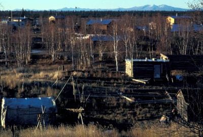
Huslia, Native Alaskan settlement in Yukon-Koyukuk Census Area, United States.
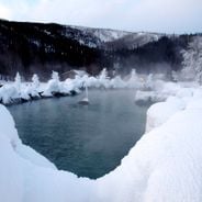
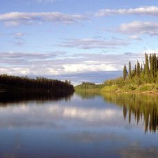
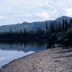
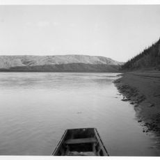
Huslia sits along the Koyukuk River in the heart of Alaska's wilderness. The settlement hugs the riverbanks, with the waterway serving as its main transportation route and lifeline.
The settlement first appeared in the 1950 Census as Cutoff, then was officially incorporated and renamed Huslia in 1969. This transition reflected the community's growing recognition and formal establishment.
The Koyukon Athabaskan people shape community life through hunting, fishing, and gathering practices that sustain residents year-round. These activities connect locals to the land and form the foundation of daily life here.
The settlement is only accessible by air, as there are no road connections to the outside. Visitors need to arrange flights in advance and plan accordingly.
The settlement serves as a checkpoint during the Iditarod Trail Sled Dog Race, linking traditional dog sledding methods with modern competitive sport. This annual event brings worldwide attention to this remote location.
Location: Yukon-Koyukuk Census Area
Elevation above the sea: 48 m
GPS coordinates: 65.70000,-156.39167
Latest update: December 6, 2025 16:04
Alaska offers landscapes that stretch far from the cities, in areas where nature is in control. You will find glaciers coming down from the mountains, large volcanoes, sandy dunes, hot springs emerging from the ground, and waterfalls rushing down the cliffs. Each area shows how the land was shaped...
Kobuk Valley National Park
242.3 km
E. L. Patton Yukon River Bridge
305.5 km
Gates of the Arctic Wilderness
304 km
Nowitna River
206 km
Mount Igikpak
200.8 km
Arrigetch Peaks
215 km
Innoko National Wildlife Refuge
280.7 km
Noatak Wilderness
297.2 km
Kanuti National Wildlife Refuge
220.8 km
John River
273.1 km
Koyukuk National Wildlife Refuge
13.9 km
Selawik National Wildlife Refuge
159 km
Innoko Wilderness
306.5 km
Nowitna National Wildlife Refuge
160.3 km
Unalakleet River
253.7 km
North Fork Koyukuk River
313.8 km
Selawik River
126.4 km
Chamisso Wilderness
253.1 km
Onion Portage Archeological District
177.2 km
Squirrel River
273.4 km
Walker Lake
182.7 km
Kanuti River
227.5 km
Iyatayet Site
280 km
Rampart Canyon
251.6 km
Kugruk River
284.6 km
Salmon River
250.7 km
Bureau of Indian Affairs Unalakleet School
291.1 km
Dall River
316.9 kmVisited this place? Tap the stars to rate it and share your experience / photos with the community! Try now! You can cancel it anytime.
Discover hidden gems everywhere you go!
From secret cafés to breathtaking viewpoints, skip the crowded tourist spots and find places that match your style. Our app makes it easy with voice search, smart filtering, route optimization, and insider tips from travelers worldwide. Download now for the complete mobile experience.
A unique approach to discovering new places❞
— Le Figaro
All the places worth exploring❞
— France Info
A tailor-made excursion in just a few clicks❞
— 20 Minutes