Chest opened
+${chestReward.xp} XP
Explorer
NOUVEAU ×${chestReward.collectible.quantity}
tapez pour fermer
Chest locked

Open chests in the app

Around Us is built for your phone — chests unlock when you walk, explore and capture nearby places.

Enable Location

We need your location to show you interesting places around you

Discover nearby places

Find interesting locations and hidden gems around you

Precise directions

Get accurate directions and distances to places

Your location is never shared with other users. It's only used when you tap the location button.

Log in to your account

Start exploring — it's free

Trusted by 73,052 travelers worldwide

Continue with Google
Continue with Apple
or

We will send you a code to connect

By continuing, you accept our Terms and Conditions and our Privacy Policy

Check your inbox

We've sent a pincode in your inbox. Please enter the code below.

National Petroleum Reserve–Alaska
Discussion Reviews Photo
16.1k Popularity

National Petroleum Reserve–Alaska, Federal protected area in Alaska North Slope, United States

This protected land covers vast arctic tundra with countless lakes and wetlands along Alaska's northern coast. The landscape features open terrain, shallow waters, and low vegetation spread across a massive expanse.

This area was established in 1923 as a naval reserve to secure oil supplies for the United States Navy. That founding decision shaped its protection status and management approach today.

The Iñupiat people continue to hunt and fish in this region today, particularly around Teshekpuk Lake and its surrounding waters. These lands remain central to their way of life and connection to the territory.

The area is remote and difficult to access; most visitors need special equipment and preparation for harsh conditions. Access is restricted in certain areas and requires permissions for entry.

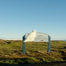
Teshekpuk Lake becomes one of the most important stopover sites for tens of thousands of waterfowl during their molting season. This brief period transforms the quiet waters into a bustling gathering point for migratory birds.

The community of curious travelers

AroundUs brings together thousands of curated places, local tips, and hidden gems, enriched daily by 60,000 contributors worldwide.

Start exploring
Location
Inception
1923
GPS coordinates
70.00000,-157.00000
Latest update
December 7, 2025 19:28
Around this place
Kobuk Valley National Park
United States of America

Kobuk Valley National Park

287.8 km
Rogers-Post Site
United States of America

Rogers-Post Site

128.7 km
Point Barrow Long Range Radar Site
United States of America

Point Barrow Long Range Radar Site

148.4 km
Gates of the Arctic Wilderness
United States of America

Gates of the Arctic Wilderness

263 km
United States of America

Ipiutak Site

429.7 km
Mount Igikpak
United States of America

Mount Igikpak

299.5 km
Arrigetch Peaks
United States of America

Arrigetch Peaks

308.9 km
Point Barrow Refuge Station
United States of America

Point Barrow Refuge Station

144.7 km
Leffingwell Camp Site
United States of America

Leffingwell Camp Site

414.9 km
Noatak Wilderness
United States of America

Noatak Wilderness

238.1 km
Kanuti National Wildlife Refuge
United States of America

Kanuti National Wildlife Refuge

452.1 km
John River
United States of America

John River

346.9 km
Koyukuk National Wildlife Refuge
United States of America

Koyukuk National Wildlife Refuge

492.1 km
Selawik National Wildlife Refuge
United States of America

Selawik National Wildlife Refuge

390.6 km
Birnirk Site
United States of America

Birnirk Site

143.2 km
North Fork Koyukuk River
United States of America

North Fork Koyukuk River

376 km
Selawik River
United States of America

Selawik River

393.5 km
Chamisso Wilderness
United States of America

Chamisso Wilderness

465.2 km
Gallagher Flint Station Archeological Site
United States of America

Gallagher Flint Station Archeological Site

328.2 km
Onion Portage Archeological District
United States of America

Onion Portage Archeological District

327.4 km
Itkillik River
United States of America

Itkillik River

264.1 km
Squirrel River
United States of America

Squirrel River

345.6 km
Walker Lake
United States of America

Walker Lake

337.3 km
Iñupiat Heritage Center
United States of America

Iñupiat Heritage Center

144.8 km
Kanuti River
United States of America

Kanuti River

476.9 km
Peters Glacier (Brooks Range)
United States of America

Peters Glacier (Brooks Range)

472.5 km
Utqiaġvik Church Manse
United States of America

Utqiaġvik Church Manse

144.1 km
Kugruk River
United States of America

Kugruk River

514.1 km
Show the full map
Reviews
Share your experience

No review yet

Discussions
Start a discussion...

No discussion yet

« National Petroleum Reserve–Alaska - Federal protected area in Alaska North Slope, United States » is provided by Around Us (aroundus.com). Images and texts are derived from Wikimedia project under a Creative Commons license. You are allowed to copy, distribute, and modify copies of this page, under the conditions set by the license, as long as this note is clearly visible.

Discover hidden gems everywhere you go!

From secret cafés to breathtaking viewpoints, skip the crowded tourist spots and find places that match your style. Our app makes it easy with voice search, smart filtering, route optimization, and insider tips from travelers worldwide. Download now for the complete mobile experience.

Around Us App Screenshot

A unique approach to discovering new places

Le Figaro

All the places worth exploring

France Info

A tailor-made excursion in just a few clicks

20 Minutes

Around Us
Travel Guide & Maps
Download

Send to your phone

QR Code
1

Open the camera app on your mobile.

2

Point at the QR code with your camera. A notification will appear.

3

Tap the notification to open the link.