Dalton Highway, Interior transportation route from Livengood to Deadhorse, Alaska
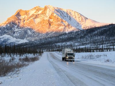
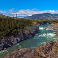
The Dalton Highway is a road in Alaska that runs more than 410 miles from Livengood to Deadhorse, passing through forests, mountains, and tundra. It runs largely parallel to the Trans-Alaska Pipeline and crosses several major rivers, including the Yukon River.
The route was built in 1974 as an access road for construction and maintenance of the Trans-Alaska Pipeline System. Initially it was restricted to construction vehicles and only later opened to general traffic.
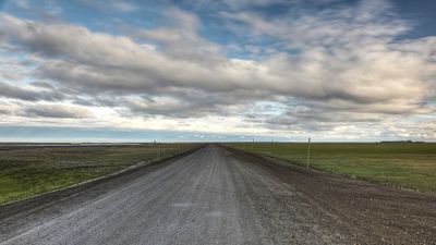
Truckers often share weather and road condition updates over CB radio as they drive the route. During the short summer months, RVs and motorcycles occasionally appear on the pavement, which remains dominated by freight trucks for most of the year.
Anyone traveling the route should carry extra fuel cans, spare tires, emergency gear, and a CB radio, as infrastructure is sparse. Most travelers go during summer, when daylight lasts longer and roads are more passable.
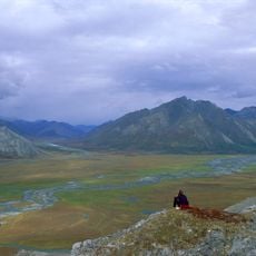
Atigun Pass sits at an elevation of roughly 4,740 feet (1,440 m) and is the only vehicular crossing through the Brooks Range. Snow can fall there during any month, even in the middle of summer.
Location: Alaska
Inception: 1974
Official opening: 1974
GPS coordinates: 70.19124,-148.43139
Latest update: December 13, 2025 16:13
Arctic National Wildlife Refuge
250.5 km
Ivvavik National Park
349.2 km
Vuntut National Park
391.1 km
Mount Isto
209.9 km
Rogers-Post Site
334.8 km
Point Barrow Long Range Radar Site
326.1 km
E. L. Patton Yukon River Bridge
483.4 km
Gates of the Arctic Wilderness
296.4 km
Yukon Flats National Wildlife Refuge
440.9 km
Mount Igikpak
405.6 km
Arrigetch Peaks
385.3 km
Point Barrow Refuge Station
329.7 km
Leffingwell Camp Site
89.7 km
Noatak Wilderness
499.5 km
Kanuti National Wildlife Refuge
442.7 km
John River
338.3 km
Birnirk Site
328.5 km
North Fork Koyukuk River
319.1 km
Herschel Island-Qikiqtaruk Territorial Park
365.3 km
Kendall Island Migratory Bird Sanctuary
521.5 km
Gallagher Flint Station Archeological Site
92.4 km
Onion Portage Archeological District
526.8 km
Itkillik River
133 km
Walker Lake
416.9 km
Iñupiat Heritage Center
329.1 km
Kanuti River
459.7 km
Peters Glacier (Brooks Range)
168 km
Utqiaġvik Church Manse
329.8 kmVisited this place? Tap the stars to rate it and share your experience / photos with the community! Try now! You can cancel it anytime.
Discover hidden gems everywhere you go!
From secret cafés to breathtaking viewpoints, skip the crowded tourist spots and find places that match your style. Our app makes it easy with voice search, smart filtering, route optimization, and insider tips from travelers worldwide. Download now for the complete mobile experience.
A unique approach to discovering new places❞
— Le Figaro
All the places worth exploring❞
— France Info
A tailor-made excursion in just a few clicks❞
— 20 Minutes