Chest opened
+${chestReward.xp} XP
Explorer
NOUVEAU ×${chestReward.collectible.quantity}
tapez pour fermer
Chest locked

Open chests in the app

Around Us is built for your phone — chests unlock when you walk, explore and capture nearby places.

Enable Location

We need your location to show you interesting places around you

Discover nearby places

Find interesting locations and hidden gems around you

Precise directions

Get accurate directions and distances to places

Your location is never shared with other users. It's only used when you tap the location button.

Madrean Archipelago

Log in to your account

Start exploring — it's free

Trusted by 72,880 travelers worldwide

Continue with Google
Continue with Apple
or

We will send you a code to connect

By continuing, you accept our Terms and Conditions and our Privacy Policy

Check your inbox

We've sent a pincode in your inbox. Please enter the code below.

Madrean Archipelago
Discussion Reviews 1 Photos
12.6k Popularity

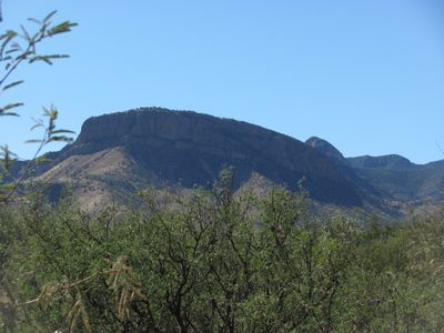
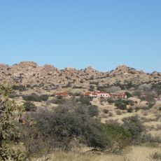
Madrean Archipelago, Mountain ecoregion in southeastern Arizona and southwestern New Mexico, United States.

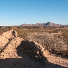
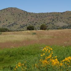
The Madrean Archipelago is a series of about 27 mountain ranges that rise from desert plains and create isolated woodland islands separated by open lowlands. These mountains reach between 3,000 and 10,000 feet in elevation and support distinct plant and animal communities in each range.

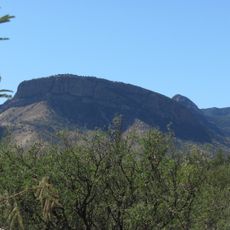
The mountains formed through geological processes that created these isolated ranges after the last ice age, separating them from the Sierra Madre Occidental. The distinctive pattern of separate peaks was shaped by volcanic activity and erosion over millions of years.

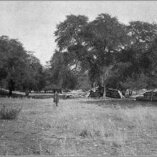
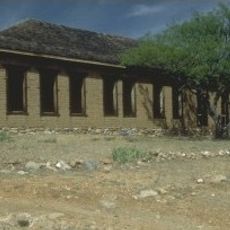
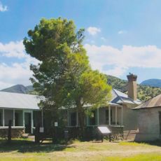
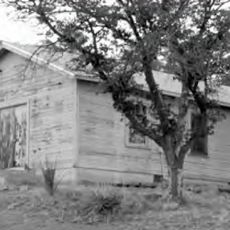
Indigenous peoples, Mexican herders, and American settlers developed distinct ways of living in these mountains for generations. Each group left marks on the landscape that visitors can still observe today through trails, old camps, and grazing patterns.

Multiple trailheads and access points are available through the Coronado National Forest and surrounding protected areas for exploring the region. The terrain can be challenging due to elevation changes and desert heat, so visitors should plan ahead and bring water.

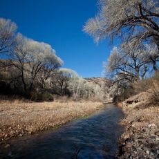
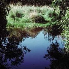
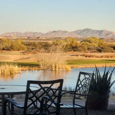
The San Pedro River within this region contains more native vertebrate species than all of Yellowstone National Park combined. This small river creates a vital water source that supports an remarkable concentration of wildlife.

The community of curious travelers

AroundUs brings together thousands of curated places, local tips, and hidden gems, enriched daily by 60,000 contributors worldwide.

Start exploring
Location
Location
Location
Location
Location
Part of
Basin and Range Province
GPS coordinates
31.81148,-110.41869
Latest update
December 7, 2025 20:44
Around this place
Kartchner Caverns State Park
United States of America

Kartchner Caverns State Park

7.4 km
Bird Cage Theatre
United States of America

Bird Cage Theatre

35.3 km
Empire Ranch
United States of America

Empire Ranch

21.3 km
Texas Canyon
United States of America

Texas Canyon

41.3 km
Colossal Cave
United States of America

Colossal Cave

34.6 km
Fort Buchanan
United States of America

Fort Buchanan

32.2 km
Schieffelin Hall
United States of America

Schieffelin Hall

35.1 km
Kentucky Camp
United States of America

Kentucky Camp

30.5 km
Tombstone Courthouse
United States of America

Tombstone Courthouse

34.9 km
Murray Springs Clovis Site
United States of America

Murray Springs Clovis Site

35.1 km
San Pedro Riparian National Conservation Area
United States of America

San Pedro Riparian National Conservation Area

37.3 km
Las Cienegas National Conservation Area
United States of America

Las Cienegas National Conservation Area

17.9 km
Tombstone Historic District
United States of America

Tombstone Historic District

35.1 km
Presidio Santa Cruz de Terrenate
United States of America

Presidio Santa Cruz de Terrenate

21.6 km
Amerind Foundation
United States of America

Amerind Foundation

41.4 km
Apache Peak
United States of America

Apache Peak

1.8 km
Brown Canyon Ranch
United States of America

Brown Canyon Ranch

39.3 km
Ciénega Bridge
United States of America

Ciénega Bridge

31.6 km
The Little Outfit Schoolhouse
United States of America

The Little Outfit Schoolhouse

38.2 km
Canelo Hills Cienega Reserve
United States of America

Canelo Hills Cienega Reserve

29.6 km
United States of America

Mae West Peaks

42.6 km
Canelo School
United States of America

Canelo School

31.2 km
Canelo Ranger Station
United States of America

Canelo Ranger Station

30.4 km
Benson Railroad Historic District
United States of America

Benson Railroad Historic District

21.1 km
Apache Powder Historic Residential District
United States of America

Apache Powder Historic Residential District

20.6 km
Programa de las Leguminosas del Desierto
United States of America

Programa de las Leguminosas del Desierto

41 km
San Pedro Golf Course
United States of America

San Pedro Golf Course

22.7 km
San Pedro River Railroad Bridge
United States of America

San Pedro River Railroad Bridge

21.6 km
Show the full map
Reviews
Share your experience

No review yet

Discussions
Start a discussion...

No discussion yet

« Madrean Archipelago - Mountain ecoregion in southeastern Arizona and southwestern New Mexico, United States » is provided by Around Us (aroundus.com). Images and texts are derived from Wikimedia project under a Creative Commons license. You are allowed to copy, distribute, and modify copies of this page, under the conditions set by the license, as long as this note is clearly visible.

Discover hidden gems everywhere you go!

From secret cafés to breathtaking viewpoints, skip the crowded tourist spots and find places that match your style. Our app makes it easy with voice search, smart filtering, route optimization, and insider tips from travelers worldwide. Download now for the complete mobile experience.

Around Us App Screenshot

A unique approach to discovering new places

Le Figaro

All the places worth exploring

France Info

A tailor-made excursion in just a few clicks

20 Minutes

Around Us
Travel Guide & Maps
Download

Send to your phone

QR Code
1

Open the camera app on your mobile.

2

Point at the QR code with your camera. A notification will appear.

3

Tap the notification to open the link.