Chest opened
+${chestReward.xp} XP
Explorer
NOUVEAU ×${chestReward.collectible.quantity}
tapez pour fermer
Chest locked

Open chests in the app

Around Us is built for your phone — chests unlock when you walk, explore and capture nearby places.

Enable Location

We need your location to show you interesting places around you

Discover nearby places

Find interesting locations and hidden gems around you

Precise directions

Get accurate directions and distances to places

Your location is never shared with other users. It's only used when you tap the location button.

McWay Cove

Log in to your account

Start exploring — it's free

Trusted by 72,888 travelers worldwide

Continue with Google
Continue with Apple
or

We will send you a code to connect

By continuing, you accept our Terms and Conditions and our Privacy Policy

Check your inbox

We've sent a pincode in your inbox. Please enter the code below.

McWay Cove
Discussion Reviews 1 Photos
70+ Popularity

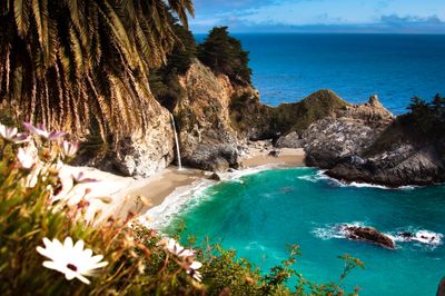
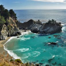
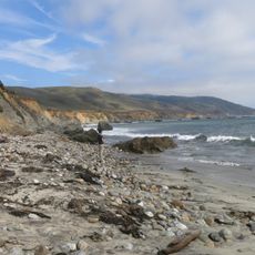
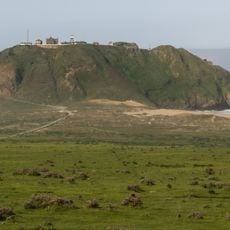
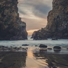
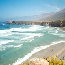
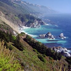
McWay Cove, Coastal inlet in Big Sur, US

McWay Cove is a coastal inlet in Big Sur featuring steep granite cliffs that rise directly from the Pacific Ocean. A waterfall flows from the cliff face down to the beach below.

Julia Pfeiffer Burns, a pioneer, lived and worked in this coastal area during the early 1900s. Her presence and land stewardship shaped the character of the region.

The cove takes its name from the McWay family who once inhabited this area. It has become a favored subject for artists and photographers seeking to capture its changing appearance across different seasons.

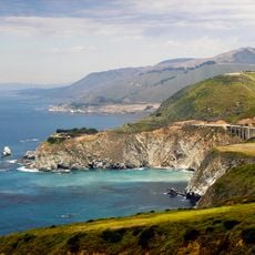
The main route to view the cove is a short walking trail through Julia Pfeiffer Burns State Park that offers several vantage points. The path is manageable for most visitors and clearly marked throughout.

This location is one of only two places in California where a waterfall flows directly into the ocean year-round. This rare occurrence makes it a special destination for those seeking unusual natural features.

The community of curious travelers

AroundUs brings together thousands of curated places, local tips, and hidden gems, enriched daily by 60,000 contributors worldwide.

Start exploring
Location
GPS coordinates
36.15861,-121.67278
Latest update
December 15, 2025 13:28
Around this place
Big Sur
United States of America

Big Sur

7.1 km
Bixby Creek Bridge
United States of America

Bixby Creek Bridge

31.4 km
McWay Falls
United States of America

McWay Falls

100 m
Julia Pfeiffer Burns State Park
United States of America

Julia Pfeiffer Burns State Park

1.1 km
Pfeiffer Big Sur State Park
United States of America

Pfeiffer Big Sur State Park

13.9 km
Mission Nuestra Señora de la Soledad
United States of America

Mission Nuestra Señora de la Soledad

39.5 km
Tassajara Zen Mountain Center
United States of America

Tassajara Zen Mountain Center

24.6 km
Tassajara Hot Springs
United States of America

Tassajara Hot Springs

13.8 km
Point Sur Lighthouse
United States of America

Point Sur Lighthouse

26 km
Limekiln State Park
United States of America

Limekiln State Park

21.6 km
Garrapata State Park
United States of America

Garrapata State Park

40.6 km
Andrew Molera State Park
United States of America

Andrew Molera State Park

20 km
Ventana Wilderness
United States of America

Ventana Wilderness

10.2 km
The Hacienda
United States of America

The Hacienda

42 km
Junipero Serra Peak
United States of America

Junipero Serra Peak

22.8 km
Point Sur State Historic Park
United States of America

Point Sur State Historic Park

26.1 km
Pfeiffer Beach
United States of America

Pfeiffer Beach

15.8 km
Rocky Creek Bridge
United States of America

Rocky Creek Bridge

32.1 km
Deetjen's Big Sur Inn
United States of America

Deetjen's Big Sur Inn

9.6 km
Sand Dollar Beach
United States of America

Sand Dollar Beach

31.9 km
Big Creek Bridge
United States of America

Big Creek Bridge

11.8 km
Big Creek State Marine Reserve and Big Creek State Marine Conservation Area
United States of America

Big Creek State Marine Reserve and Big Creek State Marine Conservation Area

5.4 km
San Clemente Dam
United States of America

San Clemente Dam

31 km
Palo Corona Regional Park
United States of America

Palo Corona Regional Park

36.1 km
Berwick Manor and Orchard
United States of America

Berwick Manor and Orchard

42.5 km
Odd Fellows Hall
United States of America

Odd Fellows Hall

44 km
Mission Soledad Museum
United States of America

Mission Soledad Museum

39.5 km
Fort Hunter Liggett
United States of America

Fort Hunter Liggett

45.9 km
Show the full map
Reviews
Share your experience

No review yet

Discussions
Start a discussion...

No discussion yet

« McWay Cove - Coastal inlet in Big Sur, US » is provided by Around Us (aroundus.com). Images and texts are derived from Wikimedia project under a Creative Commons license. You are allowed to copy, distribute, and modify copies of this page, under the conditions set by the license, as long as this note is clearly visible.

Discover hidden gems everywhere you go!

From secret cafés to breathtaking viewpoints, skip the crowded tourist spots and find places that match your style. Our app makes it easy with voice search, smart filtering, route optimization, and insider tips from travelers worldwide. Download now for the complete mobile experience.

Around Us App Screenshot

A unique approach to discovering new places

Le Figaro

All the places worth exploring

France Info

A tailor-made excursion in just a few clicks

20 Minutes

Around Us
Travel Guide & Maps
Download

Send to your phone

QR Code
1

Open the camera app on your mobile.

2

Point at the QR code with your camera. A notification will appear.

3

Tap the notification to open the link.