Enable Location

We need your location to show you interesting places around you

Discover nearby places

Find interesting locations and hidden gems around you

Precise directions

Get accurate directions and distances to places

Your location is never shared with other users. It's only used when you tap the location button.

Log in to your account

Start exploring — it's free

Trusted by 62,589 travelers worldwide

Continue with Google
Continue with Apple
or

We will send you a code to connect

By continuing, you accept our Terms and Conditions and our Privacy Policy

Check your inbox

We've sent a pincode in your inbox. Please enter the code below.

Havasu Wilderness

Havasu Wilderness, Protected wilderness area in Mohave County, Arizona

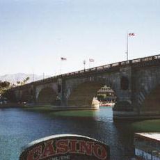
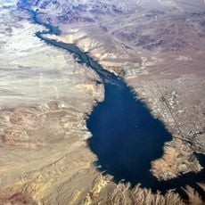
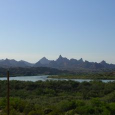
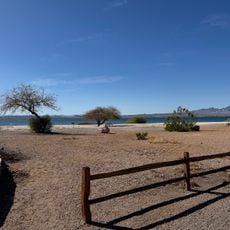
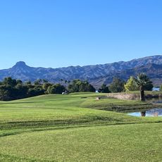
Havasu Wilderness is a protected area in Mohave County spanning roughly 17,800 acres with volcanic formations, sand dunes, and riparian wetlands. The landscape displays characteristic Mojave Desert uplands that extend along the Colorado River.

The area was established in 1941 by President Franklin D. Roosevelt as part of Havasu National Wildlife Refuge. The creation aimed to protect migratory bird habitats along the Colorado River.

This area functions as a critical stopover for migratory birds traveling between North and South America. Visitors notice geese, ducks, and herons using the wetlands, giving the place a seasonal character shaped by nature's cycles.

Visitors can hike on designated trails and observe wildlife at viewing points, but camping, fires, and motorized vehicles are not permitted. Fall and spring are ideal times to visit when migratory birds are most active.

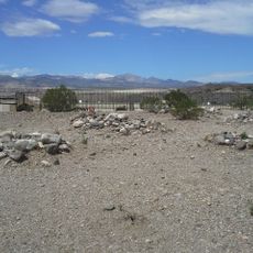
Desert bighorn sheep climb steep rock faces here while sharing the landscape with mountain lions and thousands of bats. Abandoned mining tunnels scattered across the terrain provide shelter for bat colonies and hint at the area's mining heritage.

The community of curious travelers

AroundUs brings together thousands of curated places, local tips, and hidden gems, enriched daily by 60,000 contributors worldwide.

Start exploring
Location
GPS coordinates
34.64940,-114.41500
Latest update
December 14, 2025 16:43
Around this place
London Bridge
United States of America

London Bridge

20.7 km
Lake Havasu
United States of America

Lake Havasu

18.7 km
Central Arizona Project
United States of America

Central Arizona Project

49.5 km
Colorado River Aqueduct
United States of America

Colorado River Aqueduct

45.8 km
Buckskin Mountain State Park
United States of America

Buckskin Mountain State Park

50.7 km
The Needles
United States of America

The Needles

3.6 km
Havasu National Wildlife Refuge
United States of America

Havasu National Wildlife Refuge

18.6 km
Bigelow Cholla Garden Wilderness
United States of America

Bigelow Cholla Garden Wilderness

48.1 km
Cattail Cove State Park
United States of America

Cattail Cove State Park

40.1 km
Old Trails Bridge
United States of America

Old Trails Bridge

9.8 km
Bill Williams River National Wildlife Refuge
United States of America

Bill Williams River National Wildlife Refuge

52 km
Dead Mountains
United States of America

Dead Mountains

48.3 km
Red Rock Bridge
United States of America

Red Rock Bridge

10.1 km
United States of America

Topock Gorge

3.5 km
Turtle Mountains
United States of America

Turtle Mountains

56.9 km
Warm Springs Wilderness
United States of America

Warm Springs Wilderness

29.2 km
Windsor Beach
United States of America

Windsor Beach

18.4 km
Boundary Cone
United States of America

Boundary Cone

37.2 km
Hardyville Cemetery
United States of America

Hardyville Cemetery

54.8 km
United States of America

Alexey W. Von Schmidt

46.5 km
Goffs Schoolhouse
United States of America

Goffs Schoolhouse

65.8 km
Mohave Canyon
United States of America

Mohave Canyon

2.9 km
Oatman Drug Company Building
United States of America

Oatman Drug Company Building

42 km
Parker Jail
United States of America

Parker Jail

56.8 km
Bridgewater Links
United States of America

Bridgewater Links

21.3 km
Area 66
United States of America

Area 66

34 km
Riverview Resort Golf Course
United States of America

Riverview Resort Golf Course

53.1 km
Arizona and California Railroad Bridge
United States of America

Arizona and California Railroad Bridge

55.4 km
Show the full map
« Havasu Wilderness - Protected wilderness area in Mohave County, Arizona » is provided by Around Us (aroundus.com). Images and texts are derived from Wikimedia project under a Creative Commons license. You are allowed to copy, distribute, and modify copies of this page, under the conditions set by the license, as long as this note is clearly visible.

Discover hidden gems everywhere you go!

From secret cafés to breathtaking viewpoints, skip the crowded tourist spots and find places that match your style. Our app makes it easy with voice search, smart filtering, route optimization, and insider tips from travelers worldwide. Download now for the complete mobile experience.

Around Us App Screenshot

A unique approach to discovering new places

Le Figaro

All the places worth exploring

France Info

A tailor-made excursion in just a few clicks

20 Minutes

Around Us
Travel Guide & Maps
Download

Send to your phone

QR Code
1

Open the camera app on your mobile.

2

Point at the QR code with your camera. A notification will appear.

3

Tap the notification to open the link.