Chest opened
+${chestReward.xp} XP
Explorer
NOUVEAU ×${chestReward.collectible.quantity}
tapez pour fermer
Chest locked

Open chests in the app

Around Us is built for your phone — chests unlock when you walk, explore and capture nearby places.

Enable Location

We need your location to show you interesting places around you

Discover nearby places

Find interesting locations and hidden gems around you

Precise directions

Get accurate directions and distances to places

Your location is never shared with other users. It's only used when you tap the location button.

Log in to your account

Start exploring — it's free

Trusted by 72,886 travelers worldwide

Continue with Google
Continue with Apple
or

We will send you a code to connect

By continuing, you accept our Terms and Conditions and our Privacy Policy

Check your inbox

We've sent a pincode in your inbox. Please enter the code below.

Discussion Reviews Photo
10.4k Popularity

Ramah, Census-designated place in McKinley County, United States.

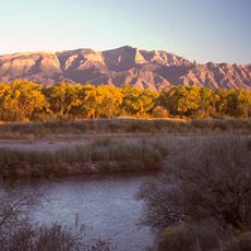
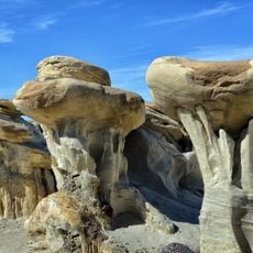
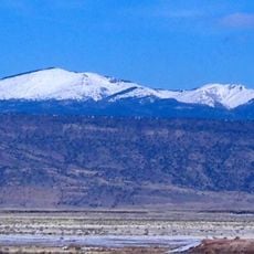
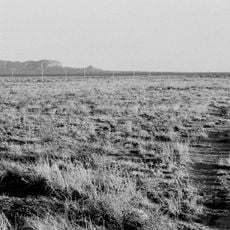
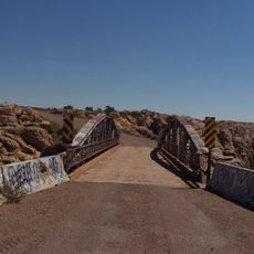
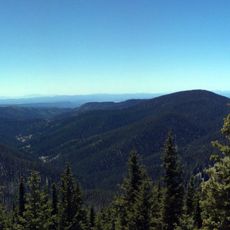
Ramah is a census-designated place in McKinley County, New Mexico, situated in high desert terrain mixed with pine forests and sandstone formations. The settlement sits at approximately 6,900 feet (2,100 meters) elevation in a landscape shaped by natural springs and rolling hills.

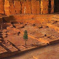
Mormon pioneers established this settlement in 1876 under Brigham Young's direction as part of missionary efforts among Zuni and Navajo communities. The founding reflected a broader plan to expand religious and economic influence across this part of the Southwest.

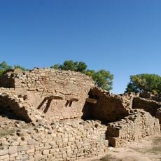
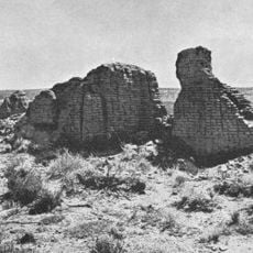
The community maintains strong ties with neighboring Zuni and Navajo reservations, and several historic stone buildings now function as educational museums. These structures help visitors understand how different groups have lived and worked together in this area.

The area is best visited during warmer months when roads are most accessible and weather is more favorable. Since major services are located in nearby Gallup, visitors should arrange supplies and fuel before arriving in the settlement.

Ramah Lake was built by early settlers as a water storage system for farm irrigation and still serves this purpose today. The reservoir captures snowmelt and spring water, enabling agriculture to continue in this arid region.

The community of curious travelers

AroundUs brings together thousands of curated places, local tips, and hidden gems, enriched daily by 60,000 contributors worldwide.

Start exploring
Location
Elevation above the sea
2,111 m
GPS coordinates
35.13500,-108.48800
Latest update
December 10, 2025 15:54
Around this place
Chaco Culture National Historical Park
United States of America

Chaco Culture National Historical Park

113.1 km
Shiprock
United States of America

Shiprock

175.6 km
Standin' on the Corner Park
United States of America

Standin' on the Corner Park

201.7 km
Karl G. Jansky Very Large Array
United States of America

Karl G. Jansky Very Large Array

142.1 km
Sandia Mountains
United States of America

Sandia Mountains

185.7 km
Valles Caldera
United States of America

Valles Caldera

192.2 km
Wigwam Motel
United States of America

Wigwam Motel

155.4 km
Sandia Peak Tramway
United States of America

Sandia Peak Tramway

182.9 km
Pueblo Bonito
United States of America

Pueblo Bonito

113.5 km
United States of America

Los Lunas Decalogue Stone

141.5 km
Bisti/De-Na-Zin Wilderness
United States of America

Bisti/De-Na-Zin Wilderness

134.4 km
Aztec Ruins National Monument
United States of America

Aztec Ruins National Monument

194.5 km
Petroglyph National Monument
United States of America

Petroglyph National Monument

157.1 km
Mount Taylor
United States of America

Mount Taylor

80.8 km
The Lightning Field
United States of America

The Lightning Field

77.2 km
Very Long Baseline Array
United States of America

Very Long Baseline Array

142 km
Fort Wingate
United States of America

Fort Wingate

37.4 km
United States of America

Chetro Ketl

113.8 km
Sandia Base
United States of America

Sandia Base

176.9 km
Chevelon Creek Bridge
United States of America

Chevelon Creek Bridge

187.6 km
Hawikuh Ruins
United States of America

Hawikuh Ruins

50.6 km
Mount Baldy
United States of America

Mount Baldy

168.6 km
El Rancho Hotel & Motel
United States of America

El Rancho Hotel & Motel

49 km
Atchison, Topeka and Santa Fe Railway 2926
United States of America

Atchison, Topeka and Santa Fe Railway 2926

167 km
Fajada Butte
United States of America

Fajada Butte

111.5 km
Mogollon
United States of America

Mogollon

195.5 km
La Luz Trail
United States of America

La Luz Trail

184.2 km
Albuquerque Plaza
United States of America

Albuquerque Plaza

167.5 km
Show the full map
Reviews
Share your experience

No review yet

Discussions
Start a discussion...

No discussion yet

« Ramah - Census-designated place in McKinley County, United States » is provided by Around Us (aroundus.com). Images and texts are derived from Wikimedia project under a Creative Commons license. You are allowed to copy, distribute, and modify copies of this page, under the conditions set by the license, as long as this note is clearly visible.

Discover hidden gems everywhere you go!

From secret cafés to breathtaking viewpoints, skip the crowded tourist spots and find places that match your style. Our app makes it easy with voice search, smart filtering, route optimization, and insider tips from travelers worldwide. Download now for the complete mobile experience.

Around Us App Screenshot

A unique approach to discovering new places

Le Figaro

All the places worth exploring

France Info

A tailor-made excursion in just a few clicks

20 Minutes

Around Us
Travel Guide & Maps
Download

Send to your phone

QR Code
1

Open the camera app on your mobile.

2

Point at the QR code with your camera. A notification will appear.

3

Tap the notification to open the link.