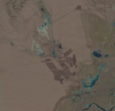
Tengger Desert Solar Park, Photovoltaic power station in Zhongwei, China.
The Tengger Desert Solar Park spans approximately 43 square miles (111 square kilometers) in the desert and uses more than 1.8 million solar panels to generate electricity with a capacity of around 1,500 megawatts.
Construction began in 2010 as part of China's strategy to expand renewable energy and reduce coal dependency, with the facility becoming fully operational by 2017 through multiple development phases.
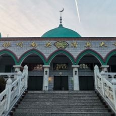
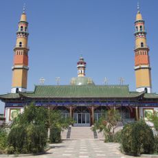
The solar park is located in Ningxia Hui Autonomous Region, an area with a diverse population including Hui Muslim communities whose traditions and heritage have shaped the cultural landscape of the region.
Access to the site is via Zhongwei city along the H26R+RJ5 road in Shapotou District, though public tours are generally not available and the facility is best viewed through aerial photography or satellite images.
Engineers faced significant challenges during construction due to extreme desert temperatures and limited water supplies, requiring specialized cooling techniques and construction methods adapted to harsh desert conditions.
Location: Zhongwei
Address: H26R+RJ5, Shapotou District, Zhongwei, Ningxia, China, 755002
GPS coordinates: 37.56200,105.04130
Latest update: December 2, 2025 10:55
Satellite imagery has transformed how we view remote locations on Earth, offering perspectives on places that are often invisible or difficult to reach from ground level. This collection presents natural formations, artificial structures and historical sites from an aerial vantage point. From geological features like the circular Richat Structure in Mauritania's desert to ancient geoglyphs and modern engineering achievements, these images provide a distinct view of our planet's diversity. Locations documented include the geometric Nazca Lines in Peru, the pyramid structure of El Castillo in Mexico's Yucatán Peninsula and the Badlands Guardian in Alberta, a natural rock formation that resembles a head wearing headphones when seen from above. The collection also features Palm Jumeirah in Dubai, an artificial archipelago shaped like a palm tree, the vivid blue potash evaporation ponds in Utah, the pink waters of Lake Hillier in Western Australia and the volcanic island of Surtsey off Iceland. Additional examples include the Atacama Giant in Chile, a prehistoric geoglyph, the heart shaped Galesnjak island off Croatia's coast and the ship graveyard of the former Aral Sea in Uzbekistan, which documents the ecological consequences of human intervention.
Western Xia Imperial Tombs
127.8 km
Helan Mountains
162.3 km
Pueblo Depot Activity
105.1 km
Zhongshan Bridge
199.3 km
Xumishan grottoes
166.1 km
Huanghe Shilin National Geopark
99.2 km
Wushao Ling Mountain
195.5 km
Museum of Contemporary Art of Yinchuan
126.2 km
One Hundred and Eight Stupas
89.5 km
Shuidonggou
152 km
Tongxin Great Mosque
101.8 km
Pagoda of Chengtian Temple
146.9 km
Nanguan Mosque
147 km
Haibao Pagoda
149.8 km
Twin Pagodas at Baisikou
148.5 km
Baisigou Square Pagoda
147.3 km
青銅峡水力発電所
91 km
Hongfo Pagoda
165.5 km
Taizi Great Mosque
123.6 km
Ningxia Museum
146.4 km
Najiahu mosque
132 km
Guangzong Temple
140.6 km
Haibao Pagoda Temple
149.8 km
Pagoda of Ci'en Temple
199 km
银川玉皇阁
148.3 km
Lanzhou Fu Chenghuang Miao
199.4 km
南门楼
147.4 km
Yanfu Temple
152.6 kmReviews
Visited this place? Tap the stars to rate it and share your experience / photos with the community! Try now! You can cancel it anytime.
Discover hidden gems everywhere you go!
From secret cafés to breathtaking viewpoints, skip the crowded tourist spots and find places that match your style. Our app makes it easy with voice search, smart filtering, route optimization, and insider tips from travelers worldwide. Download now for the complete mobile experience.
A unique approach to discovering new places❞
— Le Figaro
All the places worth exploring❞
— France Info
A tailor-made excursion in just a few clicks❞
— 20 Minutes