Log in to your account

AroundUs is a community-driven map of interesting places, built by curious explorers like you. It grows with every review, story, and photo you share.
Connect to save your favorite spots, contribute locations, and create personalized routes.
By continuing, you accept our Terms and Conditions and our Privacy Policy
Add to collection
Map
Suggest a change
Share

Topock Maze, Archaeological site in San Bernardino County, United States

Topock Maze is an archaeological site near Needles, California, where many parallel lines form patterns across the desert floor. These lines are carved or marked with stones across a small area, creating geometric designs visible from the ground.

The site was added to the National Register of Historic Places in 1978 after research documented its connection to indigenous communities in the region. Archaeological studies traced the possible creation of the lines back several hundred years.

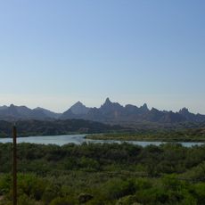
The patterns and lines reflect the presence of the Mojave people who inhabited and shaped this desert landscape over many generations. What visitors see today shows how ancient indigenous art remains woven into the natural surroundings.

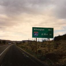
The site is located near Interstate 40 and requires a permit before visiting. Prepare for dry conditions, strong sun exposure, and rough desert terrain by wearing proper shoes and bringing plenty of water.

Studies revealed that railroad workers in the 1880s laid new tracks directly over the existing patterns without destroying the ancient art beneath. This created an accidental layering where 1800s construction lines merged with prehistoric designs on the same ground.

Location: San Bernardino County

GPS coordinates: 34.71597,-114.49776

Latest update: December 12, 2025 07:53

Photos
Around this place
London Bridge
United States of America

London Bridge

30.5 km
Lake Havasu
United States of America

Lake Havasu

27.9 km
Central Arizona Project
United States of America

Central Arizona Project

60 km
Colorado River Aqueduct
United States of America

Colorado River Aqueduct

56.1 km
Interstate 40 in California
United States of America

Interstate 40 in California

37 km
Grapevine Canyon Petroglyphs
United States of America

Grapevine Canyon Petroglyphs

59.4 km
Buckskin Mountain State Park
United States of America

Buckskin Mountain State Park

61 km
The Needles
United States of America

The Needles

7.1 km
Havasu National Wildlife Refuge
United States of America

Havasu National Wildlife Refuge

8.4 km
Bigelow Cholla Garden Wilderness
United States of America

Bigelow Cholla Garden Wilderness

38.3 km
Cattail Cove State Park
United States of America

Cattail Cove State Park

50.6 km
Old Trails Bridge
United States of America

Old Trails Bridge

1.2 km
Bill Williams River National Wildlife Refuge
United States of America

Bill Williams River National Wildlife Refuge

62.6 km
Dead Mountains
United States of America

Dead Mountains

37.9 km
Red Rock Bridge
United States of America

Red Rock Bridge

955 m
United States of America

Topock Gorge

7.2 km
Turtle Mountains
United States of America

Turtle Mountains

57.8 km
Warm Springs Wilderness
United States of America

Warm Springs Wilderness

26.6 km
United States of America

Bridge Canyon Wilderness

60 km
Boundary Cone
United States of America

Boundary Cone

30.7 km
Grapevine Canyon
United States of America

Grapevine Canyon

59.4 km
United States of America

Alexey W. Von Schmidt

36.4 km
Goffs Schoolhouse
United States of America

Goffs Schoolhouse

55.8 km
Mohave Canyon
United States of America

Mohave Canyon

8.8 km
Bridgewater Links
United States of America

Bridgewater Links

31 km
Area 66
United States of America

Area 66

35.9 km
Riverview Resort Golf Course
United States of America

Riverview Resort Golf Course

44.2 km
Cool Springs Station
United States of America

Cool Springs Station

38.7 km
Show the full map
Reviews

Visited this place? Tap the stars to rate it and share your experience / photos with the community! Try now! You can cancel it anytime.

« Topock Maze - Archaeological site in San Bernardino County, United States » is provided by Around Us (aroundus.com). Images and texts are derived from Wikimedia project under a Creative Commons license. You are allowed to copy, distribute, and modify copies of this page, under the conditions set by the license, as long as this note is clearly visible.

Discover hidden gems everywhere you go!

From secret cafés to breathtaking viewpoints, skip the crowded tourist spots and find places that match your style. Our app makes it easy with voice search, smart filtering, route optimization, and insider tips from travelers worldwide. Download now for the complete mobile experience.

Around Us App Screenshot

A unique approach to discovering new places

Le Figaro

All the places worth exploring

France Info

A tailor-made excursion in just a few clicks

20 Minutes