Enable Location

We need your location to show you interesting places around you

Discover nearby places

Find interesting locations and hidden gems around you

Precise directions

Get accurate directions and distances to places

Your location is never shared with other users. It's only used when you tap the location button.

Lagunas de Chacahua National Park

Log in to your account

Start exploring — it's free

Trusted by 61,443 travelers worldwide

Continue with Google
Continue with Apple
or

We will send you a code to connect

By continuing, you accept our Terms and Conditions and our Privacy Policy

Check your inbox

We've sent a pincode in your inbox. Please enter the code below.

Lagunas de Chacahua National Park

Lagunas de Chacahua National Park, National park with lagoon system on Pacific coast in Oaxaca, Mexico.

Description

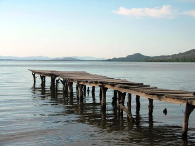
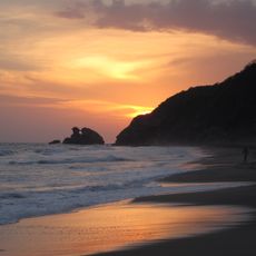
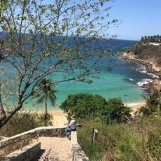
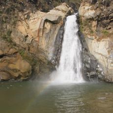
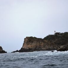
Lagunas de Chacahua is a national park on the Pacific coast of Oaxaca, featuring several interconnected lagoons surrounded by mangrove forests, tropical vegetation, and coastal dunes. The park presents a varied landscape of water and land surfaces that form connected habitats for wildlife and plants.

History

The Mexican government protected the area in 1937 to conserve its wetlands and lagoon systems. This early designation established its role as a protected ecosystem on the Pacific coast.

Culture

Local fishermen use traditional methods passed down through generations, and their presence shapes how the waterways are experienced by visitors. This way of life remains central to the community's identity and daily rhythm around the lagoons.

Practical

The park is most easily accessed from Puerto Escondido, with transport to Zapotalito followed by a boat ride through the lagoons. The drier months offer easier navigation through the waterways and better viewing conditions.

Did you know?

The park contains multiple nesting sites for sea turtles and a breeding facility for Pacific coast crocodiles. These conservation programs help protect species that depend on this ecosystem for their survival.

Location
Inception
July 9, 1937
GPS coordinates
15.96710,-97.68683
Latest update
December 6, 2025 16:02

AroundUs brings together thousands of curated places, local tips, and hidden gems, enriched daily by 60,000 contributors worldwide. Discover all places nearby (Oaxaca).

Traditional sites and natural landscapes in Oaxaca

Oaxaca has archaeological sites like Monte Albán and Mitla, where zapotec and mixtec civilizations built temples and palaces many centuries before the Spanish arrived. The land stretches between mountains in the north and Pacific coasts in the south, with lagoons and beaches such as those at Mazunte...

« Lagunas de Chacahua National Park - National park with lagoon system on Pacific coast in Oaxaca, Mexico » is provided by Around Us (aroundus.com). Images and texts are derived from Wikimedia project under a Creative Commons license. You are allowed to copy, distribute, and modify copies of this page, under the conditions set by the license, as long as this note is clearly visible.

Discover hidden gems everywhere you go!

From secret cafés to breathtaking viewpoints, skip the crowded tourist spots and find places that match your style. Our app makes it easy with voice search, smart filtering, route optimization, and insider tips from travelers worldwide. Download now for the complete mobile experience.

Around Us App Screenshot

A unique approach to discovering new places

Le Figaro

All the places worth exploring

France Info

A tailor-made excursion in just a few clicks

20 Minutes

Around Us
Travel Guide & Maps
Download

Send to your phone

QR Code
1

Open the camera app on your mobile.

2

Point at the QR code with your camera. A notification will appear.

3

Tap the notification to open the link.