Chest opened
+${chestReward.xp} XP
Explorer
NOUVEAU ×${chestReward.collectible.quantity}
tapez pour fermer
Chest locked

Open chests in the app

Around Us is built for your phone — chests unlock when you walk, explore and capture nearby places.

Enable Location

We need your location to show you interesting places around you

Discover nearby places

Find interesting locations and hidden gems around you

Precise directions

Get accurate directions and distances to places

Your location is never shared with other users. It's only used when you tap the location button.

Log in to your account

Start exploring — it's free

Trusted by 72,952 travelers worldwide

Continue with Google
Continue with Apple
or

We will send you a code to connect

By continuing, you accept our Terms and Conditions and our Privacy Policy

Check your inbox

We've sent a pincode in your inbox. Please enter the code below.

Blythe Solar Power Project
Discussion Reviews Photo
5.3k Popularity

Blythe Solar Power Project, Solar power facility in Riverside County, United States.

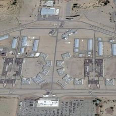
The Blythe Solar Power Project is a solar energy installation in Riverside County that spans several thousand acres across public land. The facility uses photovoltaic technology and includes a large battery storage system to manage electricity flow.

The project originally started as a concept for a thermal power plant with much larger capacity, but was redesigned as a solar installation. Construction phases rolled out between 2015 and 2020 to bring the current system online.

The installation sits on land that holds importance for indigenous communities. Development discussions involved tribal representatives who raised concerns about protecting their ancestral areas.

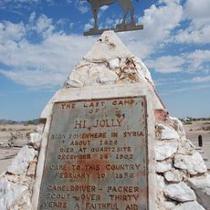
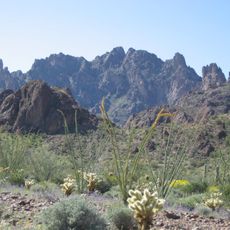
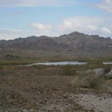
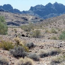
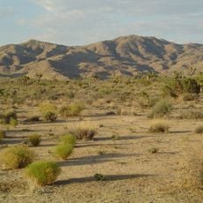
The installation sits in a dry desert area that gets very hot during peak summer months. Visitors should bring appropriate clothing, water, and sun protection when exploring the surroundings.

The facility was developed under a specific plan that connects renewable energy production with protection measures for desert ecosystems. This balance between power generation and conservation is unusual in the energy industry.

The community of curious travelers

AroundUs brings together thousands of curated places, local tips, and hidden gems, enriched daily by 60,000 contributors worldwide.

Start exploring
Location
Industry
solar power
GPS coordinates
33.65000,-114.72000
Latest update
December 10, 2025 16:27
Around this place
Salvation Mountain
United States of America

Salvation Mountain

82.6 km
Algodones Dunes
United States of America

Algodones Dunes

84.1 km
Central Arizona Project
United States of America

Central Arizona Project

90.8 km
Blythe Intaglios
United States of America

Blythe Intaglios

23.7 km
Colorado River Aqueduct
United States of America

Colorado River Aqueduct

87.4 km
Ironwood State Prison
United States of America

Ironwood State Prison

5.1 km
All-American Canal
United States of America

All-American Canal

89.2 km
Chuckawalla Valley State Prison
United States of America

Chuckawalla Valley State Prison

20 km
Hi Jolly Monument
United States of America

Hi Jolly Monument

44.8 km
Kofa National Wildlife Refuge
United States of America

Kofa National Wildlife Refuge

80.9 km
Niland Geyser
United States of America

Niland Geyser

89.3 km
General George S. Patton Memorial Museum
United States of America

General George S. Patton Memorial Museum

92.9 km
Buckskin Mountain State Park
United States of America

Buckskin Mountain State Park

86.4 km
Picacho State Recreation Area
United States of America

Picacho State Recreation Area

70.3 km
Cibola National Wildlife Refuge
United States of America

Cibola National Wildlife Refuge

37.8 km
Cattail Cove State Park
United States of America

Cattail Cove State Park

93 km
Imperial National Wildlife Refuge
United States of America

Imperial National Wildlife Refuge

62.7 km
Little Picacho Wilderness
United States of America

Little Picacho Wilderness

80.4 km
Imperial Reservoir
United States of America

Imperial Reservoir

88.5 km
Bill Williams River National Wildlife Refuge
United States of America

Bill Williams River National Wildlife Refuge

93.1 km
Corn Springs
United States of America

Corn Springs

56.1 km
Turtle Mountains
United States of America

Turtle Mountains

71.8 km
Fort Tyson
United States of America

Fort Tyson

46.3 km
Riverside Mountains
United States of America

Riverside Mountains

44.7 km
Blythe Intake
United States of America

Blythe Intake

21 km
Trigo Mountains Wilderness
United States of America

Trigo Mountains Wilderness

53 km
Joshua Tree Wilderness
United States of America

Joshua Tree Wilderness

74.1 km
Arizona and California Railroad Bridge
United States of America

Arizona and California Railroad Bridge

68.9 km
Show the full map
Reviews
Share your experience

No review yet

Discussions
Start a discussion...

No discussion yet

« Blythe Solar Power Project - Solar power facility in Riverside County, United States » is provided by Around Us (aroundus.com). Images and texts are derived from Wikimedia project under a Creative Commons license. You are allowed to copy, distribute, and modify copies of this page, under the conditions set by the license, as long as this note is clearly visible.

Discover hidden gems everywhere you go!

From secret cafés to breathtaking viewpoints, skip the crowded tourist spots and find places that match your style. Our app makes it easy with voice search, smart filtering, route optimization, and insider tips from travelers worldwide. Download now for the complete mobile experience.

Around Us App Screenshot

A unique approach to discovering new places

Le Figaro

All the places worth exploring

France Info

A tailor-made excursion in just a few clicks

20 Minutes

Around Us
Travel Guide & Maps
Download

Send to your phone

QR Code
1

Open the camera app on your mobile.

2

Point at the QR code with your camera. A notification will appear.

3

Tap the notification to open the link.