From Provence to the Pyrénées, France offers riders diverse routes. These combine riding skills with discovering different landscapes.
France offers motorcyclists a diverse landscape, from Alpine peaks to Mediterranean coasts, including wine regions. The country is suitable for all riding styles, with demanding mountain roads, winding coastal routes, and rural paths.
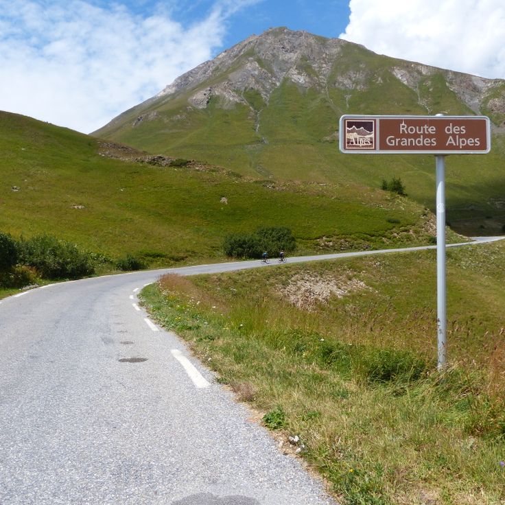
Key routes include the Col de la Bonette, reaching 2802 meters and connecting Ubaye to Tinée over 26 kilometers. The Gorges du Verdon feature 21 kilometers of rock-carved road, passing through tunnels and 700-meter-high cliffs. The Routes of the Great Alps cross 16 passes over 684 kilometers between Lake Geneva and the Mediterranean, with a total ascent of 15,700 meters. Mount Ventoux, accessible via three routes and standing at 1912 meters, passes through lavender fields and vineyards in Provence.
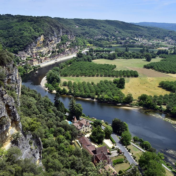
Regions display striking contrasts: Corsica alternates between cliff roads and pine forests, the French Riviera combines coast and mountainous hinterland, and Dordogne winds between limestone cliffs and medieval villages. Lake Annecy connects water bodies with forested mountain passes. These routes feature technical curves, varied landscapes, and cultural sites.
From Provence to the Pyrénées, France offers riders diverse routes. These combine riding skills with discovering different landscapes.
France offers motorcyclists a diverse landscape, from Alpine peaks to Mediterranean coasts, including wine regions. The country is suitable for all riding styles, with demanding mountain roads, winding coastal routes, and rural paths.
Key routes include the Col de la Bonette, reaching 2802 meters and connecting Ubaye to Tinée over 26 kilometers. The Gorges du Verdon feature 21 kilometers of rock-carved road, passing through tunnels and 700-meter-high cliffs. The Routes of the Great Alps cross 16 passes over 684 kilometers between Lake Geneva and the Mediterranean, with a total ascent of 15,700 meters. Mount Ventoux, accessible via three routes and standing at 1912 meters, passes through lavender fields and vineyards in Provence.
Regions display striking contrasts: Corsica alternates between cliff roads and pine forests, the French Riviera combines coast and mountainous hinterland, and Dordogne winds between limestone cliffs and medieval villages. Lake Annecy connects water bodies with forested mountain passes. These routes feature technical curves, varied landscapes, and cultural sites.
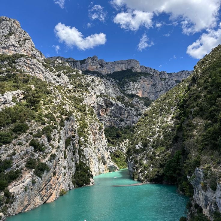
The Verdon Gorge extends over 21 kilometers and reaches depths of up to 700 meters. The road through the gorge passes through numerous tunnels and runs along steep rock walls. The Verdon River has carved this formation into the limestone over thousands of years.
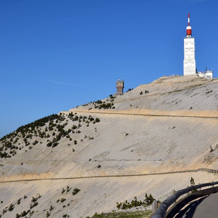
Mont Ventoux rises to 1912 meters altitude and offers motorcyclists three different ascent routes with gradients up to 10 percent. The southern route from Bédoin passes through Mediterranean vegetation, oak forests and finally bare scree fields. The northern route from Malaucène shows a different face of the mountain with denser woodland. During the ride, one crosses Provençal landscapes with lavender fields, vineyards and olive groves.
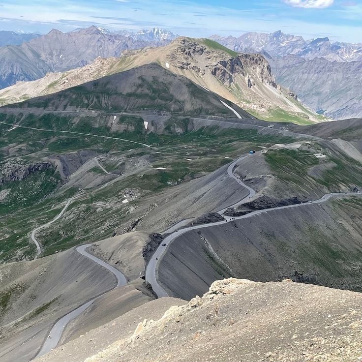
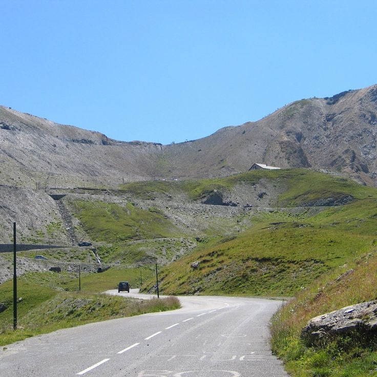
The Col de la Bonette reaches an elevation of 2802 meters and connects the Ubaye Valley with the Tinée Valley. The route extends over 26 kilometers and passes through high alpine terrain with numerous hairpin bends. This mountain pass is considered one of the highest paved roads in Europe and offers motorcyclists demanding curves along with expansive views of the surrounding peaks of the Maritime Alps.
This route connects Thonon-les-Bains on Lake Geneva with Menton on the Mediterranean Sea over a distance of 684 kilometers. The road crosses 16 Alpine passes and climbs a total of 15,700 meters in elevation through the French Alps.
The Dordogne flows through a valley with steep limestone cliffs rising on both sides of the river. Roads in this region follow the watercourse and connect medieval villages with castles and fortresses from the 12th and 13th centuries. The routes offer curves along the rock faces and pass through forested sections as well as open landscapes with vineyards and walnut groves.
Corsica combines mountain roads with coastal sections across more than 1000 kilometers of paved routes. The mountain roads pass through chestnut forests and pine groves, while coastal roads run between cliffs and coves. The D81 and D84 offer technical sequences of curves with elevation changes up to 1500 meters.
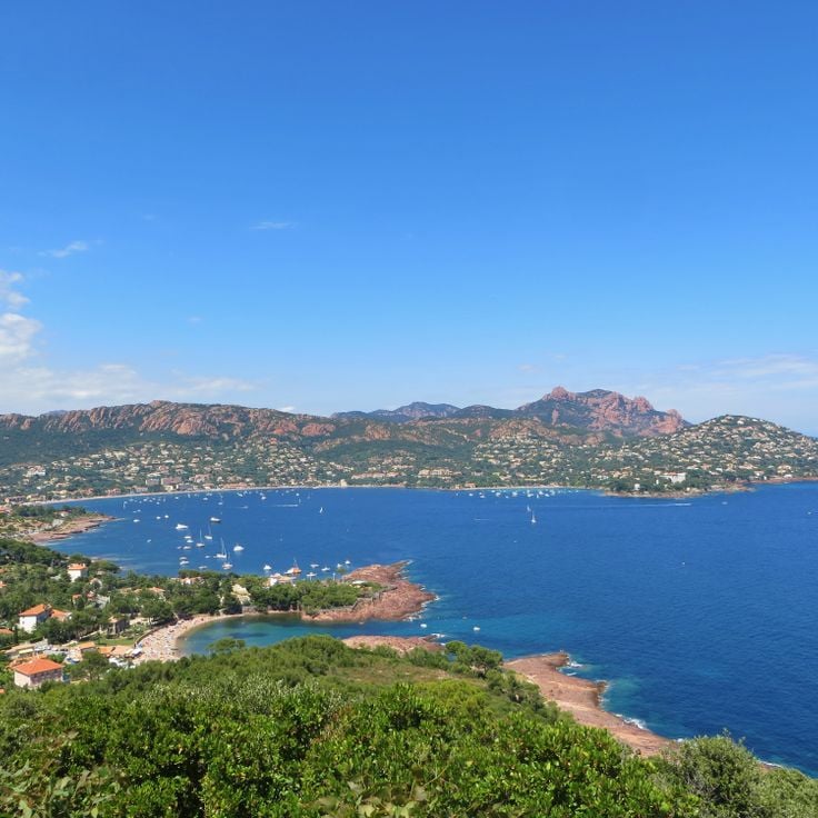
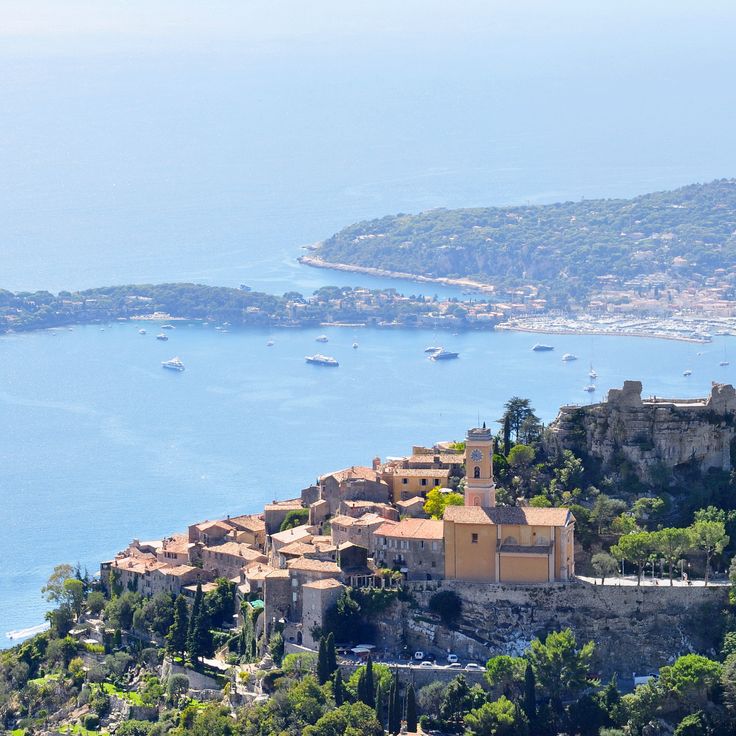
The Côte d'Azur offers coastal roads connecting beaches from Saint-Tropez to Menton with port cities like Cannes and Nice. Mountain roads cross hinterland villages and provide views over the Mediterranean Sea. The Corniche routes follow cliffs between Monaco and Èze.
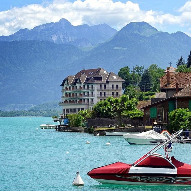
Lake Annecy sits in the French Alps and extends over 27 kilometers in length. The lakeside roads pass through several towns and provide views of the water and surrounding mountain ranges. Multiple passes in the region connect the lake basin with neighboring valleys and traverse forested areas at varying elevations.
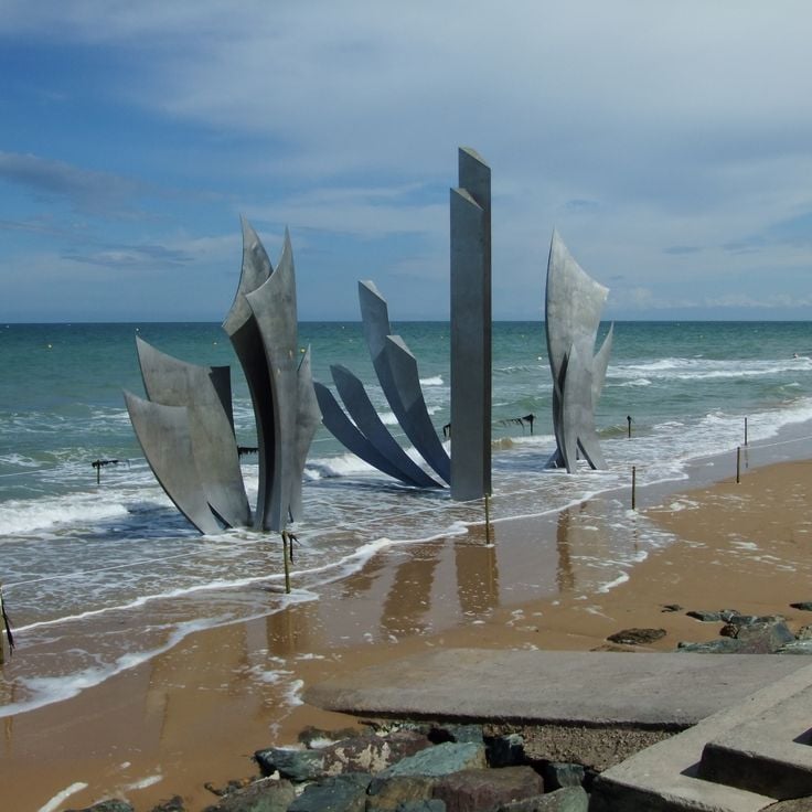
The Normandy Beaches stretch along the English Channel coast and connect historical landing beaches with coastal roads that pass through fishing villages and port towns. This route offers wide sandy beaches, cliffs and views of the sea.
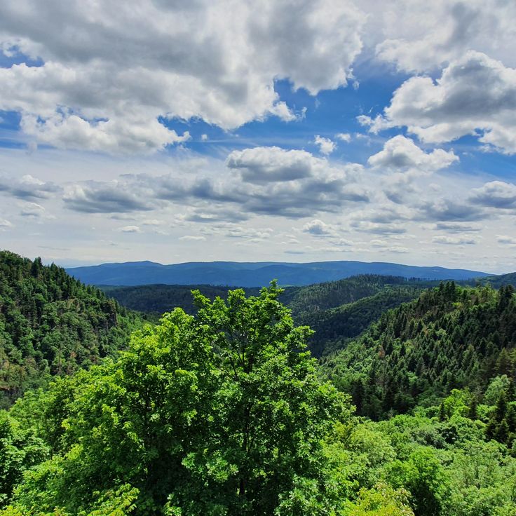
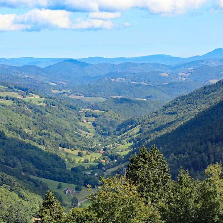
The Vosges Mountain Range forms a medium-altitude massif in eastern France, covered with extensive coniferous and mixed forests. Mountain roads wind through forested valleys and cross numerous passes with tight turns and varying gradients. Motorcyclists will find technically demanding sections that require concentration and riding skills throughout these routes.
The Col du Galibier connects the Maurienne valley with the Briançonnais region and reaches an elevation of 2642 meters. The ascent from Valloire covers 18 kilometers with an average gradient of 6.9 percent, while the route from Saint-Michel-de-Maurienne measures 34 kilometers in total. Gradients reach up to 10 percent on certain sections of this high mountain road.
The Alsatian Vineyards Route extends over 170 kilometers through the wine-growing areas between Marlenheim and Thann. This route connects numerous villages with half-timbered houses from the medieval period and passes through vineyards that stretch along the Vosges mountains and produce grape varieties such as Riesling and Gewürztraminer.
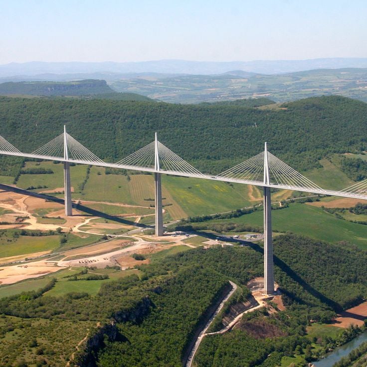
The Millau Viaduct spans 2460 meters across the Tarn River valley at a height of 270 meters above the ground. This cable-stayed bridge rests on seven concrete pylons and opened to traffic in 2004. The tallest pylon rises to 343 meters, making this structure one of the tallest bridges in the world. The roadway carries the A75 motorway, connecting Paris to the Mediterranean coast.
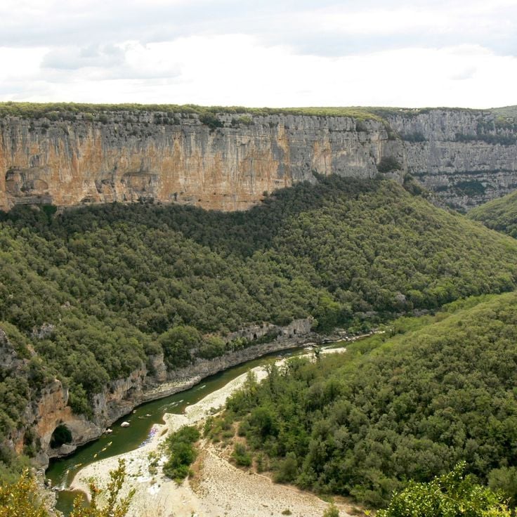
These gorges extend over 30 kilometers along the Ardèche River and run through limestone cliffs marked by natural arches and caves. The route follows the river course and offers numerous viewpoints over the rock formations.
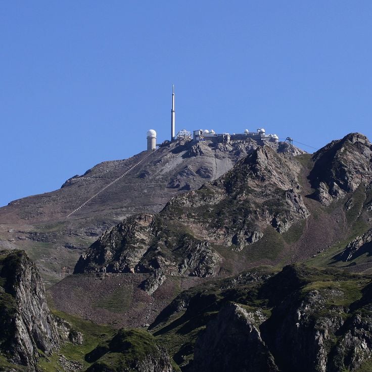
The Pic du Midi de Bigorre rises to 2877 meters in the Pyrenees and houses an astronomical observatory. The winding mountain road extends 19 kilometers through high mountain terrain, offering motorcyclists technical challenges with numerous hairpin turns and varying gradients leading to the summit.
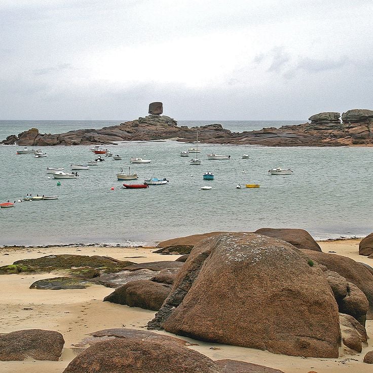
The Brittany coastline extends over 1000 kilometers along the Atlantic Ocean and the English Channel. The national roads connect numerous fishing villages with traditional architecture, while wide sandy beaches regularly open between granite cliffs. This route offers motorcyclists alternating landscapes between seashore, moorland and small harbors.
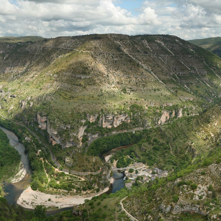
The Gorges du Tarn extend over 50 kilometers between limestone walls that rise up to 500 meters in places. This route follows the river through numerous curves and offers motorcyclists technically demanding sections through the Cevennes nature reserve.
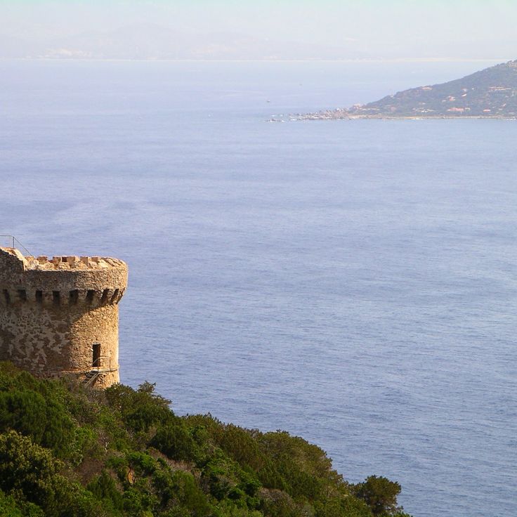
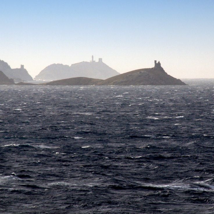
The D80 coastal road circles Cap Corse over 110 kilometers and offers continuous views of the Mediterranean Sea. This route follows the coastline of Corsica's northern peninsula and connects small fishing villages and harbor towns along steep cliffs.
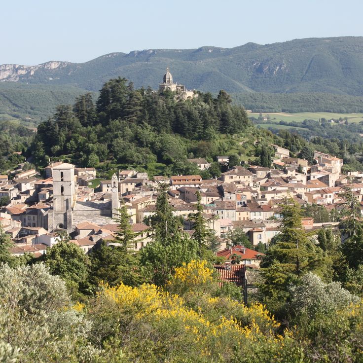
The Luberon Valley offers motorcyclists an extensive network of departmental roads that wind through lavender fields, vineyards and Provençal stone villages. This protected area of the regional nature park stretches between the Alps and the Mediterranean, connecting historic settlements with winding routes through Mediterranean vegetation.
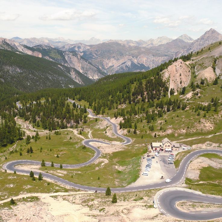
The Col d'Izoard sits at 2360 meters elevation and connects the Queyras valley with Briançonnais. This Alpine road crosses the Casse Déserte, a landscape of limestone pillars and scree fields. The northern ascent starts from Briançon with 32 hairpin bends over 20 kilometers, while the southern approach from Guillestre measures 19 kilometers.
The Route Napoléon follows the path taken by Napoleon Bonaparte in March 1815 after his return from the island of Elba. This 324-kilometer road connects Golfe-Juan on the Mediterranean coast to Grenoble, crossing through mountains and valleys of southeastern France. The route passes through varied terrain with curves and elevation changes.
This mountain road extends over 77 kilometers through the Vosges Mountains, connecting several mountain passes at elevations between 600 and 1,300 meters. La Route des Crêtes follows the ridgelines of the massif and passes through dense forests and open mountain meadows. Originally constructed during World War I for military purposes, the route now offers numerous curves and views over the surrounding valleys and the Rhine plain.
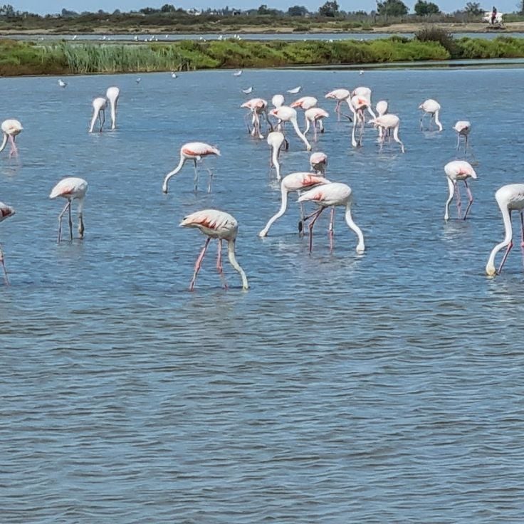
The Camargue Region extends between the Mediterranean Sea and the Rhône River delta, offering flat wetlands crossed by long straight roads. These routes pass through salt marshes, rice paddies and lagoons where herds of white horses and colonies of pink flamingos can be observed in their natural habitat.
Les Corniches are three parallel coastal roads connecting Nice to Monaco along the French Riviera. These routes provide different perspectives of the Mediterranean coastline and access to hillside communities. The lower Corniche follows the waterfront, the middle route passes through Èze, while the upper Grande Corniche traces a Roman road at over 500 meters elevation, offering views of the sea.
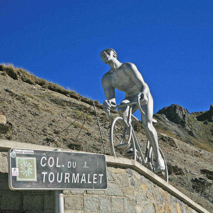
The Col du Tourmalet rises to 2115 meters in the central Pyrenees and is accessed via a 19 kilometer road from Luz-Saint-Sauveur. This pass features regularly in Tour de France stages and offers motorcyclists numerous curves with gradients reaching 10 percent.
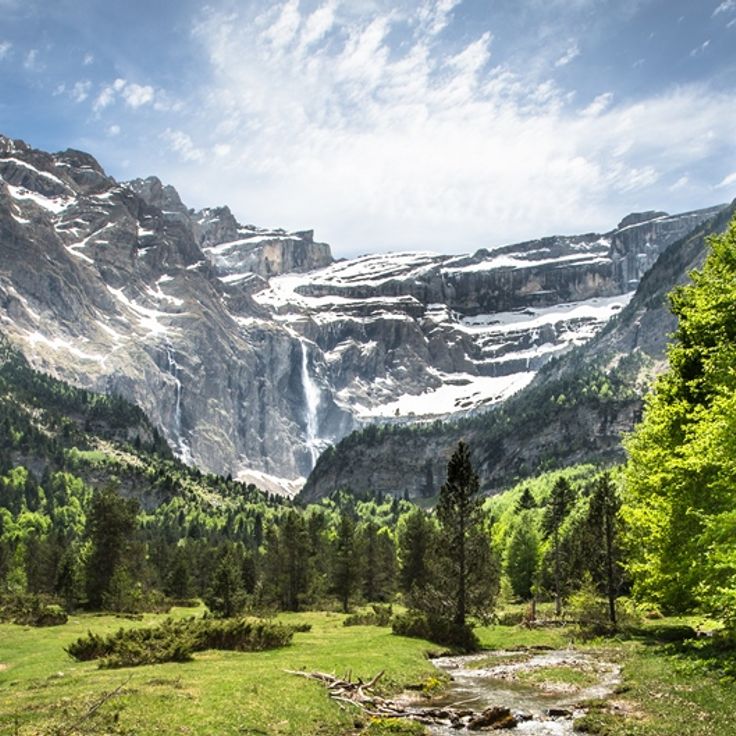
The Cirque de Gavarnie forms a natural amphitheater in the Pyrenees National Park with 1500-meter high rock walls and several waterfalls along the marked road route accessible by motorcycle.
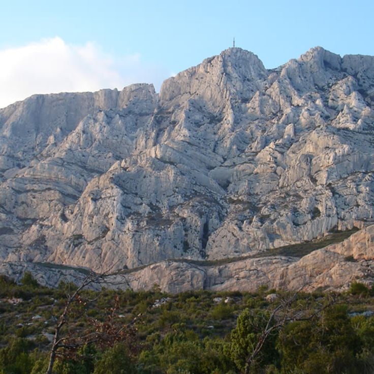
The Montagne Sainte-Victoire is a limestone massif east of Aix-en-Provence that extends over 18 kilometers. This mountain range served as the subject for more than 60 paintings by Paul Cézanne. The routes through the area pass through vineyards, pine forests and Mediterranean garrigue with views of the summit silhouette.
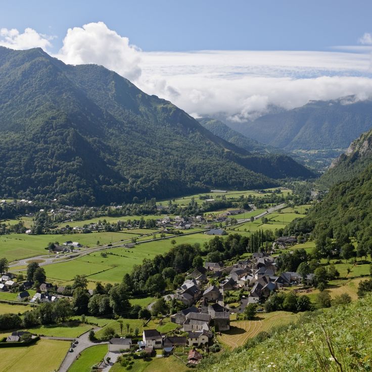
The roads of Béarn cross mountain valleys, passes and pastures. Elevations range from 100 to 2000 meters, offering varied routes through the Pyrenean landscape with its characteristic villages and agricultural areas.
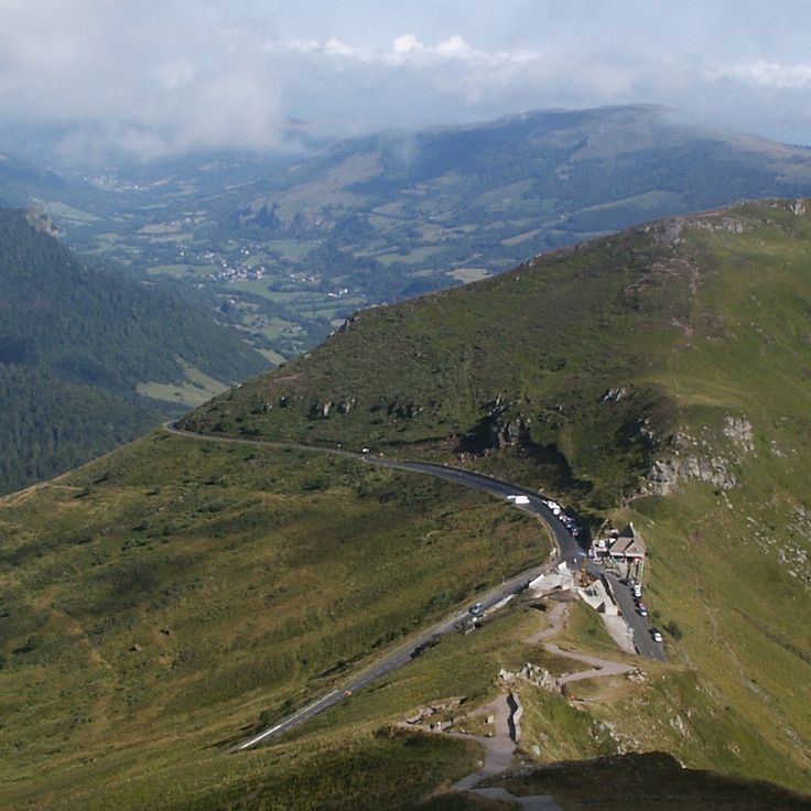
The Pas de Peyrol stands at 1589 meters in the Massif Central and features a sequence of 12 hairpin bends on its north side, marked by steep sections with an average gradient of 12 percent. This route connects the Cère valley to Puy Mary and presents motorcyclists with technical challenges through tight curves and changing road conditions.
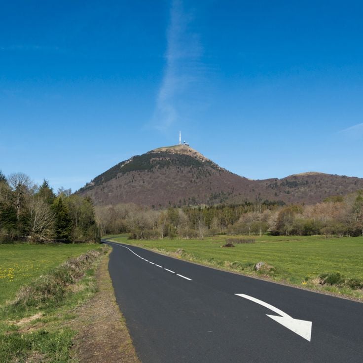
Puy de Dôme rises to 1465 meters and is connected by a 12-kilometer mountain road that features slopes reaching 13 percent in some sections. This dormant volcano overlooks Clermont-Ferrand and presents a technical challenge for motorcyclists with its winding hairpins and weather-exposed surface. The ascent passes through various vegetation zones, from beech forests to high-altitude grasslands, providing clear views of the Puy mountain chain. At the summit, the panorama extends over 80 aligned volcanoes and allows sighting the Sancy Massif in clear weather. Access for motorized two-wheelers is seasonally regulated and subject to strict weather conditions.
The Verdon Gorge extends over 21 kilometers and reaches depths of up to 700 meters. The road through the gorge passes through numerous tunnels and runs along steep rock walls. The Verdon River has carved this formation into the limestone over thousands of years.
Mont Ventoux rises to 1912 meters altitude and offers motorcyclists three different ascent routes with gradients up to 10 percent. The southern route from Bédoin passes through Mediterranean vegetation, oak forests and finally bare scree fields. The northern route from Malaucène shows a different face of the mountain with denser woodland. During the ride, one crosses Provençal landscapes with lavender fields, vineyards and olive groves.
The Col de la Bonette reaches an elevation of 2802 meters and connects the Ubaye Valley with the Tinée Valley. The route extends over 26 kilometers and passes through high alpine terrain with numerous hairpin bends. This mountain pass is considered one of the highest paved roads in Europe and offers motorcyclists demanding curves along with expansive views of the surrounding peaks of the Maritime Alps.
This route connects Thonon-les-Bains on Lake Geneva with Menton on the Mediterranean Sea over a distance of 684 kilometers. The road crosses 16 Alpine passes and climbs a total of 15,700 meters in elevation through the French Alps.
The Dordogne flows through a valley with steep limestone cliffs rising on both sides of the river. Roads in this region follow the watercourse and connect medieval villages with castles and fortresses from the 12th and 13th centuries. The routes offer curves along the rock faces and pass through forested sections as well as open landscapes with vineyards and walnut groves.
Corsica combines mountain roads with coastal sections across more than 1000 kilometers of paved routes. The mountain roads pass through chestnut forests and pine groves, while coastal roads run between cliffs and coves. The D81 and D84 offer technical sequences of curves with elevation changes up to 1500 meters.
The Côte d'Azur offers coastal roads connecting beaches from Saint-Tropez to Menton with port cities like Cannes and Nice. Mountain roads cross hinterland villages and provide views over the Mediterranean Sea. The Corniche routes follow cliffs between Monaco and Èze.
Lake Annecy sits in the French Alps and extends over 27 kilometers in length. The lakeside roads pass through several towns and provide views of the water and surrounding mountain ranges. Multiple passes in the region connect the lake basin with neighboring valleys and traverse forested areas at varying elevations.
The Normandy Beaches stretch along the English Channel coast and connect historical landing beaches with coastal roads that pass through fishing villages and port towns. This route offers wide sandy beaches, cliffs and views of the sea.
The Vosges Mountain Range forms a medium-altitude massif in eastern France, covered with extensive coniferous and mixed forests. Mountain roads wind through forested valleys and cross numerous passes with tight turns and varying gradients. Motorcyclists will find technically demanding sections that require concentration and riding skills throughout these routes.
The Col du Galibier connects the Maurienne valley with the Briançonnais region and reaches an elevation of 2642 meters. The ascent from Valloire covers 18 kilometers with an average gradient of 6.9 percent, while the route from Saint-Michel-de-Maurienne measures 34 kilometers in total. Gradients reach up to 10 percent on certain sections of this high mountain road.
The Alsatian Vineyards Route extends over 170 kilometers through the wine-growing areas between Marlenheim and Thann. This route connects numerous villages with half-timbered houses from the medieval period and passes through vineyards that stretch along the Vosges mountains and produce grape varieties such as Riesling and Gewürztraminer.
The Millau Viaduct spans 2460 meters across the Tarn River valley at a height of 270 meters above the ground. This cable-stayed bridge rests on seven concrete pylons and opened to traffic in 2004. The tallest pylon rises to 343 meters, making this structure one of the tallest bridges in the world. The roadway carries the A75 motorway, connecting Paris to the Mediterranean coast.
These gorges extend over 30 kilometers along the Ardèche River and run through limestone cliffs marked by natural arches and caves. The route follows the river course and offers numerous viewpoints over the rock formations.
The Pic du Midi de Bigorre rises to 2877 meters in the Pyrenees and houses an astronomical observatory. The winding mountain road extends 19 kilometers through high mountain terrain, offering motorcyclists technical challenges with numerous hairpin turns and varying gradients leading to the summit.
The Brittany coastline extends over 1000 kilometers along the Atlantic Ocean and the English Channel. The national roads connect numerous fishing villages with traditional architecture, while wide sandy beaches regularly open between granite cliffs. This route offers motorcyclists alternating landscapes between seashore, moorland and small harbors.
The Gorges du Tarn extend over 50 kilometers between limestone walls that rise up to 500 meters in places. This route follows the river through numerous curves and offers motorcyclists technically demanding sections through the Cevennes nature reserve.
The D80 coastal road circles Cap Corse over 110 kilometers and offers continuous views of the Mediterranean Sea. This route follows the coastline of Corsica's northern peninsula and connects small fishing villages and harbor towns along steep cliffs.
The Luberon Valley offers motorcyclists an extensive network of departmental roads that wind through lavender fields, vineyards and Provençal stone villages. This protected area of the regional nature park stretches between the Alps and the Mediterranean, connecting historic settlements with winding routes through Mediterranean vegetation.
The Col d'Izoard sits at 2360 meters elevation and connects the Queyras valley with Briançonnais. This Alpine road crosses the Casse Déserte, a landscape of limestone pillars and scree fields. The northern ascent starts from Briançon with 32 hairpin bends over 20 kilometers, while the southern approach from Guillestre measures 19 kilometers.
The Route Napoléon follows the path taken by Napoleon Bonaparte in March 1815 after his return from the island of Elba. This 324-kilometer road connects Golfe-Juan on the Mediterranean coast to Grenoble, crossing through mountains and valleys of southeastern France. The route passes through varied terrain with curves and elevation changes.
This mountain road extends over 77 kilometers through the Vosges Mountains, connecting several mountain passes at elevations between 600 and 1,300 meters. La Route des Crêtes follows the ridgelines of the massif and passes through dense forests and open mountain meadows. Originally constructed during World War I for military purposes, the route now offers numerous curves and views over the surrounding valleys and the Rhine plain.
The Camargue Region extends between the Mediterranean Sea and the Rhône River delta, offering flat wetlands crossed by long straight roads. These routes pass through salt marshes, rice paddies and lagoons where herds of white horses and colonies of pink flamingos can be observed in their natural habitat.
Les Corniches are three parallel coastal roads connecting Nice to Monaco along the French Riviera. These routes provide different perspectives of the Mediterranean coastline and access to hillside communities. The lower Corniche follows the waterfront, the middle route passes through Èze, while the upper Grande Corniche traces a Roman road at over 500 meters elevation, offering views of the sea.
The Col du Tourmalet rises to 2115 meters in the central Pyrenees and is accessed via a 19 kilometer road from Luz-Saint-Sauveur. This pass features regularly in Tour de France stages and offers motorcyclists numerous curves with gradients reaching 10 percent.
The Cirque de Gavarnie forms a natural amphitheater in the Pyrenees National Park with 1500-meter high rock walls and several waterfalls along the marked road route accessible by motorcycle.
The Montagne Sainte-Victoire is a limestone massif east of Aix-en-Provence that extends over 18 kilometers. This mountain range served as the subject for more than 60 paintings by Paul Cézanne. The routes through the area pass through vineyards, pine forests and Mediterranean garrigue with views of the summit silhouette.
The roads of Béarn cross mountain valleys, passes and pastures. Elevations range from 100 to 2000 meters, offering varied routes through the Pyrenean landscape with its characteristic villages and agricultural areas.
The Pas de Peyrol stands at 1589 meters in the Massif Central and features a sequence of 12 hairpin bends on its north side, marked by steep sections with an average gradient of 12 percent. This route connects the Cère valley to Puy Mary and presents motorcyclists with technical challenges through tight curves and changing road conditions.
Puy de Dôme rises to 1465 meters and is connected by a 12-kilometer mountain road that features slopes reaching 13 percent in some sections. This dormant volcano overlooks Clermont-Ferrand and presents a technical challenge for motorcyclists with its winding hairpins and weather-exposed surface. The ascent passes through various vegetation zones, from beech forests to high-altitude grasslands, providing clear views of the Puy mountain chain. At the summit, the panorama extends over 80 aligned volcanoes and allows sighting the Sancy Massif in clear weather. Access for motorized two-wheelers is seasonally regulated and subject to strict weather conditions.