Madagascar photography: baobabs, Tsingy, national parks
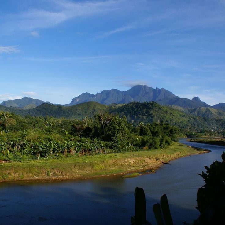
Madagascar features natural landscapes ranging from the baobab avenues near Morondava to the limestone formations of the Tsingy and coastal areas with coral reefs. The country's national parks protect tropical rainforests inhabited by lemurs, along with geological features including crater lakes and sandstone formations. The highest peaks rise in the northern mountain ranges, while the southern regions are characterized by dry landscapes.
Photogenic locations include the Isalo Massif with its eroded sandstone canyons, the Masoala Peninsula with its rainforests along the Indian Ocean, and the island of Nosy Be off the northwest coast. The beaches at Ifaty and Anakao attract visitors for their reefs, while Sainte-Marie Island is known for whale watching between July and September. The Kirindy forests in the west are home to nocturnal lemurs and fossas.
Historic sites include the royal hill of Ambohimanga, a UNESCO World Heritage site, and the Rova palace in Antananarivo. The geysers at Ampefy and the crater lake Tritriva showcase the volcanic history of the highlands. The red Tsingy near Sadjoavato formed through erosion of iron-rich sandstone and contrast with the gray limestone Tsingy in the west.
Madagascar photography: baobabs, Tsingy, national parks
Madagascar features natural landscapes ranging from the baobab avenues near Morondava to the limestone formations of the Tsingy and coastal areas with coral reefs. The country's national parks protect tropical rainforests inhabited by lemurs, along with geological features including crater lakes and sandstone formations. The highest peaks rise in the northern mountain ranges, while the southern regions are characterized by dry landscapes.
Photogenic locations include the Isalo Massif with its eroded sandstone canyons, the Masoala Peninsula with its rainforests along the Indian Ocean, and the island of Nosy Be off the northwest coast. The beaches at Ifaty and Anakao attract visitors for their reefs, while Sainte-Marie Island is known for whale watching between July and September. The Kirindy forests in the west are home to nocturnal lemurs and fossas.
Historic sites include the royal hill of Ambohimanga, a UNESCO World Heritage site, and the Rova palace in Antananarivo. The geysers at Ampefy and the crater lake Tritriva showcase the volcanic history of the highlands. The red Tsingy near Sadjoavato formed through erosion of iron-rich sandstone and contrast with the gray limestone Tsingy in the west.
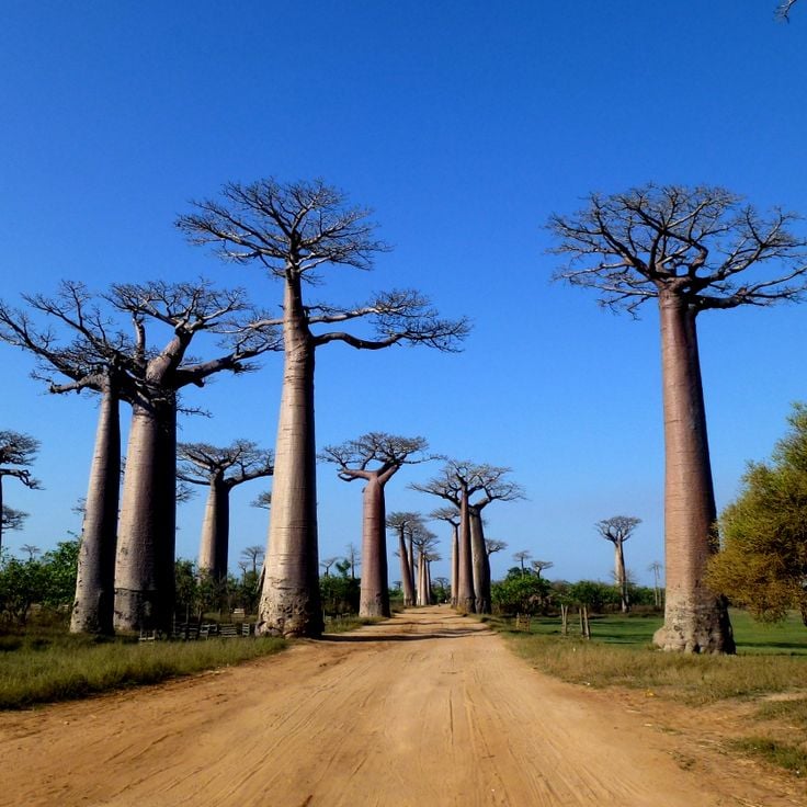
The Avenue of the Baobabs runs along a dirt road between Morondava and Belo Tsiribihina, showcasing a concentration of African baobab trees that reach heights of 65 to 100 feet (20 to 30 meters). This grouping represents one of the last remnants of the dry forest that once covered the region. The road extends for roughly 850 feet (260 meters) and is lined by several dozen of these massive trees, with trunks measuring up to 10 feet (3 meters) in diameter. The site draws photographers particularly during morning and evening hours, when the light emphasizes the vertical forms of the trees.
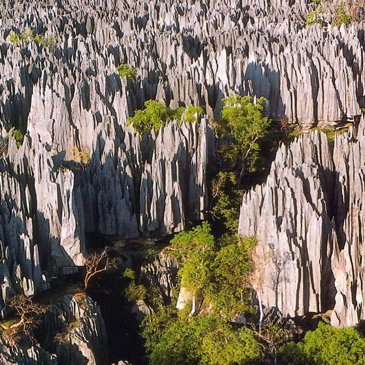
The Forêt de Pierre Tsingy consists of extensive limestone formations spanning several square miles. These needle-like structures formed through millions of years of erosion, creating a labyrinth of sharp-edged towers reaching up to 230 feet (70 meters) in height. The area supports numerous endemic plant species growing within the cracks and cavities of the rocks, along with several lemur species, reptiles and birds found nowhere else on Earth. The formations are accessible via suspension bridges and marked trails, with sturdy footwear and gloves required due to the sharp surfaces.
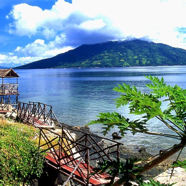
Nosy Be sits off Madagascar's northwest coast and provides access to coral reefs and sandy beaches. The island serves as a base for whale watching during the migration period between July and September and for encounters with sea turtles in the coastal waters. The tropical climate allows year-round visits, though the dry season from April through November offers more favorable conditions for water activities.
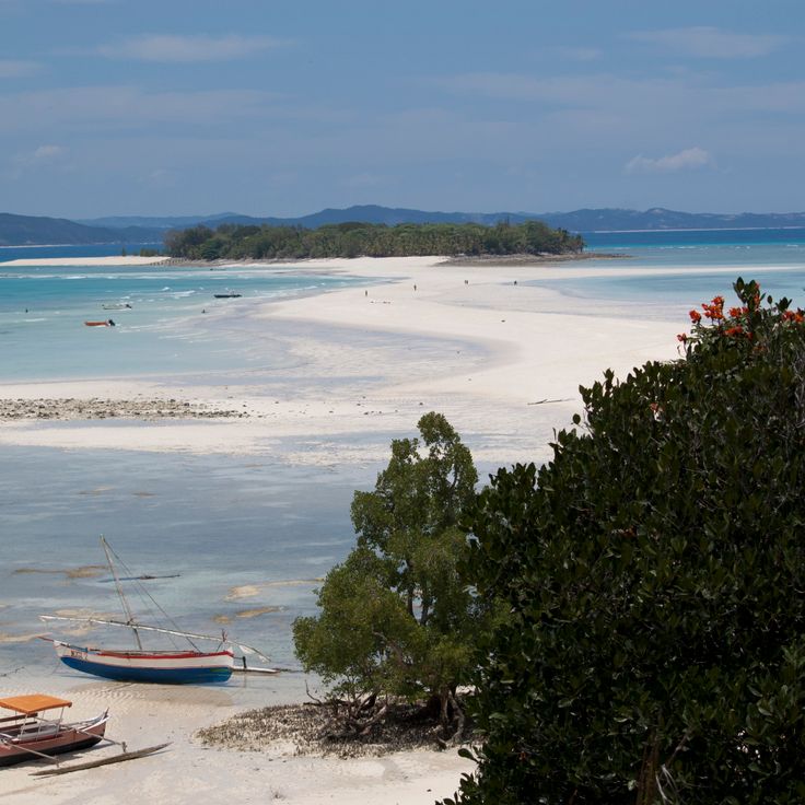
This island stretching 37 miles (60 kilometers) off Madagascar's east coast contains a 17th-century cemetery where pirate graves have been preserved. The surrounding waters hold coral reefs suitable for snorkeling and diving. The island once served as a base for privateers and traders navigating the Indian Ocean. Visitors can tour the cemetery grounds, relax on sand beaches and explore underwater marine life. The relatively sheltered location makes the island an anchorage for sailors and a departure point for whale watching during migration season.
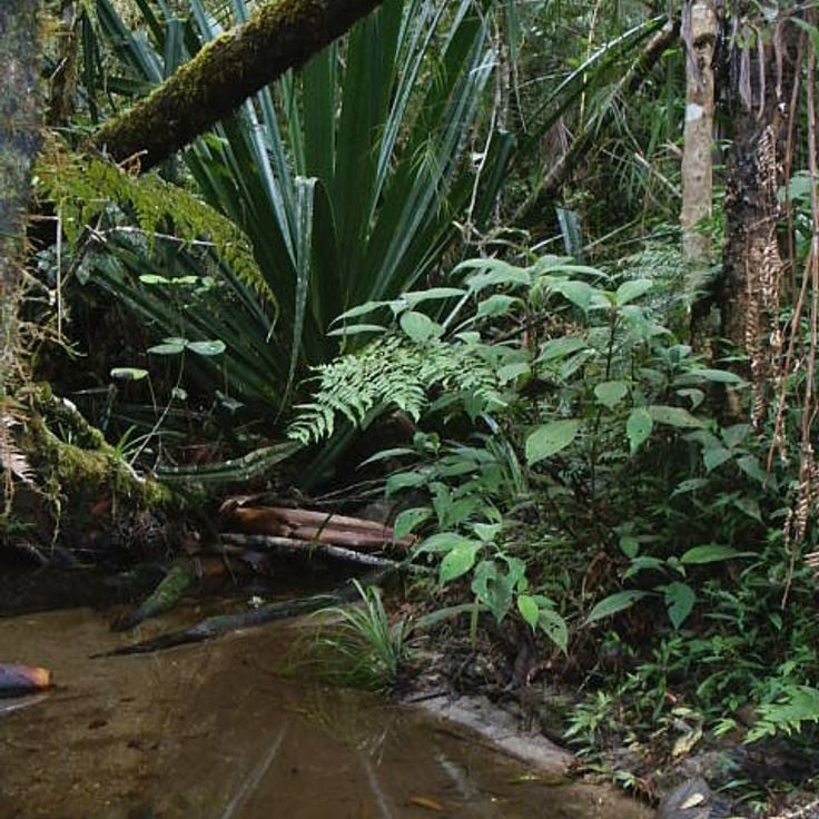
This national park in the eastern highlands protects 60 square miles (155 square kilometers) of tropical rainforest and ranks among the country's premier sites for lemur observation. The forests support 14 lemur species, including the largest population of the indri, whose distinctive calls carry for several miles. The park divides into two zones: the more accessible Analamazaotra Reserve and the larger Mantadia sector with more demanding trails. Over 100 bird species have been documented here, along with reptiles, amphibians and numerous endemic plant species. The trails wind through dense primary forest with trees reaching 100 feet (30 meters), passing orchids, ferns and small streams. Located about three hours east of Antananarivo along the national highway, the park operates through several visitor centers that organize guided walks.
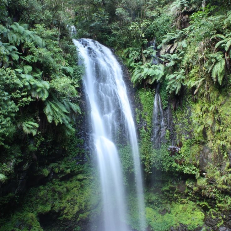
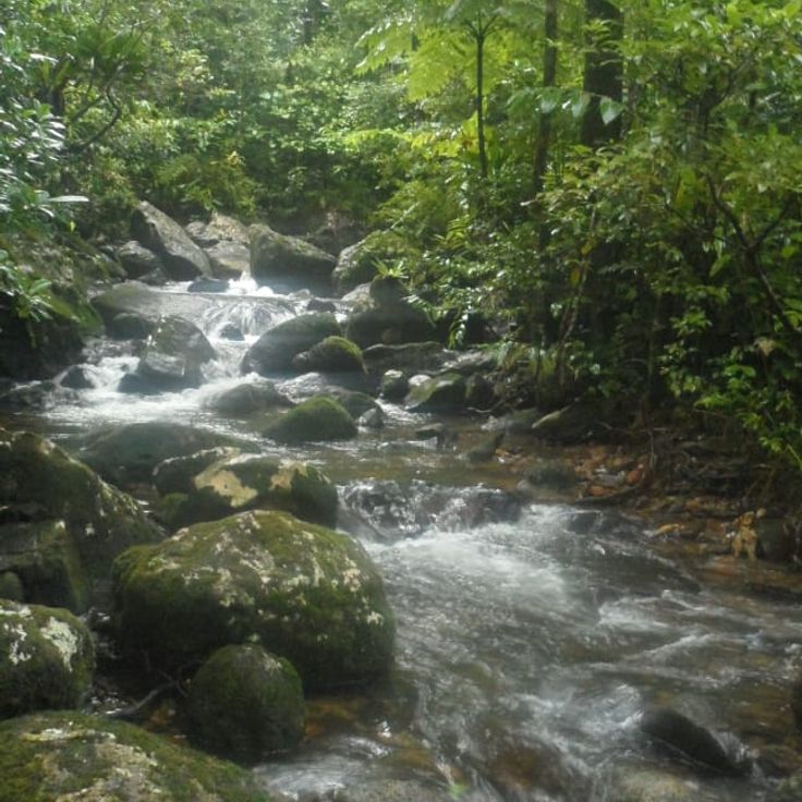
Ranomafana National Park extends across 41,600 hectares of forested mountain terrain and forms a significant habitat for twelve lemur species and over 130 bird species. The park's dense rainforests spread over steep slopes and river valleys, where trails lead to wildlife observation points. Vegetation ranges from ground-level ferns to tall canopies that shelter the rare golden bamboo lemur and greater bamboo lemur. Thermal springs surface in some sections, adding to the natural features of this protected rainforest zone in Madagascar's highlands.
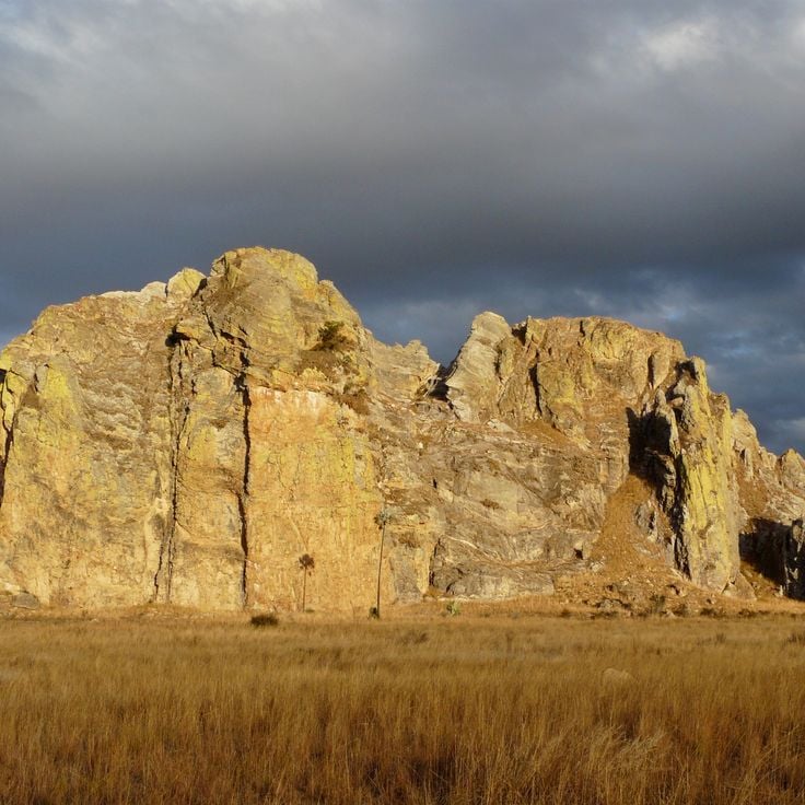
Isalo National Park protects 81,540 hectares (201,500 acres) of Jurassic sandstone formations across the central highlands. The park's eroded terrain features deep gorges, canyons and several waterfalls created through millions of years of geological activity. These sandstone formations provide habitat for various endemic species including lemurs and numerous bird species. Trails wind through the rocky landscape to natural pools and viewpoints overlooking the plateau.
Parc National de la Montagne d'Ambre covers 18,200 hectares (45,000 acres) in northern Madagascar, protecting montane rainforest with seven crater lakes formed by ancient volcanic activity. The park rises to 4,840 feet (1,475 meters), creating a cooler, wetter climate than surrounding lowland areas. Endemic reptiles, chameleons and several lemur species inhabit the forest alongside tree ferns and orchids. Trails lead to waterfalls and viewpoints marked by elevation changes and dense plant growth. The park serves as an important watershed for the region.
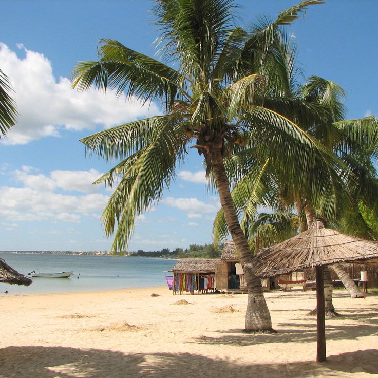
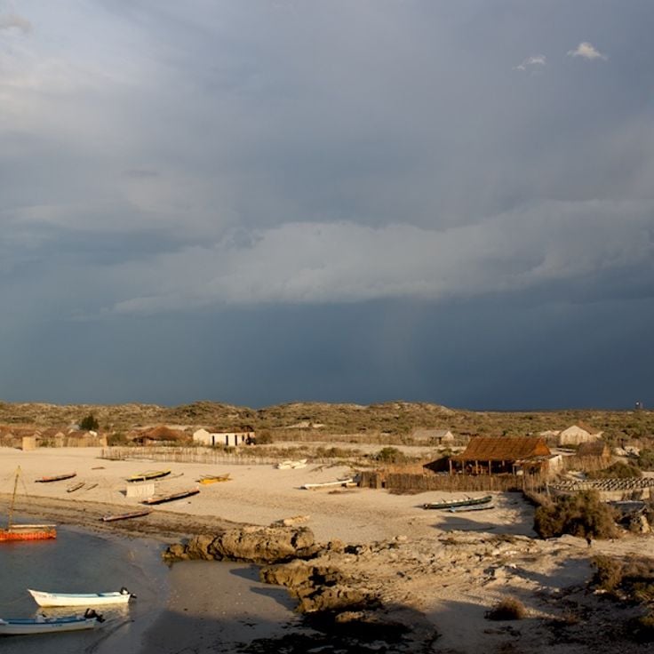
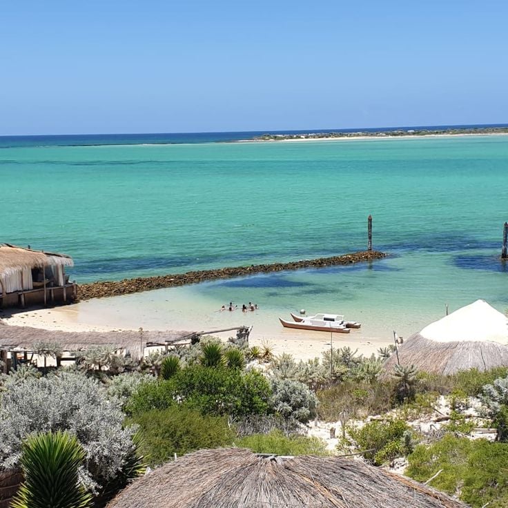
The Plage d'Ifaty stretches for several miles along Madagascar's southwest coast, bordered by a coral reef that ranks among the country's longest. Local fishermen work here using traditional methods, hauling their nets along the reef while pirogue boats drift across the turquoise water. The fine white sand contrasts with the dry spiny forest that characterizes the background, typical of this region. The warm water and sheltered conditions make this beach suitable for snorkelers and divers interested in exploring the reef's biodiversity.
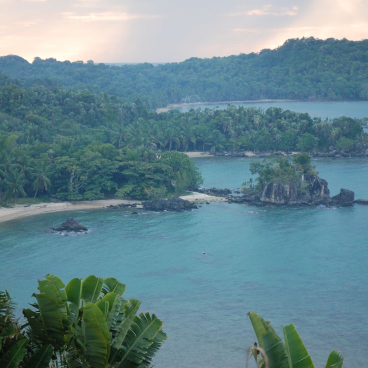
The Masoala Peninsula sits along the northeastern coast of Madagascar, protecting one of the largest remaining tracts of lowland rainforest in the country. The peninsula is home to ten lemur species, including the red ruffed lemur, and more than a hundred bird species within its dense rainforest that extends from coastal forests to mountain slopes. Coastal waters include coral reefs and mangrove forests, while the interior is characterized by rugged topography and high rainfall. Access is primarily by boat from Maroantsetra.
This small twin island in northwestern Madagascar consists of two landmasses connected by a 1,640-foot (500-meter) sandbar. At high tide, the sandy path disappears underwater, temporarily separating the islands. The turquoise waters surround the palm-covered islands, which serve as a nesting site for sea turtles. The larger island hosts a small hotel and a colonial-era lighthouse, while the smaller island remains uninhabited. Nosy Iranja can be reached by boat from Nosy Be, taking approximately one hour.
Parc National de Lokobe protects 740 acres of primary rainforest on Nosy Be. The forest shelters black lemurs, Brookesia chameleons and several endemic bird species. Trails wind through dense vegetation where visitors can observe palmetto palms, lianas and various orchid species. The reserve occupies the southeastern coast of the island and is accessible by boat from the main town of Nosy Be. Guided tours are led by local guides who share knowledge about flora and fauna as well as traditional plant uses.
Parc National Zahamena covers 247 square miles (640 square kilometers) of tropical rainforest in the Alaotra-Mangoro region. This park shelters more than 100 bird species along with several lemur species and numerous endemic plants. The rainforest vegetation forms a multilayered ecosystem with dense canopy and understory growth. Trails lead through different forest sections where visitors can observe the endemic fauna and flora. The park's remote location contributes to the preservation of natural habitats.
This crocodile breeding facility near the international airport houses over 300 Nile crocodiles in naturalistic enclosures of various sizes. A walking path leads through the grounds and allows visitors to observe the reptiles at different growth stages, from juveniles to adults measuring several yards in length. The center contributes to the conservation of Madagascar's native crocodile population and provides information about the biology and behavior of these animals. Located conveniently between Antananarivo and the airport, it often serves as a first or last stop for travelers passing through the capital region.
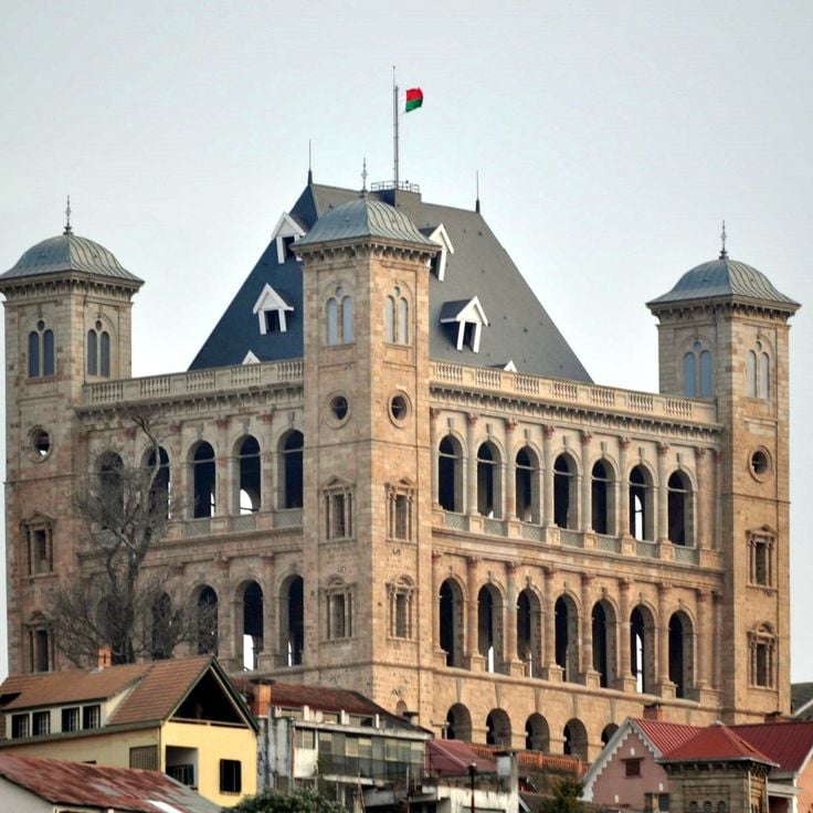
The Rova d'Antananarivo is a 17th-century palace complex occupying the highest point in Madagascar's capital and serving as the historic center of the Merina Dynasty. The site includes several royal residences and buildings that demonstrate the architectural evolution of Merina rule. A devastating fire in 1995 damaged much of the complex, though partial restoration has taken place. The elevated position provides views across the city and surrounding rice paddies. This site documents three centuries of Madagascan history and royal tradition.
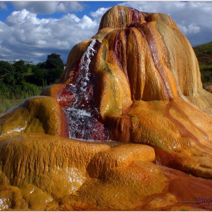
The geysers at Ampefy sit within a geothermal zone about 75 miles (120 kilometers) west of Antananarivo. Located in the volcanic Itasy region, this area features several active thermal vents that discharge warm water and steam at irregular intervals. Underground heat sources warm groundwater, which then rises and erupts through natural openings in the surface. Individual geysers vary in their patterns, with some releasing steady plumes of steam while others produce intermittent bursts. The surrounding ground shows mineral deposits and discolored earth formations created by the mineral-laden spray. These geothermal features represent some of the few examples of their kind in Madagascar and document the region's volcanic past.
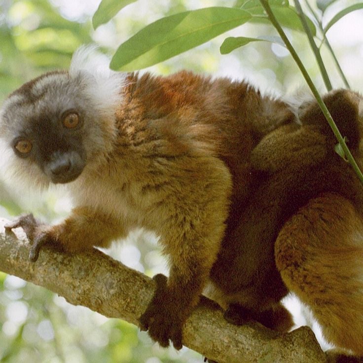
The Île aux Lémuriens is a private reserve located on a river island near Andasibe, home to four species of lemurs. The animals move freely through their natural habitat while visitors observe them from wooden walkways and trails. The reserve operates as a rescue and rehabilitation center for lemurs recovered from illegal captivity. Species living here include the bamboo lemur, the brown lemur and other prosimians that climb through the island's trees foraging for food. Visits last about an hour and provide photographers with good opportunities to document these primates in their natural environment.
Nosy Komba rises as a forested volcanic island in the Mozambique Channel off Madagascar's northwest coast. Black lemurs inhabit the wooded slopes while coastal villages sustain themselves through handicraft production and vanilla cultivation. Fishermen work from traditional pirogues, and weavers produce tablecloths and textiles for visitors. Waters surrounding the island offer coral reefs for snorkeling, and trails through rainforest lead to viewpoints overlooking the archipelago.
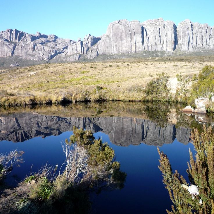
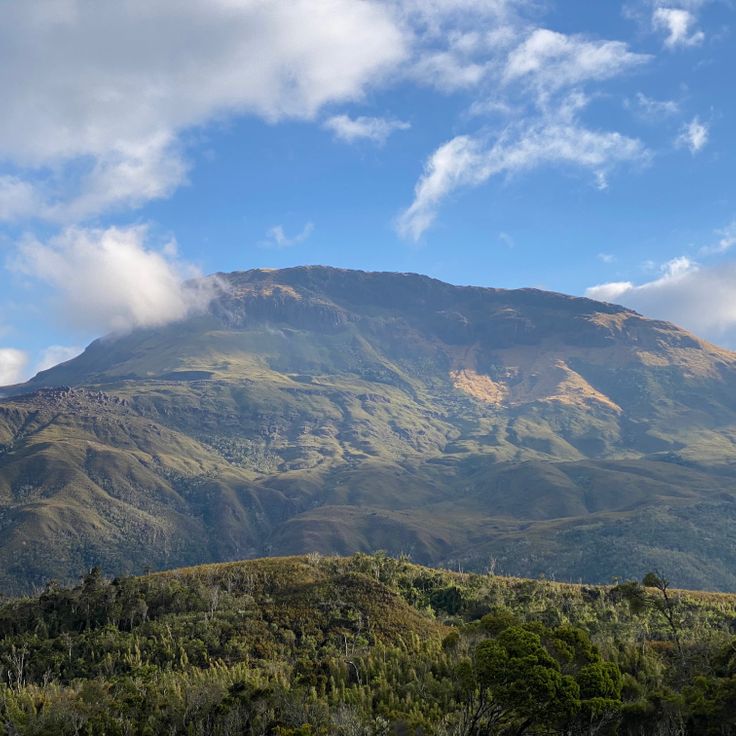
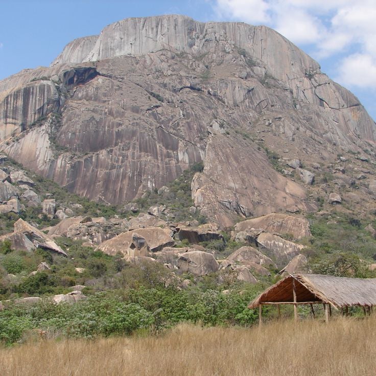
Parc National d'Andringitra covers a granite massif dominated by Pic Boby, which rises to 8,717 feet (2,658 meters). The park shelters more than 100 bird species and 50 mammal species, including several endemic lemur populations. The terrain ranges from lowland rainforest to high-altitude zones featuring rock faces and valleys.
Parc National de Masoala covers 230,000 hectares (568,000 acres) of rainforest along Madagascar's eastern coast, combining terrestrial and marine ecosystems. The park protects red ruffed lemurs and helmet vangas among other endemic species. The forest areas border three marine reserves that preserve coral reefs and marine biodiversity. Visitors reach the park by boat from Maroantsetra and can hike trails through the dense forest. The humid climate brings frequent rainfall, particularly between December and March.
Ankarafantsika National Park covers 130,000 hectares (321,236 acres) and contains dry deciduous forests, lakes and wetlands. The protected area shelters eight lemur species, including Coquerel's sifaka and golden-brown mouse lemur. More than 129 bird species have been recorded, among them several endemic species such as the Madagascar fish eagle and Van Dam's vanga. The forests display characteristic tree species including baobabs and palms, while the lakes provide important habitat for waterfowl and reptiles.
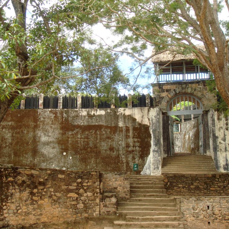
The royal hill complex served as a fortified residence and spiritual center for the Merina dynasty from the 15th to the 19th century. The fortifications include stone walls reaching 23 feet (7 meters) in height, constructed without mortar and protecting a 59-acre (24-hectare) site. Within the walls stand several historic structures, including the Mahandrihono Palace with its palisade walls made from rosewood and the Mahitsy complex with ceremonial spaces. The compound contains royal burial sites and a sacred forest with native trees used in rituals. The rova gate displays massive stone discs that were rolled to secure the entrance at night. Architectural details document craft techniques from this period.
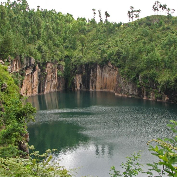
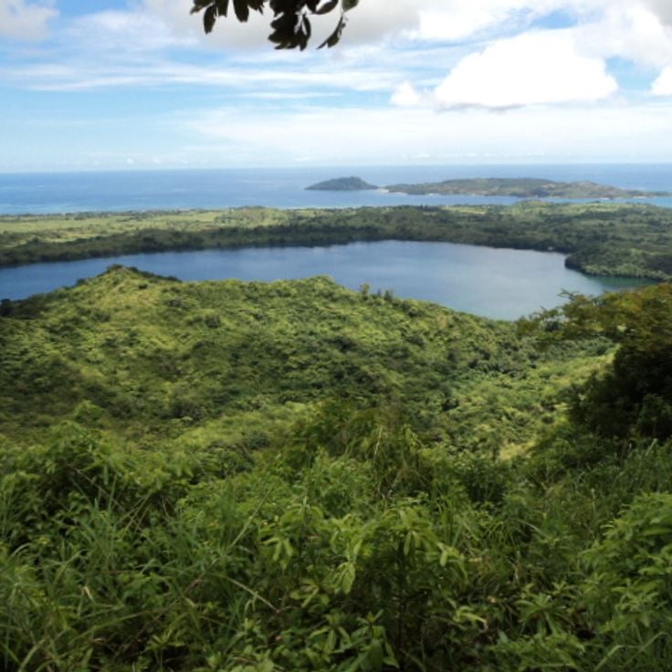
Lake Tritriva is a volcanic crater lake in the Vakinankaratra region, about 9 miles (15 kilometers) southwest of Antsirabe. The lake reaches a depth of roughly 525 feet (160 meters) and sits within a nearly circular crater measuring approximately 985 feet (300 meters) in diameter. Steep rock walls formed from volcanic material surround the water, with narrow trails descending to the shoreline. The surrounding terrain consists of grassland and scattered tree stands. Local narratives connect the lake with legends that reflect the cultural heritage of the area. Access is via unpaved roads from Antsirabe, suitable for four-wheel-drive vehicles.
Pic Maromokotro rises to 9,436 feet (2,876 meters) and marks the highest point in Madagascar within the Tsaratanana Massif. This mountain lies in a remote region in the northern part of the island, providing access to high-altitude landscapes that differ markedly from the coastal and forest areas for which Madagascar is better known. Reaching the summit requires several days of trekking through primary forest and alpine vegetation, where hikers encounter endemic plant species adapted to elevation.
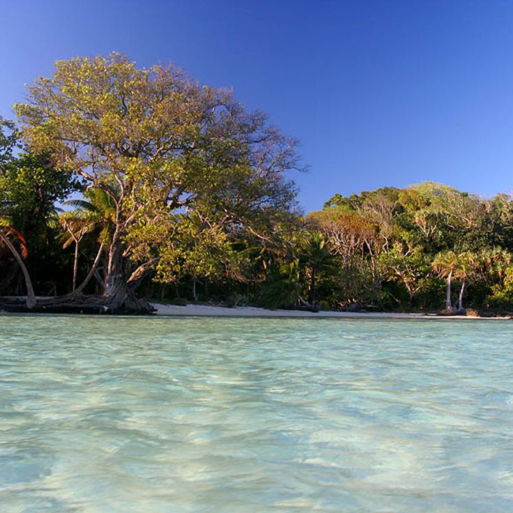
The Île aux Nattes sits off the coast of Sainte-Marie, measuring roughly 2 square miles (5 square kilometers). This forested island features several sand beaches along its irregular coastline, where palm groves extend to the waterline. Walking paths connect small villages to secluded coves. The shallow coastal water allows snorkeling over coral formations. The island is accessible only by boat from Sainte-Marie and remains home primarily to fishing families.
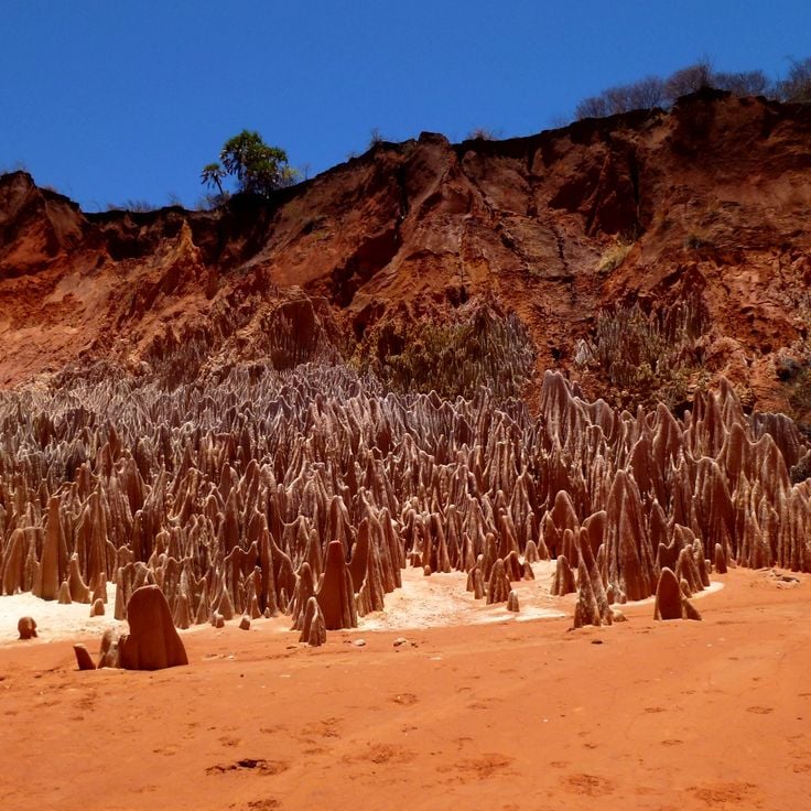
This geological formation near Diana displays pointed structures of red and white sandstone shaped by centuries of soil erosion. The site covers several acres and forms a maze of narrow passages between the stone pillars. The reddish coloring comes from iron oxide minerals in the rock. Visitors can walk on marked trails between the formations and observe the various erosion patterns. The Tsingy Rouge differs from the limestone tsingy in western Madagascar by its sandstone composition and lower height.
The Réserve Communautaire d'Anja protects over 300 ring-tailed lemurs living among granite boulders. Local guides from surrounding villages lead visitors through the reserve and share knowledge about the primates and their habitats. The reserve spans approximately 75 acres (30 hectares) and displays typical highland vegetation with succulents and endemic plants. Trails wind through rock formations where lemurs are often seen sunbathing or foraging. Community members manage the reserve, with revenues supporting conservation efforts and development projects.
The Forêt de Kirindy covers an area of dry deciduous forest in western Menabe. Trees here shed their leaves during the dry season, creating an ecosystem distinct from Madagascar's rainforests. This forest supports populations of fossas, Madagascar's largest predator, along with giant jumping rats and seven lemur species. Trails traverse different sections of the woodland, and night walks provide opportunities to observe nocturnal wildlife.
Nosy Sakatia offers white sand beaches and clear waters off Madagascar's northwest coast. The island sits across from Nosy Be and provides snorkeling access to coral reefs where sea turtles and tropical fish congregate. The underwater formations include various coral species and sponges at depths ranging from 10 to 50 feet (3 to 15 meters). Local operators organize boat tours to surrounding dive sites, while the beaches provide access to the calm waters of the Mozambique Channel.
The fishing village of Andavadoaka sits along Madagascar's west coast and provides access to an extensive coral reef system. The local population relies on fishing and manages marine resources through traditional practices. The offshore reef hosts numerous fish species, sea turtles and various coral formations. Several baobab trees grow among the houses and shape the village appearance. Diving excursions lead to reefs with visibility ranging from about 33 to 66 feet (10 to 20 meters). The village is accessible by boat or via unpaved roads.
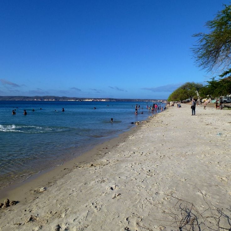
This long stretch of white sand extends for several miles along Madagascar's southwest coast and draws water sports enthusiasts. Consistent winds and waves create suitable conditions for surfing and kitesurfing. The village of Anakao sits on this coastal section, known for its clear waters and offshore coral reefs. Local fishermen head out daily in traditional pirogues. The area serves as a departure point for trips to nearby islands and diving sites in the Mozambique Channel.
Parc National Marojejy spans a mountain massif in northeastern Madagascar and shelters the critically endangered silky sifaka alongside other endemic species. The protected area ranges from 250 feet (75 meters) to 7,000 feet (2,130 meters) in elevation, displaying vegetation zones from lowland rainforest to montane heath. Trails lead through dense forest to viewpoints overlooking forested peaks and valleys. Access requires travel from Sambava followed by several hours of driving and hiking to camps within the park.
Plage de Ramena stretches for three kilometers along Madagascar's northern coast, offering white sand and shallow water. Small fishing villages line this section, where outrigger boats rest on the shore. The bay sits protected and the water remains accessible even at low tide. Local fishermen sell fresh catch directly on the beach, while palms provide shade along the coastline.
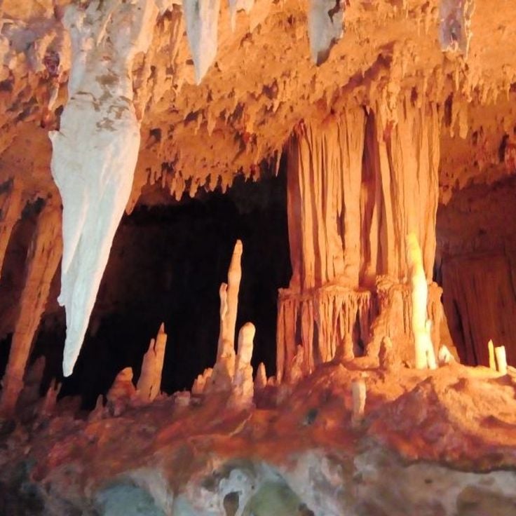
The Grottes d'Anjohibe form an underground cave system extending 3 miles (5 kilometers) through the limestone plateaus of Boeny. These caves display stalagmites and stalactites formed over millennia by mineral-rich water droplets. Underground lakes collect in deeper chambers, while fossilized remains of extinct animal species have been found throughout sections of the system, including bones of giant lemurs and flightless birds that lived centuries ago.
The Avenue of the Baobabs runs along a dirt road between Morondava and Belo Tsiribihina, showcasing a concentration of African baobab trees that reach heights of 65 to 100 feet (20 to 30 meters). This grouping represents one of the last remnants of the dry forest that once covered the region. The road extends for roughly 850 feet (260 meters) and is lined by several dozen of these massive trees, with trunks measuring up to 10 feet (3 meters) in diameter. The site draws photographers particularly during morning and evening hours, when the light emphasizes the vertical forms of the trees.
The Forêt de Pierre Tsingy consists of extensive limestone formations spanning several square miles. These needle-like structures formed through millions of years of erosion, creating a labyrinth of sharp-edged towers reaching up to 230 feet (70 meters) in height. The area supports numerous endemic plant species growing within the cracks and cavities of the rocks, along with several lemur species, reptiles and birds found nowhere else on Earth. The formations are accessible via suspension bridges and marked trails, with sturdy footwear and gloves required due to the sharp surfaces.
Nosy Be sits off Madagascar's northwest coast and provides access to coral reefs and sandy beaches. The island serves as a base for whale watching during the migration period between July and September and for encounters with sea turtles in the coastal waters. The tropical climate allows year-round visits, though the dry season from April through November offers more favorable conditions for water activities.
This island stretching 37 miles (60 kilometers) off Madagascar's east coast contains a 17th-century cemetery where pirate graves have been preserved. The surrounding waters hold coral reefs suitable for snorkeling and diving. The island once served as a base for privateers and traders navigating the Indian Ocean. Visitors can tour the cemetery grounds, relax on sand beaches and explore underwater marine life. The relatively sheltered location makes the island an anchorage for sailors and a departure point for whale watching during migration season.
This national park in the eastern highlands protects 60 square miles (155 square kilometers) of tropical rainforest and ranks among the country's premier sites for lemur observation. The forests support 14 lemur species, including the largest population of the indri, whose distinctive calls carry for several miles. The park divides into two zones: the more accessible Analamazaotra Reserve and the larger Mantadia sector with more demanding trails. Over 100 bird species have been documented here, along with reptiles, amphibians and numerous endemic plant species. The trails wind through dense primary forest with trees reaching 100 feet (30 meters), passing orchids, ferns and small streams. Located about three hours east of Antananarivo along the national highway, the park operates through several visitor centers that organize guided walks.
Ranomafana National Park extends across 41,600 hectares of forested mountain terrain and forms a significant habitat for twelve lemur species and over 130 bird species. The park's dense rainforests spread over steep slopes and river valleys, where trails lead to wildlife observation points. Vegetation ranges from ground-level ferns to tall canopies that shelter the rare golden bamboo lemur and greater bamboo lemur. Thermal springs surface in some sections, adding to the natural features of this protected rainforest zone in Madagascar's highlands.
Isalo National Park protects 81,540 hectares (201,500 acres) of Jurassic sandstone formations across the central highlands. The park's eroded terrain features deep gorges, canyons and several waterfalls created through millions of years of geological activity. These sandstone formations provide habitat for various endemic species including lemurs and numerous bird species. Trails wind through the rocky landscape to natural pools and viewpoints overlooking the plateau.
Parc National de la Montagne d'Ambre covers 18,200 hectares (45,000 acres) in northern Madagascar, protecting montane rainforest with seven crater lakes formed by ancient volcanic activity. The park rises to 4,840 feet (1,475 meters), creating a cooler, wetter climate than surrounding lowland areas. Endemic reptiles, chameleons and several lemur species inhabit the forest alongside tree ferns and orchids. Trails lead to waterfalls and viewpoints marked by elevation changes and dense plant growth. The park serves as an important watershed for the region.
The Plage d'Ifaty stretches for several miles along Madagascar's southwest coast, bordered by a coral reef that ranks among the country's longest. Local fishermen work here using traditional methods, hauling their nets along the reef while pirogue boats drift across the turquoise water. The fine white sand contrasts with the dry spiny forest that characterizes the background, typical of this region. The warm water and sheltered conditions make this beach suitable for snorkelers and divers interested in exploring the reef's biodiversity.
The Masoala Peninsula sits along the northeastern coast of Madagascar, protecting one of the largest remaining tracts of lowland rainforest in the country. The peninsula is home to ten lemur species, including the red ruffed lemur, and more than a hundred bird species within its dense rainforest that extends from coastal forests to mountain slopes. Coastal waters include coral reefs and mangrove forests, while the interior is characterized by rugged topography and high rainfall. Access is primarily by boat from Maroantsetra.
This small twin island in northwestern Madagascar consists of two landmasses connected by a 1,640-foot (500-meter) sandbar. At high tide, the sandy path disappears underwater, temporarily separating the islands. The turquoise waters surround the palm-covered islands, which serve as a nesting site for sea turtles. The larger island hosts a small hotel and a colonial-era lighthouse, while the smaller island remains uninhabited. Nosy Iranja can be reached by boat from Nosy Be, taking approximately one hour.
Parc National de Lokobe protects 740 acres of primary rainforest on Nosy Be. The forest shelters black lemurs, Brookesia chameleons and several endemic bird species. Trails wind through dense vegetation where visitors can observe palmetto palms, lianas and various orchid species. The reserve occupies the southeastern coast of the island and is accessible by boat from the main town of Nosy Be. Guided tours are led by local guides who share knowledge about flora and fauna as well as traditional plant uses.
Parc National Zahamena covers 247 square miles (640 square kilometers) of tropical rainforest in the Alaotra-Mangoro region. This park shelters more than 100 bird species along with several lemur species and numerous endemic plants. The rainforest vegetation forms a multilayered ecosystem with dense canopy and understory growth. Trails lead through different forest sections where visitors can observe the endemic fauna and flora. The park's remote location contributes to the preservation of natural habitats.
This crocodile breeding facility near the international airport houses over 300 Nile crocodiles in naturalistic enclosures of various sizes. A walking path leads through the grounds and allows visitors to observe the reptiles at different growth stages, from juveniles to adults measuring several yards in length. The center contributes to the conservation of Madagascar's native crocodile population and provides information about the biology and behavior of these animals. Located conveniently between Antananarivo and the airport, it often serves as a first or last stop for travelers passing through the capital region.
The Rova d'Antananarivo is a 17th-century palace complex occupying the highest point in Madagascar's capital and serving as the historic center of the Merina Dynasty. The site includes several royal residences and buildings that demonstrate the architectural evolution of Merina rule. A devastating fire in 1995 damaged much of the complex, though partial restoration has taken place. The elevated position provides views across the city and surrounding rice paddies. This site documents three centuries of Madagascan history and royal tradition.
The geysers at Ampefy sit within a geothermal zone about 75 miles (120 kilometers) west of Antananarivo. Located in the volcanic Itasy region, this area features several active thermal vents that discharge warm water and steam at irregular intervals. Underground heat sources warm groundwater, which then rises and erupts through natural openings in the surface. Individual geysers vary in their patterns, with some releasing steady plumes of steam while others produce intermittent bursts. The surrounding ground shows mineral deposits and discolored earth formations created by the mineral-laden spray. These geothermal features represent some of the few examples of their kind in Madagascar and document the region's volcanic past.
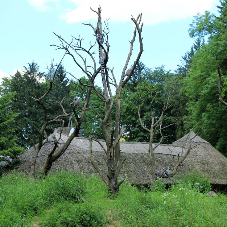
The Île aux Lémuriens is a private reserve located on a river island near Andasibe, home to four species of lemurs. The animals move freely through their natural habitat while visitors observe them from wooden walkways and trails. The reserve operates as a rescue and rehabilitation center for lemurs recovered from illegal captivity. Species living here include the bamboo lemur, the brown lemur and other prosimians that climb through the island's trees foraging for food. Visits last about an hour and provide photographers with good opportunities to document these primates in their natural environment.
Nosy Komba rises as a forested volcanic island in the Mozambique Channel off Madagascar's northwest coast. Black lemurs inhabit the wooded slopes while coastal villages sustain themselves through handicraft production and vanilla cultivation. Fishermen work from traditional pirogues, and weavers produce tablecloths and textiles for visitors. Waters surrounding the island offer coral reefs for snorkeling, and trails through rainforest lead to viewpoints overlooking the archipelago.
Parc National d'Andringitra covers a granite massif dominated by Pic Boby, which rises to 8,717 feet (2,658 meters). The park shelters more than 100 bird species and 50 mammal species, including several endemic lemur populations. The terrain ranges from lowland rainforest to high-altitude zones featuring rock faces and valleys.
Parc National de Masoala covers 230,000 hectares (568,000 acres) of rainforest along Madagascar's eastern coast, combining terrestrial and marine ecosystems. The park protects red ruffed lemurs and helmet vangas among other endemic species. The forest areas border three marine reserves that preserve coral reefs and marine biodiversity. Visitors reach the park by boat from Maroantsetra and can hike trails through the dense forest. The humid climate brings frequent rainfall, particularly between December and March.
Ankarafantsika National Park covers 130,000 hectares (321,236 acres) and contains dry deciduous forests, lakes and wetlands. The protected area shelters eight lemur species, including Coquerel's sifaka and golden-brown mouse lemur. More than 129 bird species have been recorded, among them several endemic species such as the Madagascar fish eagle and Van Dam's vanga. The forests display characteristic tree species including baobabs and palms, while the lakes provide important habitat for waterfowl and reptiles.
The royal hill complex served as a fortified residence and spiritual center for the Merina dynasty from the 15th to the 19th century. The fortifications include stone walls reaching 23 feet (7 meters) in height, constructed without mortar and protecting a 59-acre (24-hectare) site. Within the walls stand several historic structures, including the Mahandrihono Palace with its palisade walls made from rosewood and the Mahitsy complex with ceremonial spaces. The compound contains royal burial sites and a sacred forest with native trees used in rituals. The rova gate displays massive stone discs that were rolled to secure the entrance at night. Architectural details document craft techniques from this period.
Lake Tritriva is a volcanic crater lake in the Vakinankaratra region, about 9 miles (15 kilometers) southwest of Antsirabe. The lake reaches a depth of roughly 525 feet (160 meters) and sits within a nearly circular crater measuring approximately 985 feet (300 meters) in diameter. Steep rock walls formed from volcanic material surround the water, with narrow trails descending to the shoreline. The surrounding terrain consists of grassland and scattered tree stands. Local narratives connect the lake with legends that reflect the cultural heritage of the area. Access is via unpaved roads from Antsirabe, suitable for four-wheel-drive vehicles.
Pic Maromokotro rises to 9,436 feet (2,876 meters) and marks the highest point in Madagascar within the Tsaratanana Massif. This mountain lies in a remote region in the northern part of the island, providing access to high-altitude landscapes that differ markedly from the coastal and forest areas for which Madagascar is better known. Reaching the summit requires several days of trekking through primary forest and alpine vegetation, where hikers encounter endemic plant species adapted to elevation.
The Île aux Nattes sits off the coast of Sainte-Marie, measuring roughly 2 square miles (5 square kilometers). This forested island features several sand beaches along its irregular coastline, where palm groves extend to the waterline. Walking paths connect small villages to secluded coves. The shallow coastal water allows snorkeling over coral formations. The island is accessible only by boat from Sainte-Marie and remains home primarily to fishing families.
This geological formation near Diana displays pointed structures of red and white sandstone shaped by centuries of soil erosion. The site covers several acres and forms a maze of narrow passages between the stone pillars. The reddish coloring comes from iron oxide minerals in the rock. Visitors can walk on marked trails between the formations and observe the various erosion patterns. The Tsingy Rouge differs from the limestone tsingy in western Madagascar by its sandstone composition and lower height.
The Réserve Communautaire d'Anja protects over 300 ring-tailed lemurs living among granite boulders. Local guides from surrounding villages lead visitors through the reserve and share knowledge about the primates and their habitats. The reserve spans approximately 75 acres (30 hectares) and displays typical highland vegetation with succulents and endemic plants. Trails wind through rock formations where lemurs are often seen sunbathing or foraging. Community members manage the reserve, with revenues supporting conservation efforts and development projects.
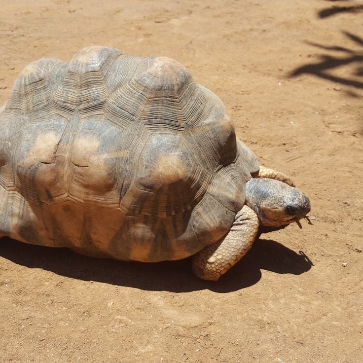
The Forêt de Kirindy covers an area of dry deciduous forest in western Menabe. Trees here shed their leaves during the dry season, creating an ecosystem distinct from Madagascar's rainforests. This forest supports populations of fossas, Madagascar's largest predator, along with giant jumping rats and seven lemur species. Trails traverse different sections of the woodland, and night walks provide opportunities to observe nocturnal wildlife.
Nosy Sakatia offers white sand beaches and clear waters off Madagascar's northwest coast. The island sits across from Nosy Be and provides snorkeling access to coral reefs where sea turtles and tropical fish congregate. The underwater formations include various coral species and sponges at depths ranging from 10 to 50 feet (3 to 15 meters). Local operators organize boat tours to surrounding dive sites, while the beaches provide access to the calm waters of the Mozambique Channel.
The fishing village of Andavadoaka sits along Madagascar's west coast and provides access to an extensive coral reef system. The local population relies on fishing and manages marine resources through traditional practices. The offshore reef hosts numerous fish species, sea turtles and various coral formations. Several baobab trees grow among the houses and shape the village appearance. Diving excursions lead to reefs with visibility ranging from about 33 to 66 feet (10 to 20 meters). The village is accessible by boat or via unpaved roads.
This long stretch of white sand extends for several miles along Madagascar's southwest coast and draws water sports enthusiasts. Consistent winds and waves create suitable conditions for surfing and kitesurfing. The village of Anakao sits on this coastal section, known for its clear waters and offshore coral reefs. Local fishermen head out daily in traditional pirogues. The area serves as a departure point for trips to nearby islands and diving sites in the Mozambique Channel.
Parc National Marojejy spans a mountain massif in northeastern Madagascar and shelters the critically endangered silky sifaka alongside other endemic species. The protected area ranges from 250 feet (75 meters) to 7,000 feet (2,130 meters) in elevation, displaying vegetation zones from lowland rainforest to montane heath. Trails lead through dense forest to viewpoints overlooking forested peaks and valleys. Access requires travel from Sambava followed by several hours of driving and hiking to camps within the park.
Plage de Ramena stretches for three kilometers along Madagascar's northern coast, offering white sand and shallow water. Small fishing villages line this section, where outrigger boats rest on the shore. The bay sits protected and the water remains accessible even at low tide. Local fishermen sell fresh catch directly on the beach, while palms provide shade along the coastline.
The Grottes d'Anjohibe form an underground cave system extending 3 miles (5 kilometers) through the limestone plateaus of Boeny. These caves display stalagmites and stalactites formed over millennia by mineral-rich water droplets. Underground lakes collect in deeper chambers, while fossilized remains of extinct animal species have been found throughout sections of the system, including bones of giant lemurs and flightless birds that lived centuries ago.
The Avenue of the Baobabs runs along a dirt road between Morondava and Belo Tsiribihina, showcasing a concentration of African baobab trees that reach heights of 65 to 100 feet (20 to 30 meters). This grouping represents one of the last remnants of the dry forest that once covered the region. The road extends for roughly 850 feet (260 meters) and is lined by several dozen of these massive trees, with trunks measuring up to 10 feet (3 meters) in diameter. The site draws photographers particularly during morning and evening hours, when the light emphasizes the vertical forms of the trees.
The Forêt de Pierre Tsingy consists of extensive limestone formations spanning several square miles. These needle-like structures formed through millions of years of erosion, creating a labyrinth of sharp-edged towers reaching up to 230 feet (70 meters) in height. The area supports numerous endemic plant species growing within the cracks and cavities of the rocks, along with several lemur species, reptiles and birds found nowhere else on Earth. The formations are accessible via suspension bridges and marked trails, with sturdy footwear and gloves required due to the sharp surfaces.
Nosy Be sits off Madagascar's northwest coast and provides access to coral reefs and sandy beaches. The island serves as a base for whale watching during the migration period between July and September and for encounters with sea turtles in the coastal waters. The tropical climate allows year-round visits, though the dry season from April through November offers more favorable conditions for water activities.
This island stretching 37 miles (60 kilometers) off Madagascar's east coast contains a 17th-century cemetery where pirate graves have been preserved. The surrounding waters hold coral reefs suitable for snorkeling and diving. The island once served as a base for privateers and traders navigating the Indian Ocean. Visitors can tour the cemetery grounds, relax on sand beaches and explore underwater marine life. The relatively sheltered location makes the island an anchorage for sailors and a departure point for whale watching during migration season.
This national park in the eastern highlands protects 60 square miles (155 square kilometers) of tropical rainforest and ranks among the country's premier sites for lemur observation. The forests support 14 lemur species, including the largest population of the indri, whose distinctive calls carry for several miles. The park divides into two zones: the more accessible Analamazaotra Reserve and the larger Mantadia sector with more demanding trails. Over 100 bird species have been documented here, along with reptiles, amphibians and numerous endemic plant species. The trails wind through dense primary forest with trees reaching 100 feet (30 meters), passing orchids, ferns and small streams. Located about three hours east of Antananarivo along the national highway, the park operates through several visitor centers that organize guided walks.
Ranomafana National Park extends across 41,600 hectares of forested mountain terrain and forms a significant habitat for twelve lemur species and over 130 bird species. The park's dense rainforests spread over steep slopes and river valleys, where trails lead to wildlife observation points. Vegetation ranges from ground-level ferns to tall canopies that shelter the rare golden bamboo lemur and greater bamboo lemur. Thermal springs surface in some sections, adding to the natural features of this protected rainforest zone in Madagascar's highlands.
Isalo National Park protects 81,540 hectares (201,500 acres) of Jurassic sandstone formations across the central highlands. The park's eroded terrain features deep gorges, canyons and several waterfalls created through millions of years of geological activity. These sandstone formations provide habitat for various endemic species including lemurs and numerous bird species. Trails wind through the rocky landscape to natural pools and viewpoints overlooking the plateau.
Parc National de la Montagne d'Ambre covers 18,200 hectares (45,000 acres) in northern Madagascar, protecting montane rainforest with seven crater lakes formed by ancient volcanic activity. The park rises to 4,840 feet (1,475 meters), creating a cooler, wetter climate than surrounding lowland areas. Endemic reptiles, chameleons and several lemur species inhabit the forest alongside tree ferns and orchids. Trails lead to waterfalls and viewpoints marked by elevation changes and dense plant growth. The park serves as an important watershed for the region.
The Plage d'Ifaty stretches for several miles along Madagascar's southwest coast, bordered by a coral reef that ranks among the country's longest. Local fishermen work here using traditional methods, hauling their nets along the reef while pirogue boats drift across the turquoise water. The fine white sand contrasts with the dry spiny forest that characterizes the background, typical of this region. The warm water and sheltered conditions make this beach suitable for snorkelers and divers interested in exploring the reef's biodiversity.
The Masoala Peninsula sits along the northeastern coast of Madagascar, protecting one of the largest remaining tracts of lowland rainforest in the country. The peninsula is home to ten lemur species, including the red ruffed lemur, and more than a hundred bird species within its dense rainforest that extends from coastal forests to mountain slopes. Coastal waters include coral reefs and mangrove forests, while the interior is characterized by rugged topography and high rainfall. Access is primarily by boat from Maroantsetra.
This small twin island in northwestern Madagascar consists of two landmasses connected by a 1,640-foot (500-meter) sandbar. At high tide, the sandy path disappears underwater, temporarily separating the islands. The turquoise waters surround the palm-covered islands, which serve as a nesting site for sea turtles. The larger island hosts a small hotel and a colonial-era lighthouse, while the smaller island remains uninhabited. Nosy Iranja can be reached by boat from Nosy Be, taking approximately one hour.
Parc National de Lokobe protects 740 acres of primary rainforest on Nosy Be. The forest shelters black lemurs, Brookesia chameleons and several endemic bird species. Trails wind through dense vegetation where visitors can observe palmetto palms, lianas and various orchid species. The reserve occupies the southeastern coast of the island and is accessible by boat from the main town of Nosy Be. Guided tours are led by local guides who share knowledge about flora and fauna as well as traditional plant uses.
Parc National Zahamena covers 247 square miles (640 square kilometers) of tropical rainforest in the Alaotra-Mangoro region. This park shelters more than 100 bird species along with several lemur species and numerous endemic plants. The rainforest vegetation forms a multilayered ecosystem with dense canopy and understory growth. Trails lead through different forest sections where visitors can observe the endemic fauna and flora. The park's remote location contributes to the preservation of natural habitats.
This crocodile breeding facility near the international airport houses over 300 Nile crocodiles in naturalistic enclosures of various sizes. A walking path leads through the grounds and allows visitors to observe the reptiles at different growth stages, from juveniles to adults measuring several yards in length. The center contributes to the conservation of Madagascar's native crocodile population and provides information about the biology and behavior of these animals. Located conveniently between Antananarivo and the airport, it often serves as a first or last stop for travelers passing through the capital region.
The Rova d'Antananarivo is a 17th-century palace complex occupying the highest point in Madagascar's capital and serving as the historic center of the Merina Dynasty. The site includes several royal residences and buildings that demonstrate the architectural evolution of Merina rule. A devastating fire in 1995 damaged much of the complex, though partial restoration has taken place. The elevated position provides views across the city and surrounding rice paddies. This site documents three centuries of Madagascan history and royal tradition.
The geysers at Ampefy sit within a geothermal zone about 75 miles (120 kilometers) west of Antananarivo. Located in the volcanic Itasy region, this area features several active thermal vents that discharge warm water and steam at irregular intervals. Underground heat sources warm groundwater, which then rises and erupts through natural openings in the surface. Individual geysers vary in their patterns, with some releasing steady plumes of steam while others produce intermittent bursts. The surrounding ground shows mineral deposits and discolored earth formations created by the mineral-laden spray. These geothermal features represent some of the few examples of their kind in Madagascar and document the region's volcanic past.
The Île aux Lémuriens is a private reserve located on a river island near Andasibe, home to four species of lemurs. The animals move freely through their natural habitat while visitors observe them from wooden walkways and trails. The reserve operates as a rescue and rehabilitation center for lemurs recovered from illegal captivity. Species living here include the bamboo lemur, the brown lemur and other prosimians that climb through the island's trees foraging for food. Visits last about an hour and provide photographers with good opportunities to document these primates in their natural environment.
Nosy Komba rises as a forested volcanic island in the Mozambique Channel off Madagascar's northwest coast. Black lemurs inhabit the wooded slopes while coastal villages sustain themselves through handicraft production and vanilla cultivation. Fishermen work from traditional pirogues, and weavers produce tablecloths and textiles for visitors. Waters surrounding the island offer coral reefs for snorkeling, and trails through rainforest lead to viewpoints overlooking the archipelago.
Parc National d'Andringitra covers a granite massif dominated by Pic Boby, which rises to 8,717 feet (2,658 meters). The park shelters more than 100 bird species and 50 mammal species, including several endemic lemur populations. The terrain ranges from lowland rainforest to high-altitude zones featuring rock faces and valleys.
Parc National de Masoala covers 230,000 hectares (568,000 acres) of rainforest along Madagascar's eastern coast, combining terrestrial and marine ecosystems. The park protects red ruffed lemurs and helmet vangas among other endemic species. The forest areas border three marine reserves that preserve coral reefs and marine biodiversity. Visitors reach the park by boat from Maroantsetra and can hike trails through the dense forest. The humid climate brings frequent rainfall, particularly between December and March.
Ankarafantsika National Park covers 130,000 hectares (321,236 acres) and contains dry deciduous forests, lakes and wetlands. The protected area shelters eight lemur species, including Coquerel's sifaka and golden-brown mouse lemur. More than 129 bird species have been recorded, among them several endemic species such as the Madagascar fish eagle and Van Dam's vanga. The forests display characteristic tree species including baobabs and palms, while the lakes provide important habitat for waterfowl and reptiles.
The royal hill complex served as a fortified residence and spiritual center for the Merina dynasty from the 15th to the 19th century. The fortifications include stone walls reaching 23 feet (7 meters) in height, constructed without mortar and protecting a 59-acre (24-hectare) site. Within the walls stand several historic structures, including the Mahandrihono Palace with its palisade walls made from rosewood and the Mahitsy complex with ceremonial spaces. The compound contains royal burial sites and a sacred forest with native trees used in rituals. The rova gate displays massive stone discs that were rolled to secure the entrance at night. Architectural details document craft techniques from this period.
Lake Tritriva is a volcanic crater lake in the Vakinankaratra region, about 9 miles (15 kilometers) southwest of Antsirabe. The lake reaches a depth of roughly 525 feet (160 meters) and sits within a nearly circular crater measuring approximately 985 feet (300 meters) in diameter. Steep rock walls formed from volcanic material surround the water, with narrow trails descending to the shoreline. The surrounding terrain consists of grassland and scattered tree stands. Local narratives connect the lake with legends that reflect the cultural heritage of the area. Access is via unpaved roads from Antsirabe, suitable for four-wheel-drive vehicles.
Pic Maromokotro rises to 9,436 feet (2,876 meters) and marks the highest point in Madagascar within the Tsaratanana Massif. This mountain lies in a remote region in the northern part of the island, providing access to high-altitude landscapes that differ markedly from the coastal and forest areas for which Madagascar is better known. Reaching the summit requires several days of trekking through primary forest and alpine vegetation, where hikers encounter endemic plant species adapted to elevation.
The Île aux Nattes sits off the coast of Sainte-Marie, measuring roughly 2 square miles (5 square kilometers). This forested island features several sand beaches along its irregular coastline, where palm groves extend to the waterline. Walking paths connect small villages to secluded coves. The shallow coastal water allows snorkeling over coral formations. The island is accessible only by boat from Sainte-Marie and remains home primarily to fishing families.
This geological formation near Diana displays pointed structures of red and white sandstone shaped by centuries of soil erosion. The site covers several acres and forms a maze of narrow passages between the stone pillars. The reddish coloring comes from iron oxide minerals in the rock. Visitors can walk on marked trails between the formations and observe the various erosion patterns. The Tsingy Rouge differs from the limestone tsingy in western Madagascar by its sandstone composition and lower height.
The Réserve Communautaire d'Anja protects over 300 ring-tailed lemurs living among granite boulders. Local guides from surrounding villages lead visitors through the reserve and share knowledge about the primates and their habitats. The reserve spans approximately 75 acres (30 hectares) and displays typical highland vegetation with succulents and endemic plants. Trails wind through rock formations where lemurs are often seen sunbathing or foraging. Community members manage the reserve, with revenues supporting conservation efforts and development projects.
The Forêt de Kirindy covers an area of dry deciduous forest in western Menabe. Trees here shed their leaves during the dry season, creating an ecosystem distinct from Madagascar's rainforests. This forest supports populations of fossas, Madagascar's largest predator, along with giant jumping rats and seven lemur species. Trails traverse different sections of the woodland, and night walks provide opportunities to observe nocturnal wildlife.
Nosy Sakatia offers white sand beaches and clear waters off Madagascar's northwest coast. The island sits across from Nosy Be and provides snorkeling access to coral reefs where sea turtles and tropical fish congregate. The underwater formations include various coral species and sponges at depths ranging from 10 to 50 feet (3 to 15 meters). Local operators organize boat tours to surrounding dive sites, while the beaches provide access to the calm waters of the Mozambique Channel.
The fishing village of Andavadoaka sits along Madagascar's west coast and provides access to an extensive coral reef system. The local population relies on fishing and manages marine resources through traditional practices. The offshore reef hosts numerous fish species, sea turtles and various coral formations. Several baobab trees grow among the houses and shape the village appearance. Diving excursions lead to reefs with visibility ranging from about 33 to 66 feet (10 to 20 meters). The village is accessible by boat or via unpaved roads.
This long stretch of white sand extends for several miles along Madagascar's southwest coast and draws water sports enthusiasts. Consistent winds and waves create suitable conditions for surfing and kitesurfing. The village of Anakao sits on this coastal section, known for its clear waters and offshore coral reefs. Local fishermen head out daily in traditional pirogues. The area serves as a departure point for trips to nearby islands and diving sites in the Mozambique Channel.
Parc National Marojejy spans a mountain massif in northeastern Madagascar and shelters the critically endangered silky sifaka alongside other endemic species. The protected area ranges from 250 feet (75 meters) to 7,000 feet (2,130 meters) in elevation, displaying vegetation zones from lowland rainforest to montane heath. Trails lead through dense forest to viewpoints overlooking forested peaks and valleys. Access requires travel from Sambava followed by several hours of driving and hiking to camps within the park.
Plage de Ramena stretches for three kilometers along Madagascar's northern coast, offering white sand and shallow water. Small fishing villages line this section, where outrigger boats rest on the shore. The bay sits protected and the water remains accessible even at low tide. Local fishermen sell fresh catch directly on the beach, while palms provide shade along the coastline.
The Grottes d'Anjohibe form an underground cave system extending 3 miles (5 kilometers) through the limestone plateaus of Boeny. These caves display stalagmites and stalactites formed over millennia by mineral-rich water droplets. Underground lakes collect in deeper chambers, while fossilized remains of extinct animal species have been found throughout sections of the system, including bones of giant lemurs and flightless birds that lived centuries ago.