
Écrins National Park, National park in southeastern France
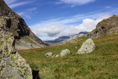
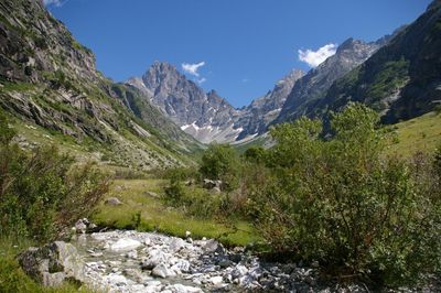
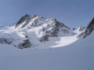
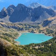
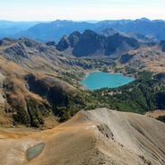
The Écrins National Park encompasses 925 square kilometers of mountain terrain with 150 peaks rising above 3000 meters and 10,000 hectares of glaciers.
Established in 1973, the park has transformed from a traditional Alpine territory into a protected natural reserve connecting the regions of Isère and Hautes-Alpes.
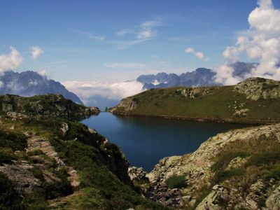
Seven distinct valleys within the park maintain their individual mountain traditions through local markets, seasonal festivals, and preservation of Alpine agricultural practices.
The park network contains 700 kilometers of marked trails and 40 mountain refuges, allowing visitors to explore different altitude zones throughout the seasons.
The Barre des Écrins summit reaches 4,102 meters, making it the highest peak in the park and a central point for observing the extensive glacier system.
Location: Ancelle
Location: Aspres-lès-Corps
Location: Besse
Location: Buissard
Location: Chabottes
Location: Champcella
Location: Champoléon
Location: Châteauroux-les-Alpes
Location: Clavans-en-Haut-Oisans
Location: Crots
Location: Embrun
Location: Entraigues
Location: Freissinières
Location: L'Argentière-la-Bessée
Location: La Chapelle-en-Valgaudémar
Location: La Grave
Location: La Motte-en-Champsaur
Location: Lavaldens
Location: Le Bourg-d'Oisans
Location: Le Monêtier-les-Bains
Location: Aubessagne
Location: Les Vigneaux
Location: Mizoën
Location: Les Deux Alpes
Location: Orcières
Location: Oris-en-Rattier
Location: Ornon
Location: Oulles
Location: Prunières
Location: Puy-Saint-Vincent
Location: Puy-Saint-Eusèbe
Location: Puy-Sanières
Location: Réallon
Location: Réotier
Location: Saint-Apollinaire
Location: Saint-Bonnet-en-Champsaur
Location: Saint-Christophe-en-Oisans
Location: Saint-Clément-sur-Durance
Location: Saint-Firmin
Location: Saint-Jacques-en-Valgodemard
Location: Saint-Jean-Saint-Nicolas
Location: Saint-Julien-en-Champsaur
Location: Saint-Léger-les-Mélèzes
Location: Saint-Maurice-en-Valgodemard
Location: Saint-Michel-de-Chaillol
Location: Savines-le-Lac
Location: Valbonnais
Location: Valjouffrey
Location: Vallouise-Pelvoux
Location: Villar-d'Arêne
Location: Villard-Notre-Dame
Location: Villard-Reymond
Location: Villar-Loubière
Location: Chantepérier
Inception: March 27, 1973
Website: http://ecrins-parcnational.fr
GPS coordinates: 44.85583,6.26361
Latest update: June 23, 2025 09:38


France features a notable variety of protected natural areas, showcasing the country’s geological and ecological richness. From Lake Allos in the Alpes-de-Haute-Provence to the underground rivers of Padirac in Dordogne, from the mountain ranges of Savoy to the limestone formations of the Ardèche gorges, each region displays landscapes shaped over millennia of natural evolution. This collection gathers sites where nature is expressed freely: primary forests, karst systems, high-altitude lakes, moving dunes of the Atlantic coast, and rock formations carved by erosion. These areas provide diverse ecosystems, home to species adapted to different environments, from Alpine flora and fauna to dune communities and underground cave biodiversity. Each natural site in this selection serves as an open-air laboratory where geological processes, ecosystem dynamics, and living adaptation to local conditions can be observed. These sites invite discovery of authentic landscapes, removed from human impact, where geological time is evident in every rock formation and glacier valley.
France contains protected areas with diverse landscapes and ecosystems. The national parks include alpine regions with peaks exceeding 3000 meters, glaciers and mountain lakes, Mediterranean coastlines with limestone cliffs and marine reserves, and island zones with underwater trails. Regional nature parks feature volcanic areas with 80 extinct volcanoes, extensive wetlands with thousands of ponds hosting over 200 bird species, moorland landscapes in the Ardennes, and coastal zones with lagoons and salt marshes. These protected areas shelter ibex, chamois, marmots, lynx and birds of prey. Visitors find marked hiking trails, historic villages and traditional farming operations.
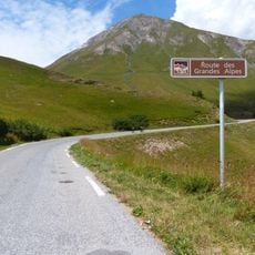
Route des Grandes Alpes
90.2 km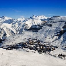
Les Deux Alpes
20.2 km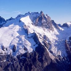
Meije
17 km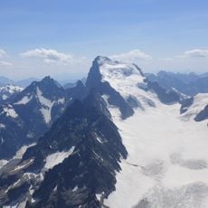
Barre des Écrins
10.6 km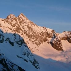
Pic de Neige Cordier
14.9 km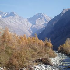
Valgaudemar
10 km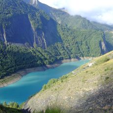
Lac du Chambon
22.6 km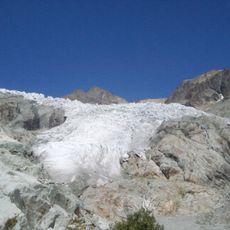
Glacier Blanc
13.3 km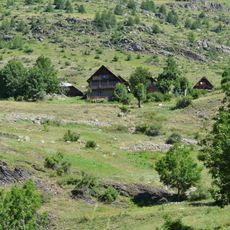
Dormillouse
19.4 km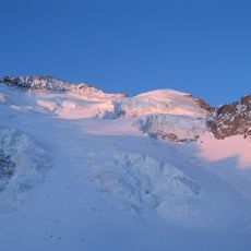
Dôme de Neige des Écrins
10.4 km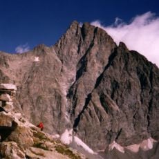
Olan
5.3 km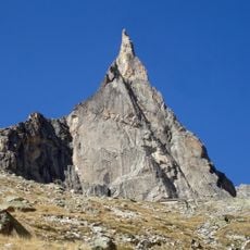
Aiguille Dibona
12.1 km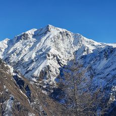
Vieux Chaillol
14.6 km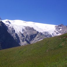
Glacier de la Girose
16.1 km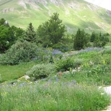
Lautaret Garden
22.8 km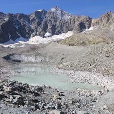
Glacier d'Arsine
16.5 km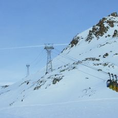
Téléphériques des glaciers de la Meije
21.2 km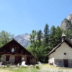
Vallée de la Vallouise
16.2 km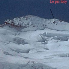
Pic Lory
10.5 km
Glacier Noir
11.5 km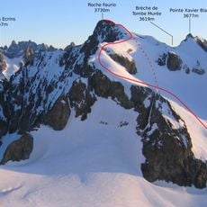
Roche Faurio
12.1 km
Roche de la Muzelle
15 km
Lauvitel
19.1 km
Château de Lesdiguières
24.8 km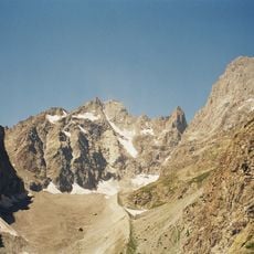
Pic Coolidge
9.5 km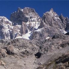
Pic Sans Nom
10.4 km
Les Bans
5.8 km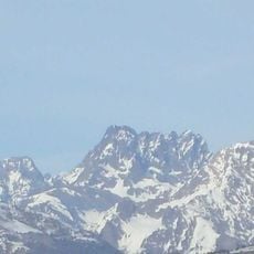
Sirac
8.2 kmReviews
Visited this place? Tap the stars to rate it and share your experience / photos with the community! Try now! You can cancel it anytime.
Discover hidden gems everywhere you go!
From secret cafés to breathtaking viewpoints, skip the crowded tourist spots and find places that match your style. Our app makes it easy with voice search, smart filtering, route optimization, and insider tips from travelers worldwide. Download now for the complete mobile experience.

A unique approach to discovering new places❞
— Le Figaro
All the places worth exploring❞
— France Info
A tailor-made excursion in just a few clicks❞
— 20 Minutes