Chest opened
+${chestReward.xp} XP
Explorer
NOUVEAU ×${chestReward.collectible.quantity}
tapez pour fermer
Chest locked

Open chests in the app

Around Us is built for your phone — chests unlock when you walk, explore and capture nearby places.

Enable Location

We need your location to show you interesting places around you

Discover nearby places

Find interesting locations and hidden gems around you

Precise directions

Get accurate directions and distances to places

Your location is never shared with other users. It's only used when you tap the location button.

Columbia Basin

Log in to your account

Start exploring — it's free

Trusted by 72,878 travelers worldwide

Continue with Google
Continue with Apple
or

We will send you a code to connect

By continuing, you accept our Terms and Conditions and our Privacy Policy

Check your inbox

We've sent a pincode in your inbox. Please enter the code below.

Columbia Basin
Discussion Reviews 1 Photos
13.6k Popularity

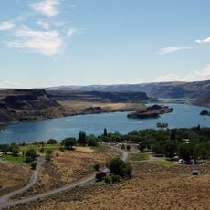
Columbia Basin, Drainage basin in Pacific Northwest, United States and Canada.

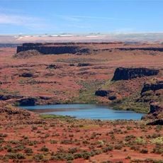
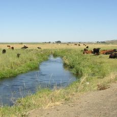
The Columbia Basin is a drainage system spanning seven U.S. states and two Canadian provinces, stretching from the Rocky Mountains to the Pacific Ocean. It encompasses the Columbia River and its many tributaries, supporting varied ecosystems across different elevations and regions.

European exploration began in 1775 when Bruno de Heceta arrived, followed by Captain Robert Gray, who named the river after his vessel in 1792. This early exploration opened the way for later settlement and resource development.

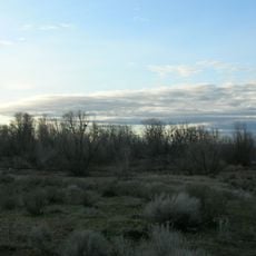
Native peoples built settlements along the river and based their way of life on salmon fishing and trade for many centuries. This heritage remains important to the communities living in the region today.

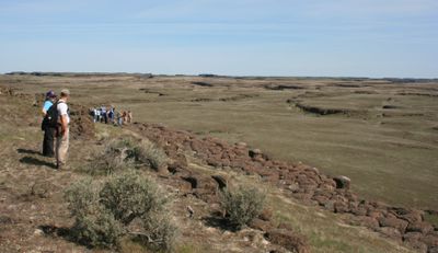
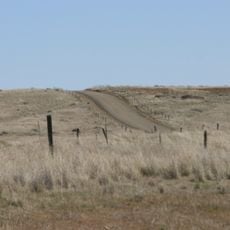
The basin can be explored by water routes, hiking trails, and scenic drives that access different sections throughout the region. Plan visits according to the season and which area you wish to explore, since conditions vary greatly across the different zones.

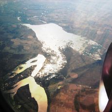
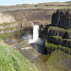
The river carries more water into the Pacific than any other river system in North or South America, and it flows through four mountain ranges. This enormous volume of water makes it a major power source for the entire region.

The community of curious travelers

AroundUs brings together thousands of curated places, local tips, and hidden gems, enriched daily by 60,000 contributors worldwide.

Start exploring
Location
Location
Location
Location
Location
Location
Location
Location
Location
GPS coordinates
47.00000,-119.00000
Latest update
December 7, 2025 20:25
Around this place
Palouse Falls
United States of America

Palouse Falls

70 km
B Reactor
United States of America

B Reactor

64.2 km
Mullan Road
United States of America

Mullan Road

65.6 km
Moses Lake
United States of America

Moses Lake

30 km
Palouse Falls State Park
United States of America

Palouse Falls State Park

69.8 km
Sun Lakes-Dry Falls State Park
United States of America

Sun Lakes-Dry Falls State Park

71.8 km
Potholes State Park
United States of America

Potholes State Park

26.7 km
Potholes Reservoir
United States of America

Potholes Reservoir

22.2 km
Drumheller Channels National Natural Landmark
United States of America

Drumheller Channels National Natural Landmark

15.1 km
Crab Creek
United States of America

Crab Creek

43 km
Columbia Plateau State Park Trail
United States of America

Columbia Plateau State Park Trail

52.1 km
Abraham Lincoln
United States of America

Abraham Lincoln

18.4 km
Columbia National Wildlife Refuge
United States of America

Columbia National Wildlife Refuge

44.1 km
Juniper Dunes Wilderness
United States of America

Juniper Dunes Wilderness

68.6 km
Lower Monumental Dam
United States of America

Lower Monumental Dam

60.2 km
Lake Lenore Caves State Park
United States of America

Lake Lenore Caves State Park

65 km
Vernita Bridge
United States of America

Vernita Bridge

68.6 km
Surf 'n Slide Water Park
United States of America

Surf 'n Slide Water Park

25.5 km
Grant County Courthouse
United States of America

Grant County Courthouse

55.1 km
Dr. Frank R. Burroughs House
United States of America

Dr. Frank R. Burroughs House

48.8 km
Nelson H. Greene House
United States of America

Nelson H. Greene House

49.3 km
Ritzville Historic District
United States of America

Ritzville Historic District

49.2 km
Ritzville Carnegie Library
United States of America

Ritzville Carnegie Library

48.9 km
Grant County Fairgrounds
United States of America

Grant County Fairgrounds

28.1 km
Skydive West Plains
United States of America

Skydive West Plains

56.7 km
Seivers Brothers Ranchhouse and Barn
United States of America

Seivers Brothers Ranchhouse and Barn

38.7 km
Moses Lake Museum & Art Center
United States of America

Moses Lake Museum & Art Center

25.4 km
Ritzville Water Park
United States of America

Ritzville Water Park

49.7 km
Show the full map
Reviews
Share your experience

No review yet

Discussions
Start a discussion...

No discussion yet

« Columbia Basin - Drainage basin in Pacific Northwest, United States and Canada » is provided by Around Us (aroundus.com). Images and texts are derived from Wikimedia project under a Creative Commons license. You are allowed to copy, distribute, and modify copies of this page, under the conditions set by the license, as long as this note is clearly visible.

Discover hidden gems everywhere you go!

From secret cafés to breathtaking viewpoints, skip the crowded tourist spots and find places that match your style. Our app makes it easy with voice search, smart filtering, route optimization, and insider tips from travelers worldwide. Download now for the complete mobile experience.

Around Us App Screenshot

A unique approach to discovering new places

Le Figaro

All the places worth exploring

France Info

A tailor-made excursion in just a few clicks

20 Minutes

Around Us
Travel Guide & Maps
Download

Send to your phone

QR Code
1

Open the camera app on your mobile.

2

Point at the QR code with your camera. A notification will appear.

3

Tap the notification to open the link.