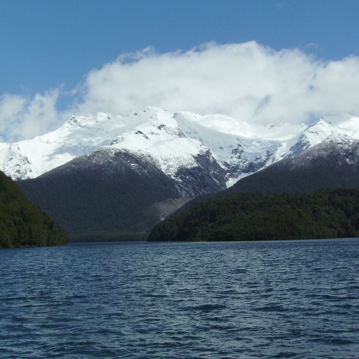
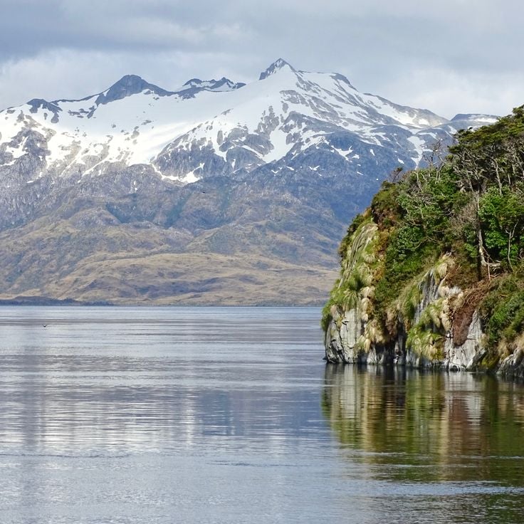
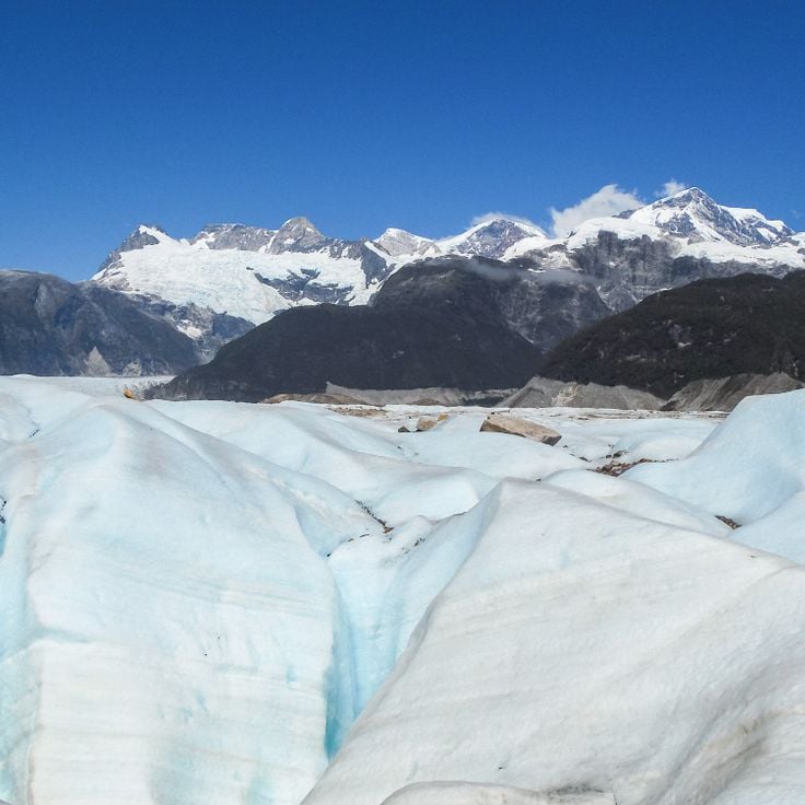
Patagonia extends across the southern reaches of Chile and Argentina, encompassing a range of natural landscapes from active glaciers to volcanic peaks. The region presents a mixture of ice, stone and water, with national parks protecting thousands of square miles of undeveloped terrain. The land was shaped by glacial processes that left deep valleys, lakes and dramatic mountain formations.
The collection includes prominent locations across both countries. In Argentina, Mount Fitz Roy and Cerro Torre rise above the valley of El Chaltén, while Perito Moreno Glacier is one of the few ice formations worldwide that continues to advance. Los Alerces National Park protects ancient alerce trees that have stood for millennia. On the Chilean side, the Marble Caves at General Carrera Lake form carved rock structures, Queulat Hanging Glacier feeds waterfalls, and the towers of Torres del Paine define one of South America's most recognizable mountain landscapes. San Rafael Lagoon provides access to tidewater glaciers, while remote protected areas such as Kawésqar National Park and Pumalín Douglas Tompkins National Park preserve extensive temperate rainforests. Historical sites like Cave of Hands display prehistoric rock art.
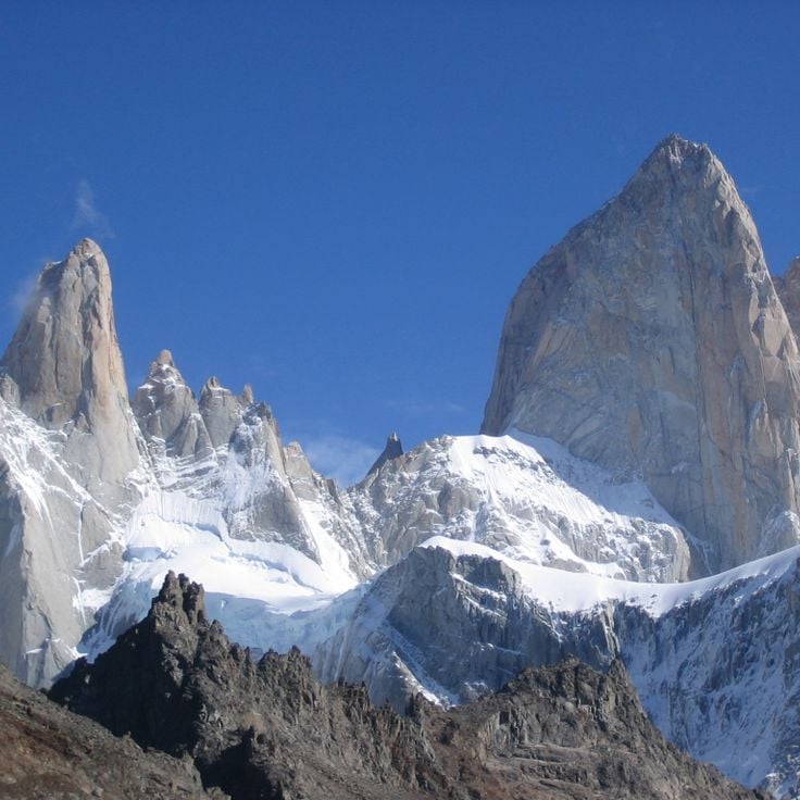
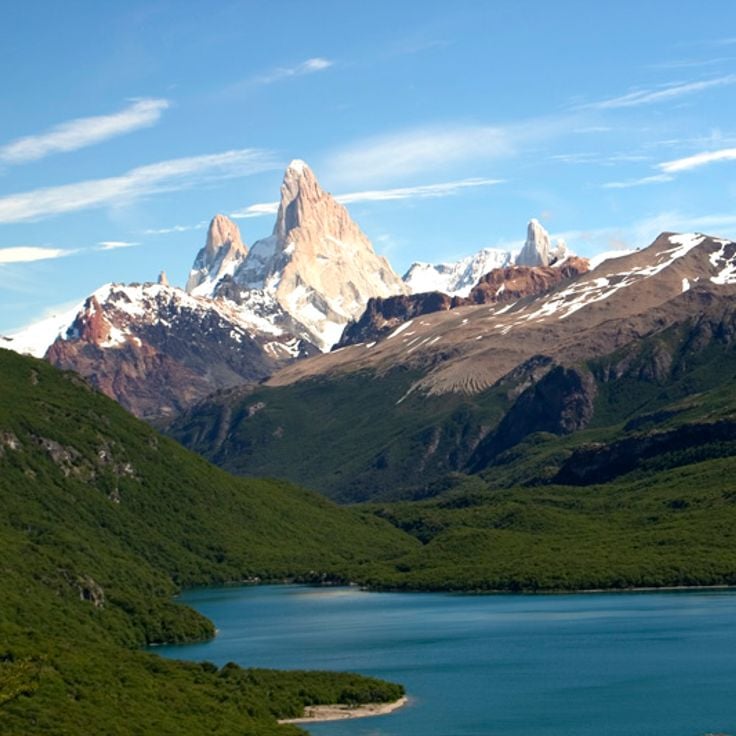
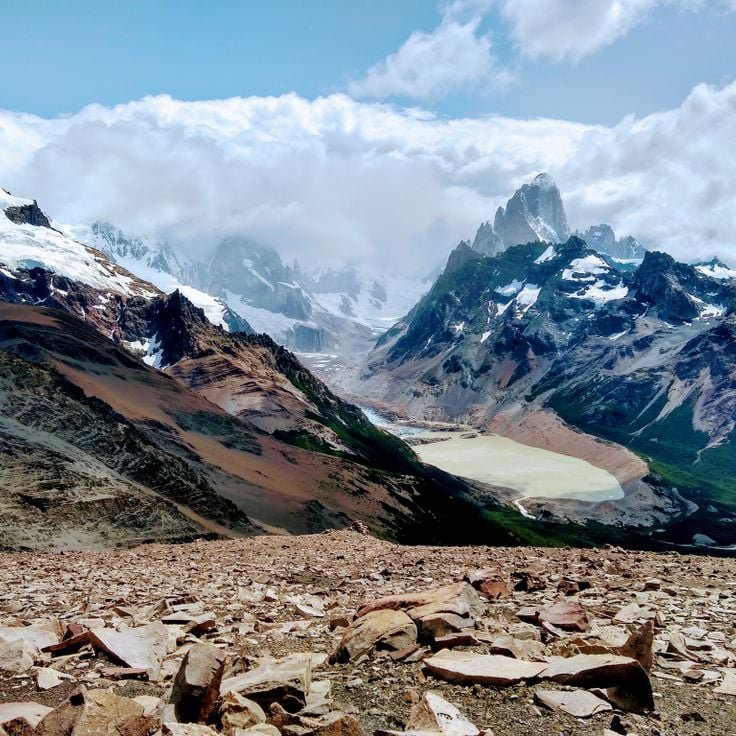
This 11,171-foot (3,405-meter) granite summit rises above Los Glaciares National Park, connecting steep rock walls with Patagonia's expansive glacier landscapes that extend across the Andean region between Chile and Argentina.
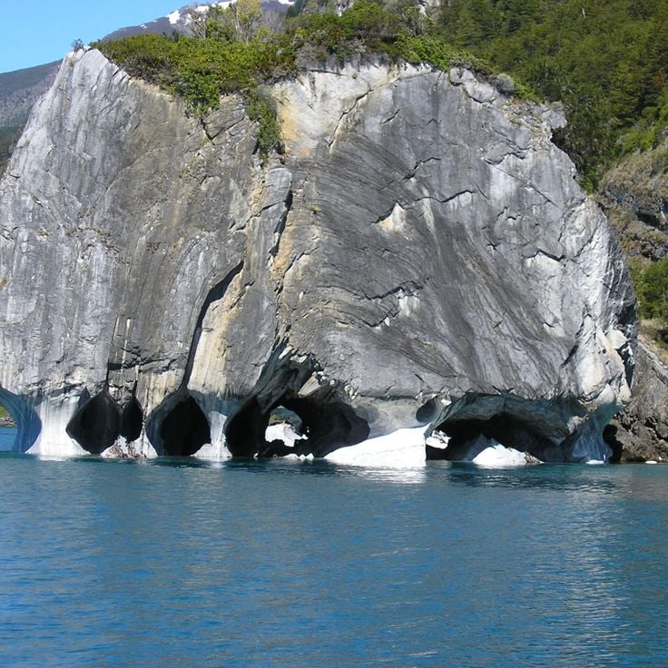
These limestone caves along the shore of Lake General Carrera formed through water erosion over 6,000 years. Mineral deposits create color patterns in blue, gray and white tones across the smooth walls. The caves are accessible only by boat and demonstrate geological processes characteristic of Patagonian coastal landscapes.
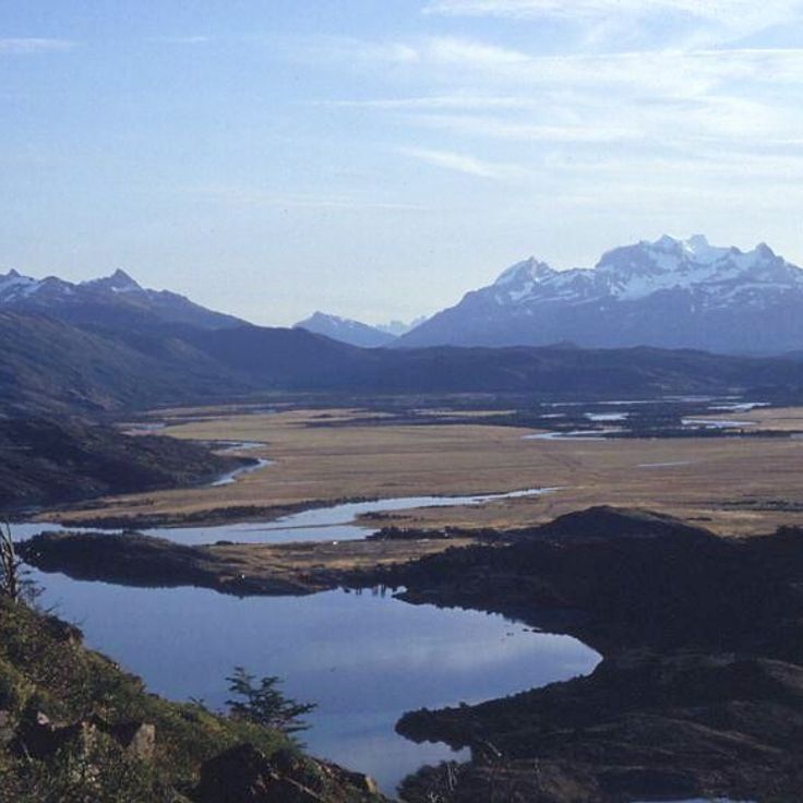
Laguna del Desierto sits at 1,660 feet (506 meters) elevation between mountains and pine forests with views of Vespignani Glacier. This lake connects the characteristic elements of Patagonian natural landscapes, where glacier formations meet forested valleys and the geological processes of the region become visible.
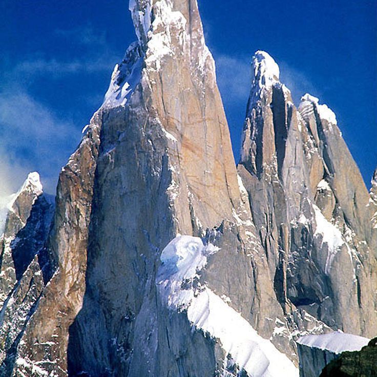
This 10,262-foot (3,128-meter) granite tower rises with vertical walls amid glaciers and snow fields, ranking among Patagonia's most challenging mountain objectives. Cerro Torre sits in Los Glaciares National Park, where extreme weather conditions and ice formations shape the landscape. Its location between the southern ice fields makes the mountain a prominent feature of the Patagonian range, surrounded by the natural landscapes that define this region spanning Chile and Argentina.
This park in western Argentina protects one of the region's oldest forests, with alerce trees reaching ages of up to 3,000 years. Los Alerces National Park extends across an area of lakes, mountains and dense woodlands that form part of Patagonia's natural landscapes. The protected area preserves a substantial population of these conifers, which rank among South America's longest living tree species.
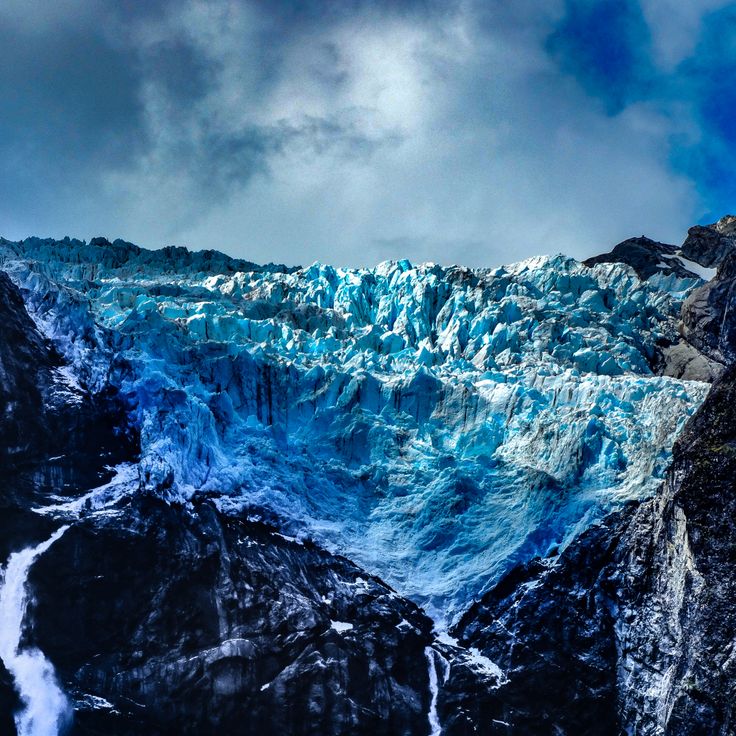
This glacier sits at 6200 feet (1889 meters) elevation and hangs over a rock wall in Queulat National Park. Ice blocks regularly break off from the glacier tongue and fall into the lake below. The glacier forms part of the northern Patagonian ice fields and demonstrates the glacial dynamics of this region. Hiking trails lead to viewpoints where visitors can observe the ice calving process.
This park protects rainforest, waterfalls and volcanoes across 990,000 acres (400,000 hectares) of Patagonian landscape. Pumalín Douglas Tompkins National Park preserves native flora and fauna in an area of ancient forests and geological formations extending through the Los Lagos region.
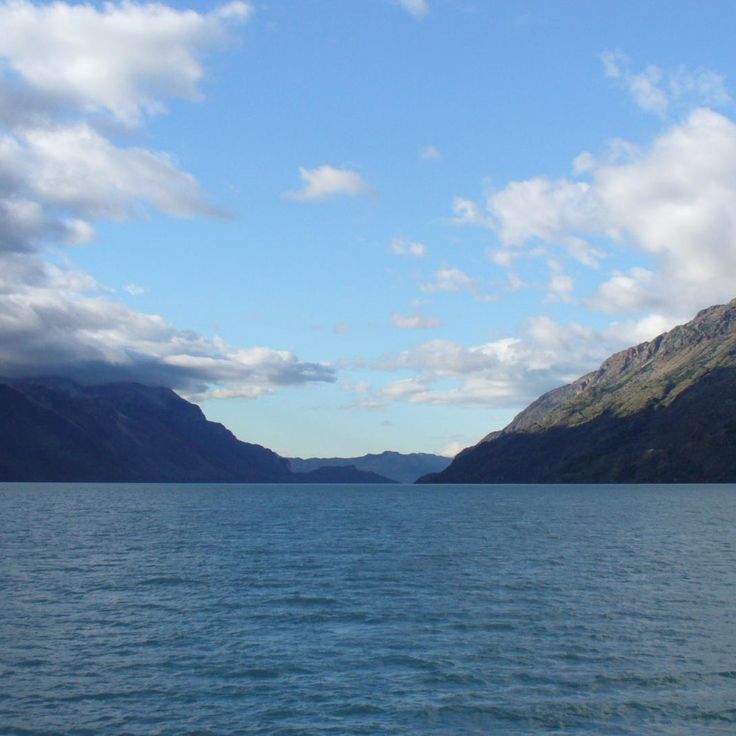
This lake on the Chilean-Argentine border reaches a depth of 2,740 feet (836 meters), making it the deepest body of water on the American continent. Several glaciers feed into Lake O'Higgins, carrying meltwater from the surrounding mountains. The remote location between the Patagonian Andes makes the lake an example of the region's glacial formations, shaped by centuries of ice movement.
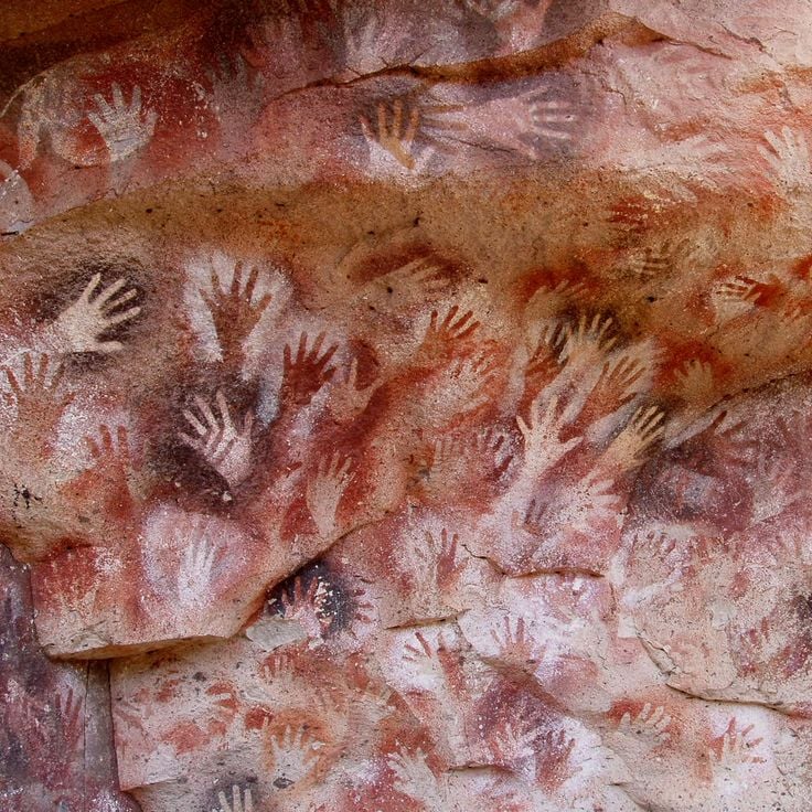
This cave displays over 2000 negative handprints in red tones, created between 13000 and 9500 years before present, ranking among the most important prehistoric artworks in Patagonia. The rock paintings document the presence of early hunter-gatherers in this remote region of Santa Cruz.
This national park is home to pumas, Andean condors and guanacos across terrain of mountains, lakes and subantarctic forests. Corcovado forms a significant part of Patagonia's natural landscapes of glaciers, lakes and mountains, where ancient forests and peaks define the terrain. The protected area covers several thousand acres and provides habitat for multiple species across varying elevations.
Cape Froward marks the southernmost point of mainland Americas at 53°54' south latitude and fits within Patagonia's geographic features. This cape rises 164 feet (50 meters) above the Strait of Magellan and forms a natural boundary between the South American continent and the Tierra del Fuego archipelago. The exposed location makes this point one of the windiest places in the region.
This glacier extends over 97 square miles (250 square kilometers) in the Argentine section of Patagonia and rises 243 feet (74 meters) above water level. The ice wall forms part of a larger glacial system fed by the southern ice field. The constant advance and retreat of the ice produces regular calving events that rank among the defining features of Patagonia's natural landscapes. The glacier sits within Los Glaciares National Park and allows observation of glacial dynamics from multiple vantage points.
This 6676-foot mountain (2035 meters) rises between the Serrano River and the fjords of the region, forming a prominent formation with its steep granite rock faces in the Patagonian landscapes of southern Chile.
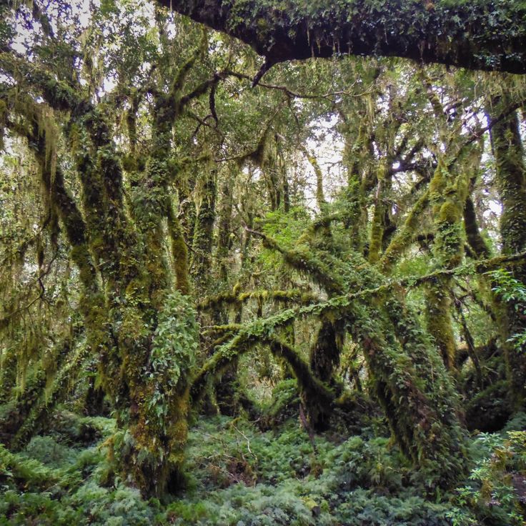
This forest features southern beech trees with curved trunks and moss-covered ground in Patagonia. The Enchanted Forest sits within Queulat National Park and forms part of the temperate rainforests in the Aysén region. Green moss and ferns grow on fallen logs and roots among the old growth Nothofagus stands. The trees display twisted shapes formed by wind and weather patterns over decades.
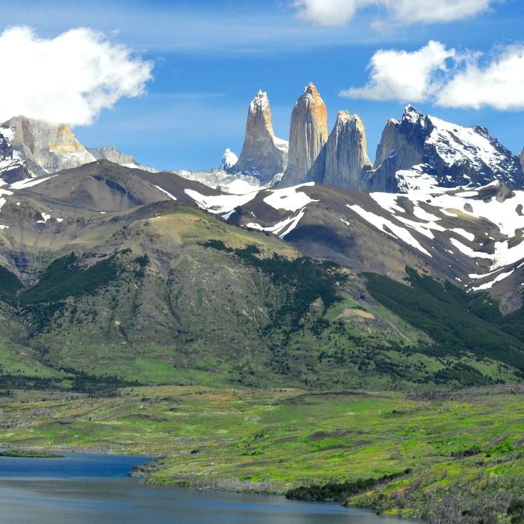
These granite towers rise 8200 feet (2500 meters) above sea level in the national park and formed 12 million years ago through tectonic forces. The three rock faces serve as the central landmark of the Patagonian landscape and draw hikers to the trails in the Chilean portion of the region, where glaciers and mountain lakes shape the surroundings.
The San Rafael Lagoon receives ice blocks from San Rafael Glacier and provides direct access to Patagonia's ice formations. This lagoon sits within a national park and displays floating icebergs that break off from the glacier face. Boat tours take visitors among the ice blocks, where blue glacier ice meets the lagoon waters.
This mountain rises in the Aysén region and displays glaciers and alpine lakes along its slopes. The jagged rock walls and towers of Cerro Castillo recall a medieval fortress and form a prominent part of the Patagonian landscape with its ice formations and geological structures.
This 12,160-foot (3,706-meter) mountain marks the border between Chile and Argentina and ranks among the notable peaks of the Patagonian Andes. The ascent requires technical climbing skills and high-altitude experience. Monte San Lorenzo fits into the rugged mountain terrain of Patagonia, where glaciers, lakes and forests shape the landscape.
This lake sits in the Patagonian steppe and covers roughly 29 square miles (74 square kilometers). The mineral water of Lago Posadas shows a turquoise tint from glacial sediment. The shores suit fishing for native trout and watching waterbirds including black-necked swans and Andean gulls.
This island hosts over 60,000 penguin pairs and fits within the natural landscapes of Patagonia. A marked path allows observation of the birds in their natural habitat, while the surrounding waters connect to other geological formations and natural areas across the region.
This lake sits within a national park in the Patagonian region, surrounded by dry steppes and forests. Lago Jeinimeni lies approximately 90 miles (150 kilometers) from the nearest town and displays the landforms and ecosystems characteristic of this remote section of Patagonia.
This coastal village in southern Chile preserves its original structure with more than 4.5 miles (7 km) of cypress wood walkways connecting houses between fjords and hillsides. Caleta Tortel holds around 500 residents and sits between the southern ice field and the Pacific, where boats remain the primary means of transport.
This river carries 870 cubic meters (30,700 cubic feet) of water per second and flows 106 miles (170 kilometers) through Patagonian terrain. The Baker River system connects several lakes and transports glacial meltwater through forested valleys and mountain passages. The current cuts through volcanic rock and sedimentary formations, creating rapids and deep pools along the riverbed before reaching the Pacific Ocean.
This park extends across 2.8 million acres (2.8 million hectares) and protects subantarctic forests, glaciers and marine channels. Kawésqar National Park forms part of the natural landscapes of Patagonia and preserves sections of ancient vegetation and geological formations between the Pacific Ocean and the Andes.
This glacier sits at the end of a vehicle accessible road in the Patagonian region of Aysén. Visitors can join guided ice walks and observe white ice formations from roughly 164 feet (50 meters) away, part of the extensive glacier landscapes that characterize the natural features of Patagonia.
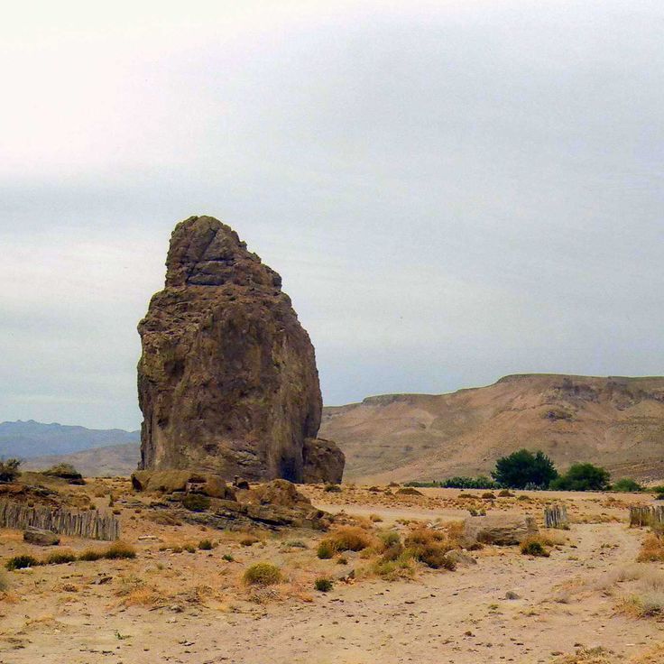
Piedra Parada rises 689 feet (210 meters) above the Chubut River valley, forming a volcanic column that attracts climbers to more than 800 established routes. This geological formation resulted from volcanic activity and erosion, creating a prominent landmark in the region between the Andes and the Patagonian steppe. The rock face offers technical climbs of varying difficulty levels that draw climbers from different countries, while the river below cuts through the valley and supplies water to the surrounding arid landscape.
Monte Zeballos sits along the Ruta de los Pioneros, which traverses mountain passes at 4,921 feet (1,500 meters) elevation. This point offers views across the Los Antiguos plateau and the distant Andes. The road connects Patagonia's natural landscapes with high mountain sections that reveal geological formations and the transition zone between steppe and peaks.
This cave in southern Patagonia measures 656 feet (200 meters) deep and 262 feet (80 meters) high. Scientists discovered fossilized skin and bones of extinct ground sloths inside this rock formation, providing evidence of the region's prehistoric fauna. The natural monument sits near the city of Puerto Natales and documents the geological and paleontological features of this landscape.
This lighthouse was built in 1904 on the Brunswick Peninsula and serves as a navigation aid for ships in the Magellan Strait. Faro San Isidro marks an important position in the Patagonian coastal landscape, where the waters connecting the Atlantic and Pacific oceans remain strategically significant for maritime traffic.
Loma del Pliegue Tumbado is a hiking trail that climbs to 4900 feet (1500 meters) and provides views of Fitz Roy and Cerro Torre from a southern angle. This trail complements the natural landscapes of Patagonia, where glaciers, lakes and mountains define the region between Chile and Argentina.
This bay sits within Los Glaciares National Park and receives icebergs from three glaciers: Onelli, Agassiz, and Bolado. Bahía Onelli offers views of ice formations drifting through the glacial waters of Lago Onelli, surrounded by mountains and subpolar forests characteristic of these Patagonian landscapes.
This 11,171-foot (3,405-meter) granite summit rises above Los Glaciares National Park, connecting steep rock walls with Patagonia's expansive glacier landscapes that extend across the Andean region between Chile and Argentina.
These limestone caves along the shore of Lake General Carrera formed through water erosion over 6,000 years. Mineral deposits create color patterns in blue, gray and white tones across the smooth walls. The caves are accessible only by boat and demonstrate geological processes characteristic of Patagonian coastal landscapes.
Laguna del Desierto sits at 1,660 feet (506 meters) elevation between mountains and pine forests with views of Vespignani Glacier. This lake connects the characteristic elements of Patagonian natural landscapes, where glacier formations meet forested valleys and the geological processes of the region become visible.
This 10,262-foot (3,128-meter) granite tower rises with vertical walls amid glaciers and snow fields, ranking among Patagonia's most challenging mountain objectives. Cerro Torre sits in Los Glaciares National Park, where extreme weather conditions and ice formations shape the landscape. Its location between the southern ice fields makes the mountain a prominent feature of the Patagonian range, surrounded by the natural landscapes that define this region spanning Chile and Argentina.
This park in western Argentina protects one of the region's oldest forests, with alerce trees reaching ages of up to 3,000 years. Los Alerces National Park extends across an area of lakes, mountains and dense woodlands that form part of Patagonia's natural landscapes. The protected area preserves a substantial population of these conifers, which rank among South America's longest living tree species.
This glacier sits at 6200 feet (1889 meters) elevation and hangs over a rock wall in Queulat National Park. Ice blocks regularly break off from the glacier tongue and fall into the lake below. The glacier forms part of the northern Patagonian ice fields and demonstrates the glacial dynamics of this region. Hiking trails lead to viewpoints where visitors can observe the ice calving process.
This park protects rainforest, waterfalls and volcanoes across 990,000 acres (400,000 hectares) of Patagonian landscape. Pumalín Douglas Tompkins National Park preserves native flora and fauna in an area of ancient forests and geological formations extending through the Los Lagos region.
This lake on the Chilean-Argentine border reaches a depth of 2,740 feet (836 meters), making it the deepest body of water on the American continent. Several glaciers feed into Lake O'Higgins, carrying meltwater from the surrounding mountains. The remote location between the Patagonian Andes makes the lake an example of the region's glacial formations, shaped by centuries of ice movement.
This cave displays over 2000 negative handprints in red tones, created between 13000 and 9500 years before present, ranking among the most important prehistoric artworks in Patagonia. The rock paintings document the presence of early hunter-gatherers in this remote region of Santa Cruz.
This national park is home to pumas, Andean condors and guanacos across terrain of mountains, lakes and subantarctic forests. Corcovado forms a significant part of Patagonia's natural landscapes of glaciers, lakes and mountains, where ancient forests and peaks define the terrain. The protected area covers several thousand acres and provides habitat for multiple species across varying elevations.
Cape Froward marks the southernmost point of mainland Americas at 53°54' south latitude and fits within Patagonia's geographic features. This cape rises 164 feet (50 meters) above the Strait of Magellan and forms a natural boundary between the South American continent and the Tierra del Fuego archipelago. The exposed location makes this point one of the windiest places in the region.
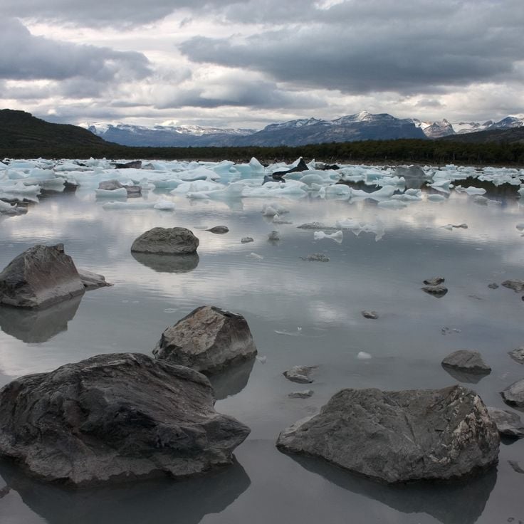
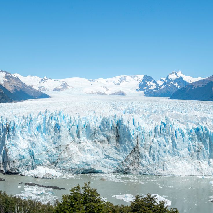
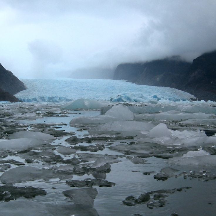
This glacier extends over 97 square miles (250 square kilometers) in the Argentine section of Patagonia and rises 243 feet (74 meters) above water level. The ice wall forms part of a larger glacial system fed by the southern ice field. The constant advance and retreat of the ice produces regular calving events that rank among the defining features of Patagonia's natural landscapes. The glacier sits within Los Glaciares National Park and allows observation of glacial dynamics from multiple vantage points.
This 6676-foot mountain (2035 meters) rises between the Serrano River and the fjords of the region, forming a prominent formation with its steep granite rock faces in the Patagonian landscapes of southern Chile.
This forest features southern beech trees with curved trunks and moss-covered ground in Patagonia. The Enchanted Forest sits within Queulat National Park and forms part of the temperate rainforests in the Aysén region. Green moss and ferns grow on fallen logs and roots among the old growth Nothofagus stands. The trees display twisted shapes formed by wind and weather patterns over decades.
These granite towers rise 8200 feet (2500 meters) above sea level in the national park and formed 12 million years ago through tectonic forces. The three rock faces serve as the central landmark of the Patagonian landscape and draw hikers to the trails in the Chilean portion of the region, where glaciers and mountain lakes shape the surroundings.
The San Rafael Lagoon receives ice blocks from San Rafael Glacier and provides direct access to Patagonia's ice formations. This lagoon sits within a national park and displays floating icebergs that break off from the glacier face. Boat tours take visitors among the ice blocks, where blue glacier ice meets the lagoon waters.
This mountain rises in the Aysén region and displays glaciers and alpine lakes along its slopes. The jagged rock walls and towers of Cerro Castillo recall a medieval fortress and form a prominent part of the Patagonian landscape with its ice formations and geological structures.
This 12,160-foot (3,706-meter) mountain marks the border between Chile and Argentina and ranks among the notable peaks of the Patagonian Andes. The ascent requires technical climbing skills and high-altitude experience. Monte San Lorenzo fits into the rugged mountain terrain of Patagonia, where glaciers, lakes and forests shape the landscape.
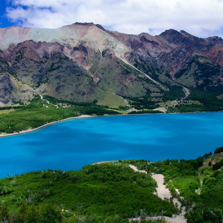
This lake sits in the Patagonian steppe and covers roughly 29 square miles (74 square kilometers). The mineral water of Lago Posadas shows a turquoise tint from glacial sediment. The shores suit fishing for native trout and watching waterbirds including black-necked swans and Andean gulls.
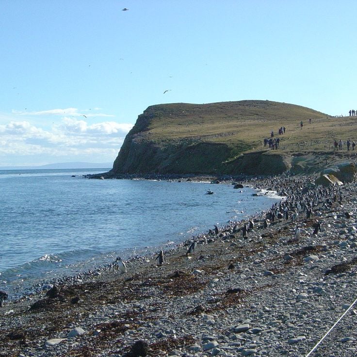
This island hosts over 60,000 penguin pairs and fits within the natural landscapes of Patagonia. A marked path allows observation of the birds in their natural habitat, while the surrounding waters connect to other geological formations and natural areas across the region.
This lake sits within a national park in the Patagonian region, surrounded by dry steppes and forests. Lago Jeinimeni lies approximately 90 miles (150 kilometers) from the nearest town and displays the landforms and ecosystems characteristic of this remote section of Patagonia.
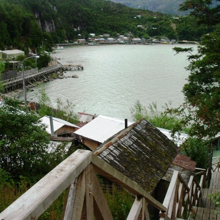
This coastal village in southern Chile preserves its original structure with more than 4.5 miles (7 km) of cypress wood walkways connecting houses between fjords and hillsides. Caleta Tortel holds around 500 residents and sits between the southern ice field and the Pacific, where boats remain the primary means of transport.
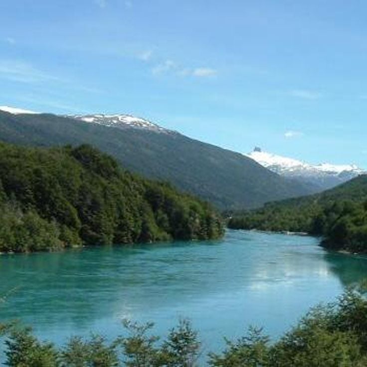
This river carries 870 cubic meters (30,700 cubic feet) of water per second and flows 106 miles (170 kilometers) through Patagonian terrain. The Baker River system connects several lakes and transports glacial meltwater through forested valleys and mountain passages. The current cuts through volcanic rock and sedimentary formations, creating rapids and deep pools along the riverbed before reaching the Pacific Ocean.
This park extends across 2.8 million acres (2.8 million hectares) and protects subantarctic forests, glaciers and marine channels. Kawésqar National Park forms part of the natural landscapes of Patagonia and preserves sections of ancient vegetation and geological formations between the Pacific Ocean and the Andes.
This glacier sits at the end of a vehicle accessible road in the Patagonian region of Aysén. Visitors can join guided ice walks and observe white ice formations from roughly 164 feet (50 meters) away, part of the extensive glacier landscapes that characterize the natural features of Patagonia.
Piedra Parada rises 689 feet (210 meters) above the Chubut River valley, forming a volcanic column that attracts climbers to more than 800 established routes. This geological formation resulted from volcanic activity and erosion, creating a prominent landmark in the region between the Andes and the Patagonian steppe. The rock face offers technical climbs of varying difficulty levels that draw climbers from different countries, while the river below cuts through the valley and supplies water to the surrounding arid landscape.
Monte Zeballos sits along the Ruta de los Pioneros, which traverses mountain passes at 4,921 feet (1,500 meters) elevation. This point offers views across the Los Antiguos plateau and the distant Andes. The road connects Patagonia's natural landscapes with high mountain sections that reveal geological formations and the transition zone between steppe and peaks.
This cave in southern Patagonia measures 656 feet (200 meters) deep and 262 feet (80 meters) high. Scientists discovered fossilized skin and bones of extinct ground sloths inside this rock formation, providing evidence of the region's prehistoric fauna. The natural monument sits near the city of Puerto Natales and documents the geological and paleontological features of this landscape.
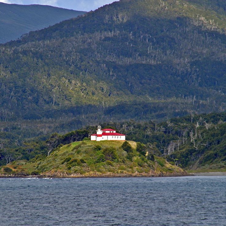
This lighthouse was built in 1904 on the Brunswick Peninsula and serves as a navigation aid for ships in the Magellan Strait. Faro San Isidro marks an important position in the Patagonian coastal landscape, where the waters connecting the Atlantic and Pacific oceans remain strategically significant for maritime traffic.
Loma del Pliegue Tumbado is a hiking trail that climbs to 4900 feet (1500 meters) and provides views of Fitz Roy and Cerro Torre from a southern angle. This trail complements the natural landscapes of Patagonia, where glaciers, lakes and mountains define the region between Chile and Argentina.
This bay sits within Los Glaciares National Park and receives icebergs from three glaciers: Onelli, Agassiz, and Bolado. Bahía Onelli offers views of ice formations drifting through the glacial waters of Lago Onelli, surrounded by mountains and subpolar forests characteristic of these Patagonian landscapes.
This 11,171-foot (3,405-meter) granite summit rises above Los Glaciares National Park, connecting steep rock walls with Patagonia's expansive glacier landscapes that extend across the Andean region between Chile and Argentina.
These limestone caves along the shore of Lake General Carrera formed through water erosion over 6,000 years. Mineral deposits create color patterns in blue, gray and white tones across the smooth walls. The caves are accessible only by boat and demonstrate geological processes characteristic of Patagonian coastal landscapes.
Laguna del Desierto sits at 1,660 feet (506 meters) elevation between mountains and pine forests with views of Vespignani Glacier. This lake connects the characteristic elements of Patagonian natural landscapes, where glacier formations meet forested valleys and the geological processes of the region become visible.
This 10,262-foot (3,128-meter) granite tower rises with vertical walls amid glaciers and snow fields, ranking among Patagonia's most challenging mountain objectives. Cerro Torre sits in Los Glaciares National Park, where extreme weather conditions and ice formations shape the landscape. Its location between the southern ice fields makes the mountain a prominent feature of the Patagonian range, surrounded by the natural landscapes that define this region spanning Chile and Argentina.
This park in western Argentina protects one of the region's oldest forests, with alerce trees reaching ages of up to 3,000 years. Los Alerces National Park extends across an area of lakes, mountains and dense woodlands that form part of Patagonia's natural landscapes. The protected area preserves a substantial population of these conifers, which rank among South America's longest living tree species.
This glacier sits at 6200 feet (1889 meters) elevation and hangs over a rock wall in Queulat National Park. Ice blocks regularly break off from the glacier tongue and fall into the lake below. The glacier forms part of the northern Patagonian ice fields and demonstrates the glacial dynamics of this region. Hiking trails lead to viewpoints where visitors can observe the ice calving process.
This park protects rainforest, waterfalls and volcanoes across 990,000 acres (400,000 hectares) of Patagonian landscape. Pumalín Douglas Tompkins National Park preserves native flora and fauna in an area of ancient forests and geological formations extending through the Los Lagos region.
This lake on the Chilean-Argentine border reaches a depth of 2,740 feet (836 meters), making it the deepest body of water on the American continent. Several glaciers feed into Lake O'Higgins, carrying meltwater from the surrounding mountains. The remote location between the Patagonian Andes makes the lake an example of the region's glacial formations, shaped by centuries of ice movement.
This cave displays over 2000 negative handprints in red tones, created between 13000 and 9500 years before present, ranking among the most important prehistoric artworks in Patagonia. The rock paintings document the presence of early hunter-gatherers in this remote region of Santa Cruz.
This national park is home to pumas, Andean condors and guanacos across terrain of mountains, lakes and subantarctic forests. Corcovado forms a significant part of Patagonia's natural landscapes of glaciers, lakes and mountains, where ancient forests and peaks define the terrain. The protected area covers several thousand acres and provides habitat for multiple species across varying elevations.
Cape Froward marks the southernmost point of mainland Americas at 53°54' south latitude and fits within Patagonia's geographic features. This cape rises 164 feet (50 meters) above the Strait of Magellan and forms a natural boundary between the South American continent and the Tierra del Fuego archipelago. The exposed location makes this point one of the windiest places in the region.
This glacier extends over 97 square miles (250 square kilometers) in the Argentine section of Patagonia and rises 243 feet (74 meters) above water level. The ice wall forms part of a larger glacial system fed by the southern ice field. The constant advance and retreat of the ice produces regular calving events that rank among the defining features of Patagonia's natural landscapes. The glacier sits within Los Glaciares National Park and allows observation of glacial dynamics from multiple vantage points.
This 6676-foot mountain (2035 meters) rises between the Serrano River and the fjords of the region, forming a prominent formation with its steep granite rock faces in the Patagonian landscapes of southern Chile.
This forest features southern beech trees with curved trunks and moss-covered ground in Patagonia. The Enchanted Forest sits within Queulat National Park and forms part of the temperate rainforests in the Aysén region. Green moss and ferns grow on fallen logs and roots among the old growth Nothofagus stands. The trees display twisted shapes formed by wind and weather patterns over decades.
These granite towers rise 8200 feet (2500 meters) above sea level in the national park and formed 12 million years ago through tectonic forces. The three rock faces serve as the central landmark of the Patagonian landscape and draw hikers to the trails in the Chilean portion of the region, where glaciers and mountain lakes shape the surroundings.
The San Rafael Lagoon receives ice blocks from San Rafael Glacier and provides direct access to Patagonia's ice formations. This lagoon sits within a national park and displays floating icebergs that break off from the glacier face. Boat tours take visitors among the ice blocks, where blue glacier ice meets the lagoon waters.
This mountain rises in the Aysén region and displays glaciers and alpine lakes along its slopes. The jagged rock walls and towers of Cerro Castillo recall a medieval fortress and form a prominent part of the Patagonian landscape with its ice formations and geological structures.
This 12,160-foot (3,706-meter) mountain marks the border between Chile and Argentina and ranks among the notable peaks of the Patagonian Andes. The ascent requires technical climbing skills and high-altitude experience. Monte San Lorenzo fits into the rugged mountain terrain of Patagonia, where glaciers, lakes and forests shape the landscape.
This lake sits in the Patagonian steppe and covers roughly 29 square miles (74 square kilometers). The mineral water of Lago Posadas shows a turquoise tint from glacial sediment. The shores suit fishing for native trout and watching waterbirds including black-necked swans and Andean gulls.
This island hosts over 60,000 penguin pairs and fits within the natural landscapes of Patagonia. A marked path allows observation of the birds in their natural habitat, while the surrounding waters connect to other geological formations and natural areas across the region.
This lake sits within a national park in the Patagonian region, surrounded by dry steppes and forests. Lago Jeinimeni lies approximately 90 miles (150 kilometers) from the nearest town and displays the landforms and ecosystems characteristic of this remote section of Patagonia.
This coastal village in southern Chile preserves its original structure with more than 4.5 miles (7 km) of cypress wood walkways connecting houses between fjords and hillsides. Caleta Tortel holds around 500 residents and sits between the southern ice field and the Pacific, where boats remain the primary means of transport.
This river carries 870 cubic meters (30,700 cubic feet) of water per second and flows 106 miles (170 kilometers) through Patagonian terrain. The Baker River system connects several lakes and transports glacial meltwater through forested valleys and mountain passages. The current cuts through volcanic rock and sedimentary formations, creating rapids and deep pools along the riverbed before reaching the Pacific Ocean.
This park extends across 2.8 million acres (2.8 million hectares) and protects subantarctic forests, glaciers and marine channels. Kawésqar National Park forms part of the natural landscapes of Patagonia and preserves sections of ancient vegetation and geological formations between the Pacific Ocean and the Andes.
This glacier sits at the end of a vehicle accessible road in the Patagonian region of Aysén. Visitors can join guided ice walks and observe white ice formations from roughly 164 feet (50 meters) away, part of the extensive glacier landscapes that characterize the natural features of Patagonia.
Piedra Parada rises 689 feet (210 meters) above the Chubut River valley, forming a volcanic column that attracts climbers to more than 800 established routes. This geological formation resulted from volcanic activity and erosion, creating a prominent landmark in the region between the Andes and the Patagonian steppe. The rock face offers technical climbs of varying difficulty levels that draw climbers from different countries, while the river below cuts through the valley and supplies water to the surrounding arid landscape.
Monte Zeballos sits along the Ruta de los Pioneros, which traverses mountain passes at 4,921 feet (1,500 meters) elevation. This point offers views across the Los Antiguos plateau and the distant Andes. The road connects Patagonia's natural landscapes with high mountain sections that reveal geological formations and the transition zone between steppe and peaks.
This cave in southern Patagonia measures 656 feet (200 meters) deep and 262 feet (80 meters) high. Scientists discovered fossilized skin and bones of extinct ground sloths inside this rock formation, providing evidence of the region's prehistoric fauna. The natural monument sits near the city of Puerto Natales and documents the geological and paleontological features of this landscape.
This lighthouse was built in 1904 on the Brunswick Peninsula and serves as a navigation aid for ships in the Magellan Strait. Faro San Isidro marks an important position in the Patagonian coastal landscape, where the waters connecting the Atlantic and Pacific oceans remain strategically significant for maritime traffic.
Loma del Pliegue Tumbado is a hiking trail that climbs to 4900 feet (1500 meters) and provides views of Fitz Roy and Cerro Torre from a southern angle. This trail complements the natural landscapes of Patagonia, where glaciers, lakes and mountains define the region between Chile and Argentina.
This bay sits within Los Glaciares National Park and receives icebergs from three glaciers: Onelli, Agassiz, and Bolado. Bahía Onelli offers views of ice formations drifting through the glacial waters of Lago Onelli, surrounded by mountains and subpolar forests characteristic of these Patagonian landscapes.