Colorado River

Log in to your account

AroundUs is a community-driven map of interesting places, built by curious explorers like you. It grows with every review, story, and photo you share.
Connect to save your favorite spots, contribute locations, and create personalized routes.
By continuing, you accept our Terms and Conditions and our Privacy Policy
Add to collection
Map
Suggest a change
Share

Colorado River, River system between Colorado and Mexico, United States

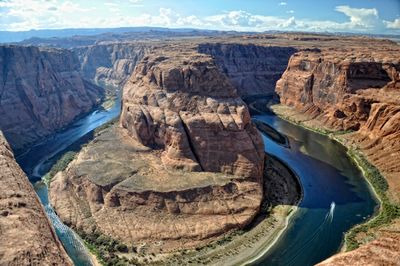
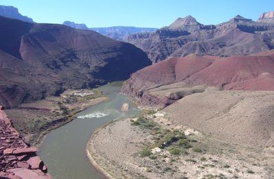
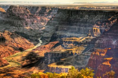
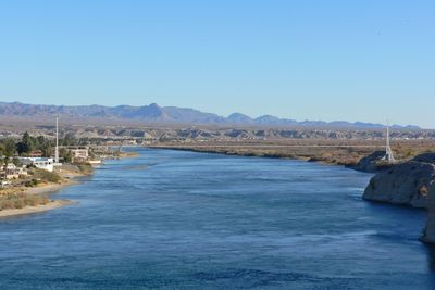
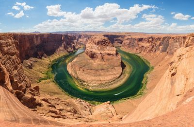
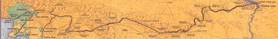
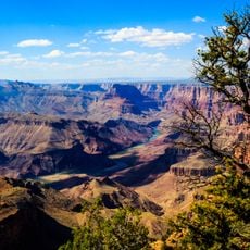
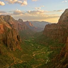
The Colorado River stretches 1450 miles through seven states, cutting deep gorges into the land and forming large reservoirs on its journey to the Gulf of California. It passes through deserts, plateaus and mountain valleys, with the water moving fast and rough in some sections, while spreading slowly and wide in other zones.

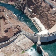
Indigenous peoples such as the Hopi and Navajo founded settlements along the banks for thousands of years and used the water for food and farming. European explorers arrived in the 16th century, and later large dam projects changed the course of the river fundamentally.

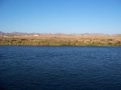
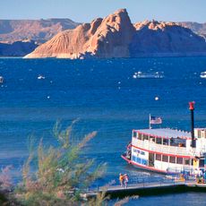
Communities along the waterway organize their routines around the water they drink, use for crops, and visit during leisure time, especially in the hot summer months when many seek relief along the banks. Boats, kayaks and rafts appear at numerous points where families and friends gather to enjoy the cool water and camp in the canyons.

Access to the waterway is possible from many points, including national parks, nature reserves and public recreation areas, with some sections easy to reach while others require a longer drive over unpaved roads. The best seasons for visits are spring and fall, when temperatures are milder and the water flows more calmly.

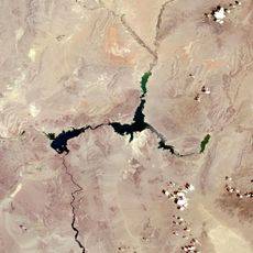
In some places the riverbed is now almost dry because so much water is diverted for cities and agriculture that it no longer reaches the ocean in large amounts. This change has altered ecosystems in the lower course significantly, where water once flowed into floodplains and wetlands.

Location: Colorado

Location: Utah

Location: Arizona

Location: Nevada

Location: California

Location: Sonora

Location: Baja California

GPS coordinates: 40.47220,-105.82610

Latest update: December 12, 2025 19:08

Photos
Around this place
Grand Ditch
United States of America

Grand Ditch

2.5 km
Alpine Visitor Center
United States of America

Alpine Visitor Center

7 km
Fall River Road
United States of America

Fall River Road

10.8 km
Lulu City
United States of America

Lulu City

3.5 km
Milner Pass
United States of America

Milner Pass

6 km
Mount Richthofen
United States of America

Mount Richthofen

5.8 km
Nokhu Crags
United States of America

Nokhu Crags

5.8 km
Mount Ida
United States of America

Mount Ida

11.8 km
Holzwarth Historic District
United States of America

Holzwarth Historic District

11.5 km
Specimen Mountain
United States of America

Specimen Mountain

3.4 km
Iron Mountain
United States of America

Iron Mountain

4.4 km
Braddock Peak
United States of America

Braddock Peak

7.4 km
Fall River Pump House and Catchment Basin
United States of America

Fall River Pump House and Catchment Basin

7.7 km
Willow Park Patrol Cabin
United States of America

Willow Park Patrol Cabin

8.9 km
Timberline Cabin
United States of America

Timberline Cabin

7.8 km
Timber Creek Campground Comfort Stations
United States of America

Timber Creek Campground Comfort Stations

10.4 km
Fall River Pass Ranger Station
United States of America

Fall River Pass Ranger Station

7 km
Willow Park Stable
United States of America

Willow Park Stable

9 km
Milner Pass Road Camp Mess Hall and House
United States of America

Milner Pass Road Camp Mess Hall and House

6.5 km
Fleshut Cabin
United States of America

Fleshut Cabin

11.4 km
Timber Creek Campground Comfort Station No. 247
United States of America

Timber Creek Campground Comfort Station No. 247

10.8 km
Timber Creek Campground Comfort Station No. 245
United States of America

Timber Creek Campground Comfort Station No. 245

10.6 km
Timber Creek Campground Comfort Station No. 246
United States of America

Timber Creek Campground Comfort Station No. 246

10.6 km
Fall River Pass Historic District
United States of America

Fall River Pass Historic District

7 km
Alpine Ridge Trail
United States of America

Alpine Ridge Trail

7.1 km
Tundra Communities Trail
United States of America

Tundra Communities Trail

10.7 km
La Poudre Pass Ranger Station
United States of America

La Poudre Pass Ranger Station

365 m
Gore Range Overlook
United States of America

Gore Range Overlook

6.6 km
Show the full map
Reviews

Visited this place? Tap the stars to rate it and share your experience / photos with the community! Try now! You can cancel it anytime.

« Colorado River - River system between Colorado and Mexico, United States » is provided by Around Us (aroundus.com). Images and texts are derived from Wikimedia project under a Creative Commons license. You are allowed to copy, distribute, and modify copies of this page, under the conditions set by the license, as long as this note is clearly visible.

Discover hidden gems everywhere you go!

From secret cafés to breathtaking viewpoints, skip the crowded tourist spots and find places that match your style. Our app makes it easy with voice search, smart filtering, route optimization, and insider tips from travelers worldwide. Download now for the complete mobile experience.

Around Us App Screenshot

A unique approach to discovering new places

Le Figaro

All the places worth exploring

France Info

A tailor-made excursion in just a few clicks

20 Minutes