Sonoran Desert

Log in to your account

AroundUs is a community-driven map of interesting places, built by curious explorers like you. It grows with every review, story, and photo you share.
Connect to save your favorite spots, contribute locations, and create personalized routes.
By continuing, you accept our Terms and Conditions and our Privacy Policy
Add to collection
Map
Suggest a change
Share

Sonoran Desert, Subtropical desert in Arizona and Mexican states, North America.

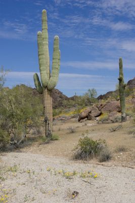
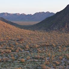
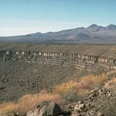
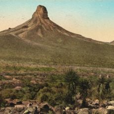
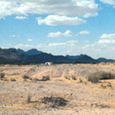
This subtropical desert stretches across Arizona, California, and several Mexican states, receiving rainfall during both winter and late summer. The landscape shifts between rocky plains, volcanic hills, and riverbeds where palo verde trees and ocotillo shrubs grow alongside towering cactus.

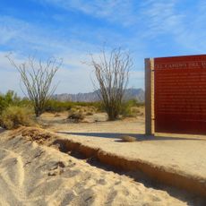
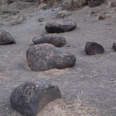
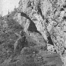
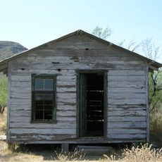
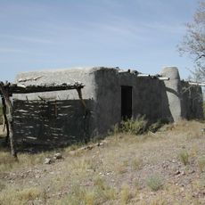
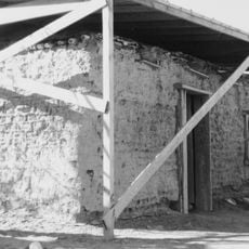
Nomadic groups inhabited this desert for thousands of years, developing methods to irrigate small fields along seasonal watercourses. European missionaries later established settlements along these ancient routes, which still exist as towns today.

Indigenous communities still sell handcrafted baskets made from desert plants and offer guided walks explaining their traditional relationship with the land. Local festivals celebrate the harvest of saguaro fruit and other seasonal foods that have been gathered for generations.

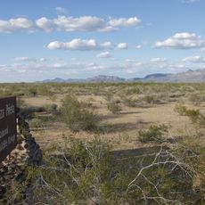
Early morning and late afternoon offer the most comfortable conditions for walking, as midday heat becomes intense especially during warmer months. Sturdy footwear and at least two liters of water per person are essential for any excursion into the terrain.

Certain cactus here bloom for just one night each year, opening their white flowers after sunset for bats and moths. Some of these plants reach ages beyond 200 years and only branch out after several decades.

Location: Arizona

Location: California

Location: Baja California Sur

Location: Baja California

Location: Sonora

GPS coordinates: 32.25986,-112.92626

Latest update: December 3, 2025 09:40

The Largest Deserts (Hot and Cold) in the World

The world's largest desert expanses range from the poles to subtropical areas. From Antarctica with its 14 million square kilometers to the Mojave plains, these regions are characterized by extreme conditions and low rainfall. Polar deserts dominate in area, followed by hot deserts like the Sahara and the Arabian Desert. Each region features specific geological and climatic characteristics, creating distinct landscapes.

Around this place
Show the full map
Basin and Range Province
United States of America

Basin and Range Province

119.7 km
El Pinacate y Gran Desierto de Altar Biosphere Reserve
Mexico

El Pinacate y Gran Desierto de Altar Biosphere Reserve

97.7 km
Sonoran Desert National Monument
United States of America

Sonoran Desert National Monument

81.5 km
El Camino Del Diablo
United States of America

El Camino Del Diablo

48.2 km
Painted Rock Petroglyph Site
United States of America

Painted Rock Petroglyph Site

85.8 km
Cabeza Prieta National Wildlife Refuge
United States of America

Cabeza Prieta National Wildlife Refuge

48.7 km
Painted Rock Dam
United States of America

Painted Rock Dam

90.9 km
Corona Satellite Calibration Targets
United States of America

Corona Satellite Calibration Targets

125.4 km
Gillespie Dam Highway Bridge
United States of America

Gillespie Dam Highway Bridge

108.7 km
Ventana Cave
United States of America

Ventana Cave

66 km
El Elegante Crater
Mexico

El Elegante Crater

63.6 km
Cabeza Prieta Wilderness
United States of America

Cabeza Prieta Wilderness

46.5 km
ARO 12m Radio Telescope
United States of America

ARO 12m Radio Telescope

128.3 km
Michigan-Dartmouth-MIT Observatory
United States of America

Michigan-Dartmouth-MIT Observatory

128.2 km
Playa Bonita Resort
Mexico

Playa Bonita Resort

120.6 km
Isanaklesh Peaks
United States of America

Isanaklesh Peaks

78 km
Bates Well Ranch
United States of America

Bates Well Ranch

10.4 km
Ajo Peak
United States of America

Ajo Peak

8.6 km
Gatlin Site
United States of America

Gatlin Site

83.6 km
Dos Lomitas Ranch
United States of America

Dos Lomitas Ranch

48 km
Gu Achi Peak
United States of America

Gu Achi Peak

99.2 km
Hassayampa Bridge
United States of America

Hassayampa Bridge

122.7 km
Gachado Well and Line Camp
United States of America

Gachado Well and Line Camp

45.2 km
The Domes of Casa Grande
United States of America

The Domes of Casa Grande

124.5 km
McGraw-Hill Telescope
United States of America

McGraw-Hill Telescope

128.2 km
Aquariam Mar De Cortez
Mexico

Aquariam Mar De Cortez

121.4 km
Gila Bend Visitor Center and Museum
United States of America

Gila Bend Visitor Center and Museum

78.5 km
Stout's Hotel
United States of America

Stout's Hotel

79 km
Show the full map

Reviews

Visited this place? Tap the stars to rate it and share your experience / photos with the community! Try now! You can cancel it anytime.

« Sonoran Desert - Subtropical desert in Arizona and Mexican states, North America » is provided by Around Us (aroundus.com). Images and texts are derived from Wikimedia project under a Creative Commons license. You are allowed to copy, distribute, and modify copies of this page, under the conditions set by the license, as long as this note is clearly visible.

Discover hidden gems everywhere you go!

From secret cafés to breathtaking viewpoints, skip the crowded tourist spots and find places that match your style. Our app makes it easy with voice search, smart filtering, route optimization, and insider tips from travelers worldwide. Download now for the complete mobile experience.

Around Us App Screenshot

A unique approach to discovering new places

Le Figaro

All the places worth exploring

France Info

A tailor-made excursion in just a few clicks

20 Minutes